Chengguan, Chamdo
| Chengguan 城关镇 · ཁྲིན་ཀོན་རྡལ། | |
|---|---|
| Town | |
 | |
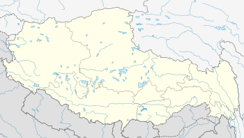 Chengguan Location in Tibet | |
| Coordinates: 31°08′27″N 97°10′19″E / 31.14083°N 97.17194°ECoordinates: 31°08′27″N 97°10′19″E / 31.14083°N 97.17194°E | |
| Country | China |
| Autonomous region | Tibet Autonomous Region |
| Prefecture | Qamdo |
| District | Karub |
| Area | |
| • Total | 195.39 km2 (75.44 sq mi) |
| Elevation | 3,256 m (10,682 ft) |
| Time zone | China Standard (UTC+08:00) |
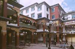
Chengguan (simplified Chinese: 城关镇; traditional Chinese: 城關鎮; pinyin: Chéngguān Zhèn) synonymous referred to as Chamdo or Qamdo, population in 1999 about 86,280,[1] is a major town in the historical region of Kham in the eastern Tibet Autonomous Region of China. The seat of Karub District and Chamdo, it is Tibet's third largest city after Lhasa and Shigatse.[2] It is located about 600 km (370 mi) (as the crow flies) from Lhasa. On the road the distance covers 1,120 km (700 mi) (southern route) or 1,030 km (640 mi) (northern route).[3] It is at an altitude of 3,230 m (10,600 ft) at the confluence of the rivers Za Qu and Ngom Qu which form the Mekong.
At the turn of the 20th century it had a population of about 12,000, a quarter of whom were monks.[2]
Galden Jampaling Monastery
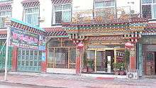
Chengguan was visited by Je Tsongkhapa in 1373 who suggested a monastery be built there. Galden Jampaling Monastery was constructed between 1436 and 1444 by a disciple of Tsongkhapa, Jansem Sherab Zangpo.[4] It is also known as the Changbalin or Qiangbalin Si Monastery. At its height it contained five main temples and housed some 2,500 monks.[5] It was destroyed in 1912 but the main hall (which was used as a prison) and two other buildings survived, and it was rebuilt in 1917 after the Tibetan army retook Chengguan. It now houses about 800 monks.[6][7]
Climate
Chengguan experiences a climate that is a transition between a humid continental and subtropical highland climate (Köppen Dwb and Cwb), with warm, wet summers and very dry, frosty winters. The monthly 24-hour average temperature ranges from −1.2 °C (29.8 °F) in January to 17.1 °C (62.8 °F) in July, with an annual mean of 8.60 °C (47.5 °F). Due to the high elevation, the diurnal temperature variation is large throughout the year, averaging 16.0 °C (28.8 °F) annually.
| Climate data for Qamdo | |||||||||||||
|---|---|---|---|---|---|---|---|---|---|---|---|---|---|
| Month | Jan | Feb | Mar | Apr | May | Jun | Jul | Aug | Sep | Oct | Nov | Dec | Year |
| Record high °C (°F) | 20.1 (68.2) |
21.4 (70.5) |
26.1 (79) |
26.7 (80.1) |
29.8 (85.6) |
32.0 (89.6) |
33.4 (92.1) |
30.8 (87.4) |
29.5 (85.1) |
27.7 (81.9) |
22.9 (73.2) |
20.2 (68.4) |
33.4 (92.1) |
| Average high °C (°F) | 8.0 (46.4) |
9.8 (49.6) |
13.0 (55.4) |
16.4 (61.5) |
20.8 (69.4) |
23.5 (74.3) |
23.9 (75) |
23.4 (74.1) |
21.2 (70.2) |
17.4 (63.3) |
12.5 (54.5) |
9.0 (48.2) |
16.6 (61.9) |
| Daily mean °C (°F) | −1.2 (29.8) |
1.3 (34.3) |
5.1 (41.2) |
8.7 (47.7) |
12.9 (55.2) |
16.2 (61.2) |
17.1 (62.8) |
16.4 (61.5) |
14.1 (57.4) |
9.4 (48.9) |
3.5 (38.3) |
−0.4 (31.3) |
8.6 (47.5) |
| Average low °C (°F) | −10.4 (13.3) |
−7.2 (19) |
−2.8 (27) |
1.0 (33.8) |
5.1 (41.2) |
8.9 (48) |
10.3 (50.5) |
9.5 (49.1) |
7.0 (44.6) |
1.5 (34.7) |
−5.5 (22.1) |
−9.9 (14.2) |
0.6 (33.1) |
| Record low °C (°F) | −19.4 (−2.9) |
−15.7 (3.7) |
−13.0 (8.6) |
−7.7 (18.1) |
−4.0 (24.8) |
0.4 (32.7) |
2.7 (36.9) |
1.1 (34) |
−1.4 (29.5) |
−8.7 (16.3) |
−14.5 (5.9) |
−20.7 (−5.3) |
−20.7 (−5.3) |
| Average precipitation mm (inches) | 1.2 (0.047) |
4.0 (0.157) |
9.6 (0.378) |
23.0 (0.906) |
39.2 (1.543) |
85.2 (3.354) |
100.2 (3.945) |
96.8 (3.811) |
76.1 (2.996) |
31.3 (1.232) |
5.5 (0.217) |
2.4 (0.094) |
474.5 (18.68) |
| Average precipitation days (≥ 0.1 mm) | 2.2 | 3.1 | 5.7 | 10.9 | 13.2 | 17.9 | 19.7 | 18.1 | 17.8 | 9.6 | 5.5 | 2.4 | 126.1 |
| Mean monthly sunshine hours | 195.3 | 175.2 | 189.1 | 195.0 | 220.1 | 201.0 | 198.4 | 201.5 | 192.0 | 204.6 | 201.0 | 204.6 | 2,377.8 |
| Percent possible sunshine | 61 | 56 | 51 | 50 | 52 | 47 | 46 | 49 | 52 | 58 | 63 | 65 | 54.2 |
| Source: China Weather (1971−2000),[8] Hong Kong Observatory (sun only, 1961−1990)[9] | |||||||||||||
Transportation
Notable people
- Qiangba Puncog, politician
Footnotes
- ↑ China County & City Population 1999 FAQ
- 1 2 Buckley and Straus 1986, p. 215.
- ↑ Distances calculated acc. to "China Road Atlas, Zhongguo Gaosugonglu Ji Chengxiang Gongluwang Diutuji", Renmin Jiaotong Chunbanshe, Beijing 2006, p. 338. ISBN 7-114-05339-8
- ↑ Gruschke 2004, p. 36f.
- ↑ According to tradition there were 3,000 monks with Jangsem Sherab Zangpo when establishing the monastery, and more than 2000 at the beginning of the 19th century (cp. Gruschke 2004, p. 37).
- ↑ Buckley and Straus 1986, p. 216.
- ↑ Mayhew and Kohn 2005, p. 241.
- ↑ 昌都城市介绍 (in Chinese). Weather China. Retrieved 2011-06-01.
- ↑ "Climatological Normals of Changdu". Hong Kong SAR Government. Retrieved 2011-01-05.
Further reading
- Buckley, Michael and Straus, Robert (1986): Tibet: a travel survival kit, Lonely Planet Publications. South Yarra, Victoria, Australia. ISBN 0-908086-88-1.
- Forbes, Andrew ; Henley, David (2011). China's Ancient Tea Horse Road. Chiang Mai: Cognoscenti Books. ASIN: B005DQV7Q2
- Gruschke, Andreas (2004): Chamdo town in: The Cultural Monuments of Tibet’s Outer Provinces: Kham - vol. 1. The TAR part of Kham, White Lotus Press, Bangkok 2004, pp. 36–45. ISBN 974-480-049-6
- Mayhew, Bradley and Kohn, Michael. (2005). Tibet. 6th Edition. Lonely Planet. ISBN 1-74059-523-8
