Qian Gorlos Mongol Autonomous County
| Qian Gorlos County ᠡᠮᠦᠨᠡᠳᠦ ᠭᠣᠷᠯᠣᠰ ᠰᠢᠶᠠᠨ 前郭尔罗斯县 | |
|---|---|
| Autonomous county | |
ᠡᠮᠦᠨᠡᠳᠦ ᠭᠣᠷᠯᠣᠰ ᠮᠣᠩᠭᠣᠯ ᠥᠪᠡᠷᠲᠡᠭᠡᠨ ᠵᠠᠰᠠᠬᠤ ᠰᠢᠶᠠᠨ Qian Gorlos Mongol 前郭尔罗斯蒙古族自治县 Autonomous County | |
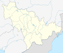
 Qian Gorlos Location in Jilin | |
| Coordinates: 45°07′N 124°51′E / 45.117°N 124.850°ECoordinates: 45°07′N 124°51′E / 45.117°N 124.850°E | |
| Country | People's Republic of China |
| Province | Jilin |
| Prefecture-level city | Songyuan |
| Township-level divisions |
8 towns 14 townships |
| County seat | Qian Gorlos Town (前郭尔罗斯镇) |
| Area | |
| • Total | 5,117 km2 (1,976 sq mi) |
| Elevation | 133 m (436 ft) |
| Population | |
| • Total | 570,000 |
| • Density | 110/km2 (290/sq mi) |
| Time zone | China Standard (UTC+8) |
| Postal code | 131100 |
| Area code(s) | 0438 |
Qian Gorlos Mongol Autonomous County (simplified Chinese: 前郭尔罗斯蒙古族自治县; traditional Chinese: 前郭爾羅斯蒙古族自治縣; pinyin: Qiánguō'ěr Luósī Měnggǔzú Zìzhìxiàn), or simply Qian Gorlos County, Front Gorlos County or Qianguo County, is a county of northwestern Jilin province, China. It is under the administration of Songyuan City. Gorlos Mongols live here.
Geography and climate
Qian Gorlos has a monsoon-influenced humid continental climate (Köppen Dwa), with long, bitterly cold and very dry winters and hot, humid summers. The monthly 24-hour average temperature ranges from −16.2 °C (2.8 °F) in January to 23.8 °C (74.8 °F) in July, and the annual mean is 5.41 °C (41.7 °F). Over two-thirds of the annual precipitation occurs from June to August, with barely any in the winter months. With monthly percent possible sunshine ranging from 52% in July to 68% in February and March, the area receives 2,732 hours of bright sunshine annually.
| Climate data for Qian Gorlos County (1971−2000) | |||||||||||||
|---|---|---|---|---|---|---|---|---|---|---|---|---|---|
| Month | Jan | Feb | Mar | Apr | May | Jun | Jul | Aug | Sep | Oct | Nov | Dec | Year |
| Average high °C (°F) | −10.1 (13.8) |
−5 (23) |
3.7 (38.7) |
14.2 (57.6) |
21.7 (71.1) |
26.5 (79.7) |
28.5 (83.3) |
27.0 (80.6) |
21.4 (70.5) |
12.6 (54.7) |
1.2 (34.2) |
−7.6 (18.3) |
11.18 (52.13) |
| Average low °C (°F) | −21.1 (−6) |
−17 (1) |
−8.1 (17.4) |
1.5 (34.7) |
9.1 (48.4) |
15.8 (60.4) |
19.4 (66.9) |
17.5 (63.5) |
10.1 (50.2) |
1.4 (34.5) |
−8.7 (16.3) |
−17.4 (0.7) |
0.21 (32.38) |
| Average precipitation mm (inches) | 1.4 (0.055) |
2.5 (0.098) |
6.7 (0.264) |
15.7 (0.618) |
35.4 (1.394) |
80.8 (3.181) |
126.5 (4.98) |
83.6 (3.291) |
40.5 (1.594) |
20.9 (0.823) |
5.5 (0.217) |
2.9 (0.114) |
422.4 (16.629) |
| Average precipitation days (≥ 0.2 mm) | 2.3 | 3.3 | 3.9 | 5.0 | 8.3 | 11.9 | 13.2 | 10.8 | 8.0 | 5.9 | 3.9 | 3.7 | 80.2 |
| Average relative humidity (%) | 65 | 60 | 50 | 48 | 51 | 64 | 75 | 75 | 68 | 61 | 62 | 67 | 62.2 |
| Mean monthly sunshine hours | 185.9 | 199.3 | 250.6 | 249.9 | 268.2 | 257.8 | 247.0 | 256.0 | 247.9 | 221.7 | 184.5 | 163.4 | 2,732.2 |
| Percent possible sunshine | 66 | 68 | 68 | 62 | 59 | 55 | 52 | 59 | 66 | 65 | 64 | 60 | 62 |
| Source: China Meteorological Administration | |||||||||||||
Administrative divisions
The county administers 8 towns and 14 townships.[1]
Towns:
- Qian Gorlos Town (前郭尔罗斯镇), Changshan (长山镇), Haiborige (海渤日戈镇), Wulantuga (乌兰图嘎镇), Chaganhua (查干花镇), Wangfuzhan (王府站镇), Balang (八郎镇), Halamaodu (哈拉毛都镇)
Townships:
- Baodian Township (宝甸乡), Pingfeng Township (平凤乡), Menggu'aili Township (蒙古艾里乡), Daliba Township (达里巴乡), Jilatu Township (吉拉吐乡), Baiyilaga Township (白依拉嘎乡), Hongquan Township (洪泉乡), Eru Township (额如乡), Taohaotai Township (套浩太乡), Changlong Township (长龙乡), Wulantala Township (乌兰塔拉乡), Dongsanjiazi Township (东三家子乡), Haotemangha Township (浩特芒哈乡), Wulan'aodu Township (乌兰敖都乡)
Transport
- G12 Hunchun–Ulanhot Expressway
- G45 Daqing–Guangzhou Expressway
- China National Highway 203
- China National Highway 302
References
- ↑ 2011年统计用区划代码和城乡划分代码:桥东区 (in Chinese). National Bureau of Statistics of the People's Republic of China. Retrieved 2013-01-16.
