Qiandongnan Miao and Dong Autonomous Prefecture
| Qiandongnan Prefecture 黔东南州 S.E. Qian Prefecture | |
|---|---|
| Autonomous Prefecture | |
黔东南苗族侗族自治州 Qiandongnan Miao and Dong Autonomous Prefecture | |
|
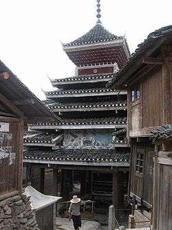
Drum Tower | |
.png) Location of Qiandongnan Prefecture in Guizhou | |
| Coordinates: 26°35′N 107°59′E / 26.583°N 107.983°E | |
| Country | People's Republic of China |
| Province | Guizhou |
| Area | |
| • Total | 30,339 km2 (11,714 sq mi) |
| Population (2000) | |
| • Total | 3,844,697 |
| Time zone | China Standard (UTC+8) |
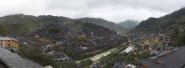
Qiandongnan Miao and Dong Autonomous Prefecture (simplified Chinese: 黔东南苗族侗族自治州; traditional Chinese: 黔東南苗族侗族自治州; pinyin: Qiándōngnán Miáozú Dòngzú Zìzhìzhōu) , also known as Southeast Qian Autonomous Prefecture of Miao and Dong and can be shortened as S.E. Qian Prefecture, is an autonomous prefecture in the southeast of Guizhou province in the People's Republic of China, bordering Hunan to the east and Guangxi to the south. The seat of the prefecture is Kaili. Qiandongnan has an area of 30,339 km2 (11,714 sq mi).
Demographics
According to the 2000 Census Qiandongnan has 3,844,697 inhabitants with a population density of 126.72 inhabitants/km².
Ethnic groups in Qiandongnan, 2000 census
| Nationality | Population | Percentage |
|---|---|---|
| Miao | 1,594,939 | 41.48% |
| Dong | 1,207,197 | 31.4% |
| Han | 742,109 | 19.3% |
| Shui | 62,492 | 1.63% |
| Buyei | 40,148 | 1.04% |
| Tujia | 39,512 | 1.03% |
| She | 37,315 | 0.97% |
| ethnicity not given | 32,109 | 0.84% |
| Mulam | 25,286 | 0.66% |
| Zhuang | 25,257 | 0.66% |
| Yao | 24,753 | 0.64% |
| Yi | 5,707 | 0.15% |
| Hui | 2,389 | 0.06% |
| Gelao | 1,958 | 0.05% |
| Others | 3,526 | 0.09% |
Subdivisions
The prefecture is subdivided into 16 county-level divisions: 1 county-level city and 15 counties
- County level city: Kaili City (凯里市)
- Counties:
- Shibing County (施秉县)
- Congjiang County (从江县)
- Jinping County (锦屏县)
- Zhenyuan County (镇远县)
- Majiang County (麻江县)
- Taijiang County (台江县)
- Tianzhu County (天柱县)
- Huangping County (黄平县)
- Rongjiang County (榕江县)
- Jianhe County (剑河县)
- Sansui County (三穗县)
- Leishan County (雷山县)
- Liping County (黎平县)
- Cengong County (岑巩县)
- Danzhai County (丹寨县)
| Map |
|---|

External links
- Citadel of the Dong Magazine article on the Dong minority village of Zengchong.
- National Geographic article about the Dong of Dimen, Liping County, by Amy Tan (2008)
Listening
Coordinates: 26°35′N 107°59′E / 26.583°N 107.983°E