Rabun Gap, Georgia
| Rabun Gap, Georgia | |
|---|---|
| Unincorporated community | |
 Rabun Gap, Georgia | |
| Coordinates: 34°57′26″N 83°23′11″W / 34.95722°N 83.38639°WCoordinates: 34°57′26″N 83°23′11″W / 34.95722°N 83.38639°W | |
| Country | United States |
| State | Georgia |
| County | Rabun |
| Elevation | 2,142 ft (653 m) |
| Time zone | Eastern (EST) (UTC-5) |
| • Summer (DST) | EDT (UTC-4) |
| ZIP code | 30568 |
| Area code(s) | 706 & 762 |
| GNIS feature ID | 356484[1] |
Rabun Gap is an unincorporated community in Rabun County, Georgia, United States. The community is located along U.S. Route 23/441 south of Dillard. Rabun Gap has a post office with ZIP code 30568.[2][3]
References
- ↑ "Rabun Gap". Geographic Names Information System. United States Geological Survey.
- ↑ United States Postal Service. "USPS - Look Up a ZIP Code". Retrieved May 25, 2015.
- ↑ "Postmaster Finder - Post Offices by ZIP Code". United States Postal Service. Retrieved May 25, 2015.
Municipalities and communities of Rabun County, Georgia, United States | ||
|---|---|---|
| Cities | 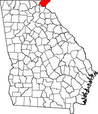 | |
| Towns | ||
| Unincorporated communities | ||
| Footnotes | ‡This populated place also has portions in an adjacent county or counties | |
This article is issued from Wikipedia - version of the 2/15/2016. The text is available under the Creative Commons Attribution/Share Alike but additional terms may apply for the media files.