Rancho Santa Fe, California
| Rancho Santa Fe | |
|---|---|
| Census-designated place | |
 | |
| Nickname(s): The Ranch, Rancho | |
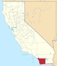
 Location of Rancho Santa Fe within San Diego County, California. | |
 Rancho Santa Fe Location in the United States | |
| Coordinates: 33°1′26″N 117°12′0″W / 33.02389°N 117.20000°WCoordinates: 33°1′26″N 117°12′0″W / 33.02389°N 117.20000°W | |
| Country |
|
| State |
|
| County | San Diego |
| Area[1] | |
| • Total | 6.788 sq mi (17.581 km2) |
| • Land | 6.715 sq mi (17.392 km2) |
| • Water | 0.073 sq mi (0.189 km2) 1.07% |
| Elevation[2] | 246 ft (75 m) |
| Population (April 1, 2010) | |
| • Total | 3,117 |
| • Density | 460/sq mi (180/km2) |
| Time zone | Pacific Time Zone (UTC−8) |
| • Summer (DST) | PDT (UTC−7) |
| ZIP codes | 92067, 92091, 92127 |
| Area code | 858 |
| FIPS code | 06-59584 |
| GNIS feature IDs | 247968, 2409138 |
| Reference no. | 982[3] |
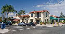
Rancho Santa Fe (Spanish: santa—holy, fe—faith) is a census-designated place (CDP) in San Diego County, California, United States, within the San Diego metropolitan area. The population was 3,117 at the 2010 census. The CDP is primarily residential with a few shopping blocks, a middle and elementary school, and several restaurants.
History
In 1841, Rancho San Dieguito, as it was originally named, was a Mexican land grant of 8,824 acres (35.71 km2) from Governor Pío Pico of Alta California to Juan Maria Osuna, the first alcalde (mayor) of the Pueblo of San Diego.[4]
In 1906, the Santa Fe Railway, a subsidiary of the Atchison, Topeka & Santa Fe Railway, purchased the entire land grant to plant a Blue gum eucalyptus (Eucalyptus globulus) tree plantation for use as railroad ties, but the wood proved too soft to hold railroad spikes. The railroad then formed the Santa Fe Land Improvement Company to develop a planned community of country estates, and 6,200 acres developed from the original Rancho San Dieguito land grant were renamed "Rancho Santa Fe" in 1922.
In 1921, architect Lilian Rice, working under Requa and Jackson, was chosen to develop the community's master plan. Rice worked through to 1927, designing, supervising, and constructing the village center, as well as several homes.[5]
In 1923, the Santa Fe Land Company constructed a guest house called "La Morada" to house potential land purchasers. It was renamed in 1941, as "The Inn", when it was purchased by a private owner.[6]
From 1937 to 1947, Bing Crosby hosted a golf tournament known as the "Bing Crosby Clambake" at the Rancho Santa Fe Country Club. Crosby's golf tournaments, which included Hollywood celebrities matched against professionals, drew great crowds to the area. After 1947, the tournament was moved to Monterey Peninsula, just outside San Francisco.[7]
In 1989, "The Covenant" of Rancho Santa Fe was registered as California Historical Landmark #982 for its status as a historic planned community.[3]
In 1997, the religious cult Heaven's Gate committed mass suicide in a rented mansion here.[8]
In 2007, the Witch Fire caused significant damage to Rancho Santa Fe, damaging or destroying over 80 homes.[9]
Geography
Rancho Santa Fe is located at 33°1′26″N 117°12′0″W / 33.02389°N 117.20000°W (33.023943, -117.200110).[10]
According to the United States Census Bureau, the CDP has a total area of 6.8 square miles (18 km2). 6.7 square miles (17 km2) of it is land and 0.1 square miles (0.26 km2) of it (1.07%) is water.
Climate
According to the Köppen Climate Classification system, Rancho Santa Fe has a warm-summer Mediterranean climate, abbreviated "Csa" on climate maps.[11]
The climate of Rancho Santa Fe is, for the most part, typical of the San Diego metropolitan area though its higher elevation and inland location lends itself to larger temperature variations.
Demographics
2010
The 2010 United States Census[12] reported that Rancho Santa Fe had a population of 3,117. The population density was 459.2 people per square mile (177.3/km²). The racial makeup of Rancho Santa Fe was 2,910 (93.4%) White, 10 (0.3%) African American, 1 (0.0%) Native American, 87 (2.8%) Asian, 4 (0.1%) Pacific Islander, 45 (1.4%) from other races, and 60 (1.9%) from two or more races. Hispanic or Latino of any race were 176 persons (5.6%).
The Census reported that 3,117 people (100% of the population) lived in households, 0 (0%) lived in non-institutionalized group quarters, and 0 (0%) were institutionalized.
There were 1,195 households, out of which 364 (30.5%) had children under the age of 18 living in them, 848 (71.0%) were opposite-sex married couples living together, 62 (5.2%) had a female householder with no husband present, 33 (2.8%) had a male householder with no wife present. There were 23 (1.9%) unmarried opposite-sex partnerships, and 9 (0.8%) same-sex married couples or partnerships. 213 households (17.8%) were made up of individuals and 124 (10.4%) had someone living alone who was 65 years of age or older. The average household size was 2.61. There were 943 families (78.9% of all households); the average family size was 2.93.
The population was spread out with 724 people (23.2%) under the age of 18, 142 people (4.6%) aged 18 to 24, 332 people (10.7%) aged 25 to 44, 1,178 people (37.8%) aged 45 to 64, and 741 people (23.8%) who were 65 years of age or older. The median age was 51.3 years. For every 100 females there were 96.4 males. For every 100 females age 18 and over, there were 93.5 males.
There were 1,391 housing units at an average density of 204.9 per square mile (79.1/km²), of which 1,010 (84.5%) were owner-occupied, and 185 (15.5%) were occupied by renters. The homeowner vacancy rate was 2.4%; the rental vacancy rate was 12.3%. 2,674 people (85.8% of the population) lived in owner-occupied housing units and 443 people (14.2%) lived in rental housing units.
The median income for a household in the CDP was $188,859. Males had a median income of over $153,512 versus $71,667 for females. The per capita income for the CDP was $125,367. 3.2% of the population and 2.1% of families were below the poverty line. 2.3% under the age of 18 and 9.6% of those 65 and older were living below the poverty line.
2000
As of the census[13] of 2000, there were 3,252 people, 1,204 households, and 947 families residing in the CDP. The population density was 476.2 inhabitants per square mile (183.8/km²). There were 1,339 housing units at an average density of 196.1 per square mile (75.7/km²). The racial makeup of the CDP was 93.33% White, 0.46% African American, 0.15% Native American, 2.77% Asian, 0.06% Pacific Islander, 2.15% from other races, and 1.08% from two or more races. Hispanic or Latino of any race were 5.32% of the population.
There were 1,204 households out of which 33.1% had children under the age of 18 living with them, 72.4% were married couples living together, 4.3% had a female householder with no husband present, and 21.3% were non-families. 17.9% of all households were made up of individuals and 11.2% had someone living alone who was 65 years of age or older. The average household size was 2.70 and the average family size was 3.01.
In the CDP the population was spread out with 25.9% under the age of 18, 2.9% from 18 to 24, 17.7% from 25 to 44, 33.0% from 45 to 64, and 20.5% who were 65 years of age or older. The median age was 47 years. For every 100 females there were 95.2 males. For every 100 females age 18 and over, there were 91.7 males.
The median income for a household in the CDP was in excess of $200,000, as was the median income for a family. Males had a median income of over $150,000 versus $86,933 for females. The per capita income for the CDP was $113,132; and was the second wealthiest community in the United States.[14] 3.5% of the population and 2.0% of families were below the poverty line. 4.4% under the age of 18 and 5.5% of those 65 and older was living below the poverty line.
Politics
Rancho Santa Fe is a stronghold of the Republican Party in San Diego County;[15] however in terms of political donations it gives overwhelmingly to the Democratic Party.[16] In the 2008 Presidential Election, its voters chose John McCain over Barack Obama with 66.61%, significantly higher than the county-wide average of 43.79%.[17] The community approved of California Proposition 8 with 57.57%,[18] while Proposition 4 passed with 53.06% of the vote.[19]
In the California State Legislature, Rancho Santa Fe is in the 38th Senate District, represented by Republican Joel Anderson, and in the 77th Assembly District, represented by Republican Brian Maienschein.[20]
In the United States House of Representatives, Rancho Santa Fe is located in California's 49th congressional district, which has a Cook PVI of R +4[21] and is represented by Republican Darrell Issa.[22]
Education
Rancho Santa Fe is serviced by the following school districts:
- Rancho Santa Fe Elementary School District
- Solana Beach School District (Pre-K through Grade 6)
- San Dieguito Union High School District (Grade 7 through Grade 12)
The public library in Rancho Santa Fe is a branch of the San Diego County Library system,[23] and is open to all California residents. The Rancho Santa Fe Library Guild owns the building and land that house the Rancho Santa Fe Library, as well as providing the staff for the children's room.
Notable residents
- Warren Barton, former English football player[24]
- Bud Black, major league pitcher from 1981–1995, pitching coach for Anaheim Angels 2000-2006, manager of the San Diego Padres, 2007–2015[25]
- Jenny Craig, weight loss guru and founder of Jenny Craig Inc.[26]
- Steve Finley, former major league baseball player[27]
- Taylor Fritz, professional tennis player, 2015 US Open junior boys' singles champion[28]
- Bill Gates, entrepreneur, software executive, philanthropist and former chairman of Microsoft.[29]
- Jelena Janković, Serbian professional tennis player, former number 1[30]
- Mike Love, Beach Boys singer and songwriter [31]
- John Moores, philanthropist, former owner of San Diego Padres, former regent of University of California[32]
Notable former residents
- Jackson D. Arnold, retired Admiral, USN[33]
- Glen Bell, founder of Taco Bell[34]
- Clair Burgener, former congressman[35]
- Bing Crosby, actor, singer
- Sidney Frank, liquor promotions billionaire[36]
- Howard Hughes, business magnate, investor, aviator, aerospace engineer, film maker and philanthropist
- Joan Kroc, philanthropist and widow of McDonald's founder Ray Kroc[37]
- George J. Lewis, actor, best known for playing Don Alejandro de la Vega in the 1950s television series Zorro[38]
- Victor Mature, stage, film and television actor[39]
- Lilian Jennette Rice, early 20th-century architect, designed The Inn and civic center of Rancho Santa Fe, plus homes that hold a historic designation[5]
- Pete Rozelle, former commissioner of the NFL[40]
- Milburn Stone, actor, "Doc Adams" on the TV series Gunsmoke
References
| Wikimedia Commons has media related to Rancho Santa Fe, California. |
- ↑ "2010 Census U.S. Gazetteer Files – Places – California". United States Census Bureau.
- ↑ "Rancho Santa Fe". Geographic Names Information System. United States Geological Survey. Retrieved February 11, 2015.
- 1 2 "Rancho Santa Fe". Office of Historic Preservation, California State Parks. Retrieved 2012-10-13.
- ↑ Diseño del Rancho San Dieguito
- 1 2 Ray Brandes (August 1990). "Lilian Rice Designed Buildings in Rancho Santa Fe MPS" (PDF).
- ↑ "THE INN AT RANCHO SANTA FE'S BEGINNINGS ARE WOVEN INTO THE HISTORY OF OLD CALIFORNIA" (PDF).
- ↑ "How the Bing Crosby Clambake, Now the AT&T Pro-Am Golf Tournament, Changed Golf".
- ↑ "Mass suicide involved sedatives, vodka and careful planning".
- ↑ "Witch Creek Fire Rancho Santa Fe Fire Protection District Damage Assesment by Area" (PDF).
- ↑ "US Gazetteer files: 2010, 2000, and 1990". United States Census Bureau. 2011-02-12. Retrieved 2011-04-23.
- ↑ Climate Summary for Rancho Santa Fe, California
- ↑ "2010 Census Interactive Population Search: CA - Rancho Santa Fe CDP". U.S. Census Bureau. Retrieved July 12, 2014.
- ↑ "American FactFinder". United States Census Bureau. Retrieved 2008-01-31.
- ↑ Sam Roberts (October 1, 2004). Who We Are Now: The Changing Face of America in the 21st Century. Henry Holt and Company. p. 186. ISBN 978-0-8050-7080-4.
Yves Gerem (March 2004). A Marmac Guide to Dallas. Pelican Publishing. p. 53. ISBN 978-1-58980-199-8. - ↑ Orlovsky, Christina; Blair, Graham; Radack, Lauren (March 2006). "The Best Places to Live (In San Diego)". San Diego Magazine. Retrieved February 8, 2015.
- ↑ David Callahan (June 22, 2010). Fortunes of Change: The Rise of the Liberal Rich and the Remaking of America. John Wiley & Sons. p. 20. ISBN 978-0-470-60654-4.
- ↑ http://www.jamesewelch.com/2008/12/09/san-diego-county-presidential-results-by-community/
- ↑ http://www.jamesewelch.com/2008/12/19/san-diego-county-proposition-8-results-by-community/#more-724
- ↑ http://www.jamesewelch.com/2008/12/15/san-diego-county-proposition-4-results-by-community/#more-711
- ↑ "Statewide Database". UC Regents. Retrieved December 10, 2014.
- ↑ http://www.cookpolitical.com/sites/default/files/pvistate.pdf
- ↑ "California's 49th Congressional District - Representatives & District Map". Civic Impulse, LLC.
- ↑ San Diego Country Library
- ↑ http://virtualglobetrotting.com/map/warren-bartons-house/view/bing/
- ↑ Associated Press. "Padres hire Angels coach Bud Black as manager", ESPN, November 9, 2006.
- ↑ Wedemeyer, Jessica (April 30, 2010). "Jenny Craig's Horse Racing in the Kentucky Derby". People Magazine. Retrieved March 15, 2015.
- ↑ http://virtualglobetrotting.com/map/steve-finleys-house-1/view/bing/
- ↑ http://www.atpworldtour.com/en/players/taylor-fritz/fb98/overview
- ↑ http://virtualglobetrotting.com/map/bill-gates-house-5/view/google/
- ↑ http://virtualglobetrotting.com/map/jelena-jankovics-house/view/google/
- ↑
- ↑ http://virtualglobetrotting.com/map/john-moores-house/
- ↑ "JACKSON D. ARNOLD". San Diego Union Tribune. December 23, 2007.
- ↑ Hevesi, Dennis (January 18, 2010). "Glen W. Bell Jr., Founder of Taco Bell, Dies at 86". The New York Times. Retrieved January 19, 2010.
- ↑ Biographical directory of the United States Congress : 1774-2005 ; the Continental Congress, Sept. 5, 1774 to Oct. 21, 1788, and the Congress of the United States from the First through the One Hundred Eighth Congresses, March 4, 1789 to Jan. 3, 2005 inclusive. ([2005 ed., closing date of compilation, January 3, 2005] ed.). Washington, D.C.: U.S. G.P.O. 2005. p. 458. ISBN 9780160731761.
|first2=missing|last2=in Authors list (help) - ↑ Taipei Times
- ↑ NPR.org
- ↑ Western Clippings Serial Report 21
- ↑ "From the Archives: Victor Mature, Beefcake Star of '40s and '50s, Dies".
- ↑ "Pete Rozelle, 70, Dies; Led N.F.L. in its Years of Growth".