Randolph, Utah
| Randolph, Utah | |
|---|---|
| Town | |
|
The Randolph Tabernacle, an early Latter-day Saint meetinghouse | |
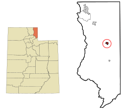 Location in Rich County and the state of Utah | |
 Location of Utah in the United States | |
| Coordinates: 41°39′52″N 111°11′0″W / 41.66444°N 111.18333°WCoordinates: 41°39′52″N 111°11′0″W / 41.66444°N 111.18333°W | |
| Country | United States |
| State | Utah |
| County | Rich |
| Founded | March 14, 1870 |
| Founded by | Randolph H. Stewart |
| Area | |
| • Total | 1.0 sq mi (2.7 km2) |
| • Land | 1.0 sq mi (2.7 km2) |
| • Water | 0.0 sq mi (0.0 km2) |
| Elevation | 6,283 ft (1,915 m) |
| Population (2010) | |
| • Total | 463 |
| • Density | 466.1/sq mi (180.0/km2) |
| Time zone | Mountain (MST) (UTC-7) |
| • Summer (DST) | MDT (UTC-6) |
| ZIP code | 84064 |
| Area code(s) | 435 |
| FIPS code | 49-63020[1] |
| GNIS feature ID | 1431567[2] |

Randolph is a town in Rich County, Utah, in the United States. As of the 2010 census, the town population was 464. It is the county seat of Rich County.[3] Randolph had the highest percentage of people of any city in the country vote for George W. Bush in the 2004 election, at 95.6%. Randolph's municipal classification was officially changed from a city to a town on January 1, 2009.
Geography and climate
According to the United States Census Bureau, the town has a total area of 1.0 square miles (2.7 km²), all of it land.
| Climate data for Randolph, Utah (1981–2010) | |||||||||||||
|---|---|---|---|---|---|---|---|---|---|---|---|---|---|
| Month | Jan | Feb | Mar | Apr | May | Jun | Jul | Aug | Sep | Oct | Nov | Dec | Year |
| Average high °F (°C) | 27.6 (−2.4) |
31.1 (−0.5) |
42.6 (5.9) |
53.2 (11.8) |
63.0 (17.2) |
72.7 (22.6) |
81.9 (27.7) |
80.2 (26.8) |
70.2 (21.2) |
57.8 (14.3) |
40.9 (4.9) |
27.7 (−2.4) |
54.1 (12.3) |
| Average low °F (°C) | 1.5 (−16.9) |
4.0 (−15.6) |
15.5 (−9.2) |
23.2 (−4.9) |
30.3 (−0.9) |
37.5 (3.1) |
42.9 (6.1) |
40.4 (4.7) |
31.4 (−0.3) |
22.4 (−5.3) |
13.9 (−10.1) |
2.5 (−16.4) |
22.1 (−5.5) |
| Average precipitation inches (mm) | 0.86 (21.8) |
0.92 (23.4) |
0.88 (22.4) |
1.31 (33.3) |
1.68 (42.7) |
1.21 (30.7) |
0.90 (22.9) |
1.20 (30.5) |
1.44 (36.6) |
1.17 (29.7) |
1.08 (27.4) |
0.94 (23.9) |
13.58 (344.9) |
| Average snowfall inches (cm) | 10.7 (27.2) |
10.8 (27.4) |
8.0 (20.3) |
6.0 (15.2) |
2.1 (5.3) |
0.1 (0.3) |
0.0 (0) |
0.0 (0) |
1.2 (3) |
2.7 (6.9) |
7.8 (19.8) |
11.9 (30.2) |
61.2 (155.4) |
| Source: NOAA[4] | |||||||||||||
Demographics
| Historical population | |||
|---|---|---|---|
| Census | Pop. | %± | |
| 1870 | 76 | — | |
| 1880 | 446 | 486.8% | |
| 1890 | 472 | 5.8% | |
| 1900 | 821 | 73.9% | |
| 1910 | 533 | −35.1% | |
| 1920 | 586 | 9.9% | |
| 1930 | 447 | −23.7% | |
| 1940 | 656 | 46.8% | |
| 1950 | 562 | −14.3% | |
| 1960 | 537 | −4.4% | |
| 1970 | 500 | −6.9% | |
| 1980 | 659 | 31.8% | |
| 1990 | 488 | −25.9% | |
| 2000 | 483 | −1.0% | |
| 2010 | 464 | −3.9% | |
| Est. 2015 | 462 | [5] | −0.4% |
As of the census[1] of 2000, there were 483 people, 150 households, and 118 families residing in the town. The population density was 466.1 people per square mile (179.3/km²). There were 190 housing units at an average density of 183.4 per square mile (70.5/km²). The racial makeup of the city was 99.38% (480 people) White, 0.21% (one person) Asian, and 0.41% (two people) from two or more races. Hispanic or Latino of any race were 1.86% of the population (nine individuals).
There were 150 households out of which 49.3% had children under the age of 18 living with them, 73.3% were married couples living together, 2.7% had a female householder with no husband present, and 20.7% were non-families. 18.7% of all households were made up of individuals and 7.3% had someone living alone who was 65 years of age or older. The average household size was 3.21 and the average family size was 3.74.
In the town the population was spread out with 38.5% under the age of 18, 7.2% from 18 to 24, 26.3% from 25 to 44, 16.8% from 45 to 64, and 11.2% who were 65 years of age or older. The median age was 30 years. For every 100 females there were 101.3 males. For every 100 females age 18 and over, there were 102.0 males.
The median income for a household in the town was $34,792, and the median income for a family was $42,917. Males had a median income of $35,625 versus $20,833 for females. The per capita income for the city was $13,477. About 9.5% of families and 14.0% of the population were below the poverty line, including 17.6% of those under age 18 and 3.5% of those age 65 or over.
Notable residents
- Monte J. Brough, official in The Church of Jesus Christ of Latter-day Saints
- David M. Kennedy, Secretary of the Treasury from 1969–1971
- George Kennedy, Utah State Road Superintendent, father of David M. Kennedy
- Reuben D. Law, college president, chairman of the Utah State Board of Education (1976-7)
- LaRell Muir, mayor of Murray, Utah from 1977–1986
References
- 1 2 "American FactFinder". United States Census Bureau. Retrieved 2008-01-31.
- ↑ "US Board on Geographic Names". United States Geological Survey. 2007-10-25. Retrieved 2008-01-31.
- ↑ "Find a County". National Association of Counties. Retrieved 2011-06-07.
- ↑ "NOWData - NOAA Online Weather Data". National Oceanic and Atmospheric Administration. Retrieved May 5, 2013.
- ↑ "Annual Estimates of the Resident Population for Incorporated Places: April 1, 2010 to July 1, 2015". Retrieved July 2, 2016.
- ↑ "Census of Population and Housing". Census.gov. Retrieved June 4, 2015.
 |
Laketown | |
|
|
| North Logan Logan Providence / Wasatch-Cache National Forest Nibley Hyrum Paradise |
|
| ||
| ||||
| | ||||
| Huntsville / Wasatch-Cache National Forest | Woodruff | |
Municipalities and communities of Rich County, Utah, United States | ||
|---|---|---|
| Towns | 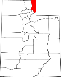 | |
| CDP | ||
| Ghost town | ||