Ravelo Municipality
| Ravelo Municipality | |
|---|---|
| Municipality | |
|
The small village of Toroca in the Ravelo Municipality | |
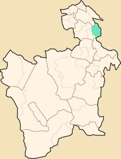 Location within Potosí Department | |
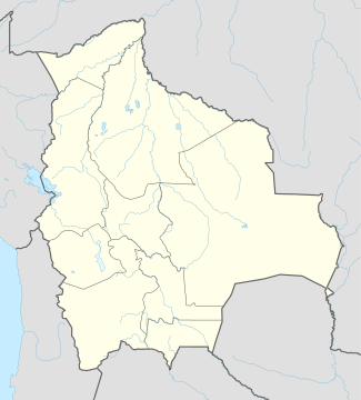 Ravelo Municipality Location within Bolivia | |
| Coordinates: 18°47′S 65°33′W / 18.783°S 65.550°WCoordinates: 18°47′S 65°33′W / 18.783°S 65.550°W | |
| Country |
|
| Department | Potosí Department |
| Province | Chayanta Province |
| Seat | Ravelo |
| Population (2001) | |
| • Total | 20,536 |
| • Ethnicities | Quechua |
| Time zone | -4 (UTC-4) |

Ravelo Municipality is the second municipal section of the Chayanta Province in the Potosí Department in Bolivia. Its seat is Ravelo.
Geography
Some of the highest mountains of the municipality are listed below:[1][2][3][4]
- Apachita
- Chullpa Urqu
- Ch'iyar Jaqhi
- Jatun Lluqhi
- Jatun Urqu
- Katariri
- Kuntur Qaqa
- Markawi
- Palta Urqu
- Pata Urqu
- Puka Q'asa
- Puka Urqu
- Q'illu Wasi
- Sankayu
- Sikuyayuq
- Tullu Muqu
- Ura Urqu
- Urqu Pata
- Wathiya Punta
- Wayra Wasi
- Wichhu Qullu
- Wisk'achani
- Wisk'achani Punta
- Yana Qaqa
- Yana Urqu
- Yuraq Urqu
Subdivision
The municipality consists of the following cantons:
- Antora
- Huaycoma
- Pitantora
- Ravelo
- Tomoyo
- Toroca
The people
The people are predominantly indigenous citizens of Quechua descent.[5]
| Ethnic group | % |
|---|---|
| Quechua | 94.4 |
| Aymara | 0.3 |
| Guaraní, Chiquitos, Moxos | 0.1 |
| Not indigenous | 5.2 |
| Other indigenous groups | 0.1 |
References
External links
Capital: Potosí | ||
| Provinces | 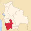 | |
| Municipalities (and seats) |
| |
This article is issued from Wikipedia - version of the 5/4/2016. The text is available under the Creative Commons Attribution/Share Alike but additional terms may apply for the media files.