Yocalla Municipality
| Yocalla Municipality | |
|---|---|
| Municipality | |
|
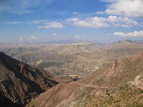
Cordillera de los Frailes, looking west. Pari Chata (Yocalla Municipality) is on the right in the background, left of it is the Pillku Mayu valley. | |
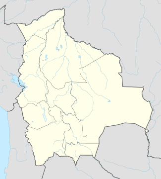
 Location within Potosí Department | |
 Yocalla Municipality Location within Bolivia | |
| Coordinates: 19°23′S 65°55′W / 19.383°S 65.917°WCoordinates: 19°23′S 65°55′W / 19.383°S 65.917°W | |
| Country |
|
| Department | Potosí Department |
| Province | Tomás Frías Province |
| Seat | Yocalla |
| Population (2001) | |
| • Total | 8,046 |
| • Ethnicities | Quechua |
| Time zone | -4 (UTC-4) |
Yocalla Municipality is the second municipal section of the Tomás Frías Province in the Potosí Department in Bolivia. Its seat is Yocalla.
Geography
Some of the highest mountains of the municipality are listed below:[1]
- Achakana
- Chawpi Urqu
- Jalsuri
- Jatun Pampa
- Jatun Qaqa
- Jatun Q'asa
- Kuntur Nasa
- Kunturiri
- Pari Chata
- Puka Urqu
- T'ula P'ujru
- Waylla Qullu
- Waylla Q'asa
- Wichhu Qullu
- Wila Salla
- Wila Sirka
Subdivision
The municipality consists of the following cantons:
- Salinas de Yocalla
- Santa Lucia
- Yocalla
The people
The people are predominantly indigenous citizens of Quechua descent.[2]
| Ethnic group | % |
|---|---|
| Quechua | 93.8 |
| Aymara | 0.4 |
| Guaraní, Chiquitos, Moxos | 0.1 |
| Not indigenous | 5.7 |
| Other indigenous groups | 0.1 |
See also
References
- ↑ Bolivian IGM map 1:50,000 Potosí (Oeste) 6435-III, Puna 6435-III
- ↑ obd.descentralizacion.gov.bo/municipal/fichas/ (inactive)
External links
Capital: Potosí | ||
| Provinces | 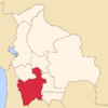 | |
| Municipalities (and seats) |
| |
This article is issued from Wikipedia - version of the 9/14/2016. The text is available under the Creative Commons Attribution/Share Alike but additional terms may apply for the media files.