Reedham, Norfolk
| Reedham | |
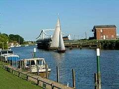 Reedham Swing Bridge |
|
 Reedham |
|
| Area | 12.45 km2 (4.81 sq mi) |
|---|---|
| Population | 1,207 (2011)[1] |
| – density | 97/km2 (250/sq mi) |
| OS grid reference | TG420018 |
| Civil parish | Reedham |
| District | Broadland |
| Shire county | Norfolk |
| Region | East |
| Country | England |
| Sovereign state | United Kingdom |
| Post town | NORWICH |
| Postcode district | NR13 |
| Police | Norfolk |
| Fire | Norfolk |
| Ambulance | East of England |
| EU Parliament | East of England |
Coordinates: 52°33′37″N 1°34′08″E / 52.56018°N 1.56889°E
Reedham is a village and civil parish in the English county of Norfolk and within The Broads. It is on the north bank of the River Yare, some 12 miles (19 km) east of the city of Norwich, 7.5 mi (12.1 km) south-west of the town of Great Yarmouth and the same distance north-west of the Suffolk town of Lowestoft.[2]
Before the draining of the marshes towards Great Yarmouth,Reedham was a coastal village which included a Roman lighthouse. Fragments of Roman brick and stone can be found in the local church.
King Edmund of East Anglia is said to have lived here. The Fastolf family, whose most celebrated member was Sir John Fastolf, are recorded here from the 13th century.
The civil parish includes a significant area of nearby marshland, together with the famously isolated settlement of Berney Arms. It has an area of 4.81 sq mi (12.5 km2) and in the 2001 census had a population of 925 in 406 households, increasing to a population of 1,207 in 505 households at the 2011 Census. For the purposes of local government, the parish falls within the district of Broadland.[3]

Reedham Ferry, a chain ferry just outside the village, is the only road crossing point on the River Yare between Norwich and Great Yarmouth. The railway line between Norwich and Lowestoft crosses the river on Reedham Swing Bridge. Reedham railway station, which serves the village, gives connections to Norwich, Lowestoft, and Great Yarmouth (via Berney Arms).
Polkey's Mill is a derelict grade II* listed windpump dating from the 19th century.[4]
HMS Reedham was a Ham class minesweeper.
Notes
- ↑ "Civil Parish population 2011". Neighbourhood Statistics. Office for National Statistics. Retrieved 29 July 2016.
- ↑ Ordnance Survey (2005). OS Explorer Map OL40 - The Broads. ISBN 0-319-23769-9.
- ↑ Office for National Statistics & Norfolk County Council (2001). Census population and household counts for unparished urban areas and all parishes. Retrieved December 2, 2005.
- ↑ Historic England. "Polkey's Mill, 75 metres north-east of Seven Mile House (Grade II*) (1051425)". National Heritage List for England. Retrieved 6 January 2014.
External links
| Wikimedia Commons has media related to Reedham, Norfolk. |
- Map sources for Reedham, Norfolk
- Information from Genuki Norfolk on Reedham.