Rhosneigr
| Rhosneigr | |
 |
|
 Rhosneigr |
|
| Population | 1,008 |
|---|---|
| Community | Llanfaelog |
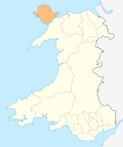
| Principal area | Anglesey |
| Ceremonial county | Gwynedd |
| Country | Wales |
| Sovereign state | United Kingdom |
| Post town | RHOSNEIGR |
| Postcode district | LL64 |
| Dialling code | 01407 |
| Police | North Wales |
| Fire | North Wales |
| Ambulance | Welsh |
| EU Parliament | Wales |
| UK Parliament | Ynys Môn |
| Welsh Assembly | Ynys Môn |
Coordinates: 53°13′45″N 4°31′12″W / 53.229154°N 4.520006°W
Rhosneigr is a village in the south-west of Anglesey, North Wales. It is situated on the A4080 road some 10 km south-east of Holyhead, and is on the Anglesey Coastal Path. From the clock at the centre of the village can be seen RAF Valley and Holyhead Mountain. The major towns of Holyhead and Llangefni and the city of Bangor are all within easy travelling distance. It is the most expensive place to live in Anglesey in terms of house prices.
The village contains four caravan sites, three camp sites, holiday homes and bungalows, pubs, hotels, cafes, a new village hall, a chapel, residential homes, a school, a fire station, a convenience store and Post Office, a pharmacy and a fish and chip shop. It is served by Rhosneigr railway station.
Recreational activities include: swimming, surfing, wind surfing, kite surfing, wakeboarding, shore and boat fishing, water skiing, golf, tennis and underwater diving. The village is home to Anglesey Golf Club.
It has three main beaches:
- 'Traeth Cymyran' that stretches from Afon Crigyll estuary to the Cymyran Strait.
- 'Pwll Cwch' and the 'Town Beach' – a small, rocky beach where boats and yachts stay overnight, running into a sandy beach interspersed by rocks and views of Snowdonia. It is popular with watersports enthusiasts, notably windsurfers and sailors.
- 'Traeth Llydan' which runs from the Barclodiad y Gawres ancient monument to Rhosneigr, ranging from pebble shores to pristine sandy shores. It is perfect for canoeing, walking and surfing. Traeth Llydan is a regular Green Coast Award Winner and is backed by sand dunes.
Llyn Maelog is around 65 acres in total with varying depth up to seven feet. It is a designated Site of Special Scientific Interest. There is a good stock of fish in the lake including perch, bream, roach and pike. A large variety of birdlife inhabits the reedbeds. grey heron, snipe, reed warblers, coots, mallard, shelducks etc.. Black headed gulls nest on the small island. The lake is circled by public footpath and is popular with walkers. In 2011 it became the first lake in Wales to be classified as a village green.[1]
Maelog Lake Golf Club (now defunct) appeared prior to WW1. The club and course disappeared at the onset of WW2.[2]
Governance
An electoral ward in the same name exists. This ward has a population taken at the 2011 census was 1,008.[3] It is in the community of Llanfaelog.
References
- ↑ "Llyn Maelog lake on Anglesey given village green status". BBC News. 7 July 2011. Retrieved 7 July 2011.
- ↑ “Maelog Lake Golf Club”, “Golf’s Missing Links”.
- ↑ "Ward population 2011". Retrieved 20 May 2015.

External links
 Rhosneigr travel guide from Wikivoyage
- Rhosneigr Community web site
- Llanfaelog Community Council web site
- A description of Rhosneigr during World War II
- Photos of Rhosneigr and surrounding area on geograph.org.uk
- Rhosneigr Holidays
- Map sources for Rhosneigr