Riebeek West
| Riebeek West Riebeek-Wes | |
|---|---|
|
Riebeek West | |
 Riebeek West  Riebeek West  Riebeek West
| |
| Coordinates: 33°21′1.69″S 18°52′2.52″E / 33.3504694°S 18.8673667°ECoordinates: 33°21′1.69″S 18°52′2.52″E / 33.3504694°S 18.8673667°E | |
| Country | South Africa |
| Province | Western Cape |
| District | West Coast |
| Municipality | Swartland |
| Established | 1858 |
| Area[1] | |
| • Total | 3.43 km2 (1.32 sq mi) |
| Population (2011)[1] | |
| • Total | 4,350 |
| • Density | 1,300/km2 (3,300/sq mi) |
| Racial makeup (2011)[1] | |
| • Black African | 5.1% |
| • Coloured | 83.6% |
| • Indian/Asian | 0.6% |
| • White | 10.5% |
| • Other | 0.2% |
| First languages (2011)[1] | |
| • Afrikaans | 93.6% |
| • English | 4.2% |
| • Other | 2.3% |
| Postal code (street) | 7306 |
| PO box | 7306 |
| Area code | 022 |
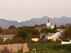
Riebeek West (Afrikaans: Riebeek-Wes) is a small town situated 5 km from Riebeek Kasteel and about 75 km north-east of Cape Town in the Swartland area of the Western Cape, South Africa.
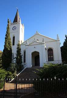
Village some 50 km north-north-west of Paarl and 61 km south-south-west of Piketberg. It was established as a parish of the Dutch Reformed Church in 1858 and named after Riebeek-Kasteel, at the foot of which it is situated. It was the birthplace of General Jan Christiaan Smuts, former Prime Minister of South Africa. The form Riebeek-Wes is preferred for official purposes.[2]
The Riebeek Valley is known for its wheat, wines and more recently olives. The area of Riebeek West was first seen by Cape Dutch scouts in the late 17th century. The first settlers arrived in the area in the early 18th century.
Today the population of Riebeek West is about 4,000 people; on the west side of the main road (Voortrekker Road) is mainly white people, on the east side it is mainly coloured people.
References
- 1 2 3 4 "Main Place Riebeek West". Census 2011.
- ↑ "Dictionary of Southern African Place Names (Public Domain)". Human Science Research Council. p. 386.
External links
Municipalities and communities of West Coast District Municipality, Western Cape | ||
|---|---|---|
District seat: Moorreesburg | ||
| Matzikama | .svg.png) | |
| Cederberg | ||
| Bergrivier | ||
| Saldanha Bay | ||
| Swartland | ||