Ringland, Newport
| Ringland | |
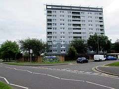 Milton Court, Ringland in June 2016 |
|
 Ringland |
|
| Population | 8,550 (2011 census)[1] |
|---|---|
| OS grid reference | ST352888 |
| Principal area | Newport |
| Country | Wales |
| Sovereign state | United Kingdom |
| Post town | NEWPORT |
| Postcode district | NP19 9 |
| Postcode district | NP18 2 |
| Dialling code | 01633 Maindee exchange |
| Police | Gwent |
| Fire | South Wales |
| Ambulance | Welsh |
| EU Parliament | Wales |
| UK Parliament | Newport East |
Coordinates: 51°35′39″N 2°56′13″W / 51.59430°N 2.93686°W
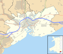
Ringland is both an electoral ward (district) and community (parish) of the city of Newport, South Wales.
The ward is bounded by Ringland Way to the east, the southern boundary of Llanwern High School to the south, Balfe Rd, Aberthaw Rd, Ringland Circle, Ringwood Avenue, across Chepstow Rd, Mountbatten close and behind Chiltern Close and Glanwern Grove to the west and the M4 motorway to the north. The area is governed by the Newport City Council.
References
External links
| Wikimedia Commons has media related to Ringland, Newport. |
This article is issued from Wikipedia - version of the 11/17/2016. The text is available under the Creative Commons Attribution/Share Alike but additional terms may apply for the media files.