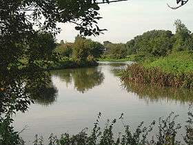
River Stort
| Stort | |
| River | |
 | |
| Country | United Kingdom |
|---|---|
| Source | New Lake |
| - location | Near Langley, Essex, England |
| - elevation | 130 m (427 ft) |
| - coordinates | 52°00′10″N 0°04′06″E / 52.0027°N 0.0683°E |
| Mouth | River Lea |
| - location | Near Hoddesdon, Hertfordshire |
| - elevation | 28 m (92 ft) |
| - coordinates | 51°45′52″N 0°00′51″E / 51.7644°N 0.0141°ECoordinates: 51°45′52″N 0°00′51″E / 51.7644°N 0.0141°E |
| Length | 38 km (24 mi) |
The River Stort is a river in Essex and Hertfordshire, England. It is 24 miles (38 km) long and flows from just south of the village of Langley to the River Lea at Hoddesdon. Unusually, the town of Bishop's Stortford does not derive its name from the River Stort, but the other way around. 16th-century cartographers Saxton & Camden named the river Stort, assuming the town of Stortford was named for its ford.[1]
Course
From Langley, the Stort flows in a generally southerly direction through the villages of Clavering and Manuden and the market town of Bishop's Stortford.
It then flows past Sawbridgeworth, before it changes direction and flows west past Harlow and Roydon. It finally empties into the Lea at Feildes Weir, Hoddesdon. This 14-mile (22-km) long section was canalised in the 18th century as the Stort Navigation.
External links
References
- ↑ "River Stort – Stort Navigation". Bishop's Stortford and Thorley, A History and Guide. Retrieved 6 November 2013.
| Wikimedia Commons has media related to River Stort. |