River Rib
| Rib | |
| River | |
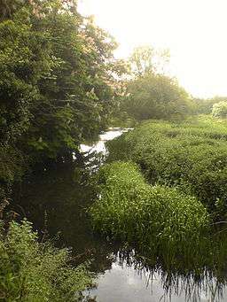 The Rib close to its confluence with the River Lea | |
| Country | United Kingdom |
|---|---|
| Source | |
| - location | Buckland Nr. Buntingford, Hertfordshire |
| - elevation | 130 m (427 ft) |
| Mouth | |
| - location | Hertford, Hertfordshire into River Lea |
| Length | 30.7 km (19 mi) |

Rib Valley near Bengeo
The River Rib originates near the East Hertfordshire village of Buckland and runs parallel with the A10 through Wyddial, Buntingford, Westmill, Braughing, Puckeridge and Standon, before dividing the villages of Thundridge and Wadesmill and continuing until it reaches its confluence with the River Lea near Hertford.
History
The River Rib used to have frequent floods due to heavy rain in the autumn, but this propensity was resolved by dredging and engineering work in the 1970s. It was used as the main water supply in Buntingford and the surrounding areas before a pump was installed.
See also
 Media related to River Rib at Wikimedia Commons
- Index: River Lea
Coordinates: 51°48′N 0°04′W / 51.800°N 0.067°W
This article is issued from Wikipedia - version of the 6/16/2016. The text is available under the Creative Commons Attribution/Share Alike but additional terms may apply for the media files.