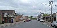
Roberts, Wisconsin
| Roberts, Wisconsin | |
|---|---|
| Village | |
 | |
 Location of Roberts, Wisconsin | |
| Coordinates: 44°59′2″N 92°33′14″W / 44.98389°N 92.55389°WCoordinates: 44°59′2″N 92°33′14″W / 44.98389°N 92.55389°W | |
| Country | United States |
| State | Wisconsin |
| County | St. Croix |
| Area[1] | |
| • Total | 2.26 sq mi (5.85 km2) |
| • Land | 2.26 sq mi (5.85 km2) |
| • Water | 0 sq mi (0 km2) |
| Elevation[2] | 1,033 ft (315 m) |
| Population (2010)[3] | |
| • Total | 1,651 |
| • Estimate (2012[4]) | 1,649 |
| • Density | 730.5/sq mi (282.0/km2) |
| Time zone | Central (CST) (UTC-6) |
| • Summer (DST) | CDT (UTC-5) |
| Area code(s) | 715 & 534 |
| FIPS code | 55-68475[5] |
| GNIS feature ID | 1581705[2] |
Roberts is a village in St. Croix County, Wisconsin, United States. The population was 1,651 at the 2010 census. The village is surrounded by the town of Warren.
History
Roberts was named in 1873 for a railroad engineer.[6] A post office called Roberts has been in operation since 1884.[7]
Geography
Roberts is located at 44°59′2″N 92°33′14″W / 44.98389°N 92.55389°W (44.983807, -92.553790).[8]
According to the United States Census Bureau, the village has a total area of 2.26 square miles (5.85 km2), all of it land.[1]
Demographics
| Historical population | |||
|---|---|---|---|
| Census | Pop. | %± | |
| 1880 | 86 | — | |
| 1950 | 290 | — | |
| 1960 | 308 | 6.2% | |
| 1970 | 484 | 57.1% | |
| 1980 | 833 | 72.1% | |
| 1990 | 1,043 | 25.2% | |
| 2000 | 969 | −7.1% | |
| 2010 | 1,651 | 70.4% | |
| Est. 2015 | 1,638 | [9] | −0.8% |
2010 census
At the 2010 census,[3] there were 1,651 people, 625 households and 442 families in the village. The population density was 730.5 inhabitants per square mile (282.0/km2). There were 724 housing units at an average density of 320.4 per square mile (123.7/km2). The racial makeup of the village was 94.5% White, 1.4% African American, 0.4% Native American, 1.5% Asian, 0.2% Pacific Islander, 0.7% from other races, and 1.3% from two or more races. Hispanic or Latino of any race were 2.1% of the population.
There were 625 households of which 41.1% had children under the age of 18 living with them, 52.0% were married couples living together, 11.5% had a female householder with no husband present, 7.2% had a male householder with no wife present, and 29.3% were non-families. 21.9% of all households were made up of individuals and 5.2% had someone living alone who was 65 years of age or older. The average household size was 2.64 and the average family size was 3.09.
The median age was 31.3 years. 29.5% of residents were under the age of 18; 7% were between the ages of 18 and 24; 35.6% were from 25 to 44; 22% were from 45 to 64; and 5.7% were 65 years of age or older. The population was 50.5% male and 49.5% female.
2000 census
At the 2000 census,[5] there were 969 people, 392 households and 255 families residing in the village. The population density was 1,805.3 per square mile (692.8/km²). There were 402 housing units at an average density of 748.9 per square mile (287.4/km²). The racial makeup of the village was 97.94% White, 0.10% African American, 0.52% Native American, 0.41% Asian, 0.31% from other races, and 0.72% from two or more races. Hispanic or Latino of any race were 0.93% of the population.
There were 392 households of which 33.2% had children under the age of 18 living with them, 48.7% were married couples living together, 10.5% had a female householder with no husband present, and 34.7% were non-families. 25.8% of all households were made up of individuals and 5.6% had someone living alone who was 65 years of age or older. The average household size was 2.47 and the average family size was 3.00.
24.9% of the population were under the age of 18, 11.6% from 18 to 24, 35.3% from 25 to 44, 21.7% from 45 to 64, and 6.6% who were 65 years of age or older. The median age was 32 years. For every 100 females there were 99.8 males. For every 100 females age 18 and over, there were 100.6 males.
The median household income was $42,258 and the median family income was $47,857. Males had a median income of $35,968 compared with $23,819 for females. The per capita income for the village was $19,616. About 3.5% of families and 5.5% of the population were below the poverty line, including 4.2% of those under age 18 and 21.2% of those age 65 or over.
Education
St. Croix Central Elementary School is in Roberts. St. Croix Central Middle and High Schools are in the neighboring community of Hammond.
References
- 1 2 "US Gazetteer files 2010". United States Census Bureau. Retrieved 2012-11-18.
- 1 2 "US Board on Geographic Names". United States Geological Survey. 2007-10-25. Retrieved 2008-01-31.
- 1 2 "American FactFinder". United States Census Bureau. Retrieved November 18, 2012.
- ↑ "Population Estimates". United States Census Bureau. Retrieved 2013-06-24.
- 1 2 "American FactFinder". United States Census Bureau. Retrieved 2008-01-31.
- ↑ Chicago and North Western Railway Company (1908). A History of the Origin of the Place Names Connected with the Chicago & North Western and Chicago, St. Paul, Minneapolis & Omaha Railways. p. 189.
- ↑ "Saint Croix County". Jim Forte Postal History. Retrieved 4 April 2015.
- ↑ "US Gazetteer files: 2010, 2000, and 1990". United States Census Bureau. 2011-02-12. Retrieved 2011-04-23.
- ↑ "Annual Estimates of the Resident Population for Incorporated Places: April 1, 2010 to July 1, 2015". Retrieved July 2, 2016.
- ↑ "Census of Population and Housing". Census.gov. Retrieved June 4, 2015.
External links
Municipalities and communities of St. Croix County, Wisconsin, United States | ||
|---|---|---|
| Cities |  | |
| Villages | ||
| Towns | ||
| CDPs | ||
| Unincorporated communities | ||
| Footnotes | ‡This populated place also has portions in an adjacent county or counties | |