Rochester, Massachusetts
| Rochester, Massachusetts | ||
|---|---|---|
| Town | ||
|
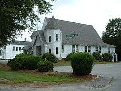
Rochester Town Hall | ||
| ||
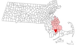 Location in Plymouth County in Massachusetts | ||
| Coordinates: 41°43′54″N 70°49′14″W / 41.73167°N 70.82056°WCoordinates: 41°43′54″N 70°49′14″W / 41.73167°N 70.82056°W | ||
| Country | United States | |
| State | Massachusetts | |
| County | Plymouth | |
| Settled | 1638 | |
| Incorporated | 1686 | |
| Government | ||
| • Type | Open town meeting | |
| Area | ||
| • Total | 36.4 sq mi (94.2 km2) | |
| • Land | 33.9 sq mi (87.9 km2) | |
| • Water | 2.5 sq mi (6.4 km2) | |
| Elevation | 29 ft (9 m) | |
| Population (2010) | ||
| • Total | 5,232 | |
| • Density | 154.3/sq mi (59.5/km2) | |
| Time zone | Eastern (UTC-5) | |
| • Summer (DST) | Eastern (UTC-4) | |
| ZIP code | 02770 | |
| Area code(s) | 508 / 774 | |
| FIPS code | 25-57600 | |
| GNIS feature ID | 0618350 | |
| Website | http://www.townofrochestermass.com | |

Rochester is a town in Plymouth County, Massachusetts, United States. The population was 5,232 at the 2010 census.[1]
History
Rochester was settled in 1679 on the lands called "Sippican" by the local Wampanoags, along the coast of Buzzards Bay. (Sippican was the name of the local tribe.[2]) It originally included the lands of Mattapoisett, Marion and parts of Wareham (which was lost when Wareham was founded in 1739). The town was officially incorporated on June 4, 1686 as Rochester, and was renamed for Rochester, England, from which early settlers to the town came. The town originally thrived with the early shipbuilding and whaling trade in Mattapoisett Harbor. However, in 1852 and 1857 the towns of Marion and Mattapoisett, respectively, were separated and incorporated as separate towns, thus landlocking Rochester. Since that time, the town has become mostly rural-residential, with some farms located in town.[3] Rochester is a "Right to Farm" community. [4]
Geography
According to the United States Census Bureau, the town has a total area of 36.4 square miles (94 km2), of which 33.9 square miles (88 km2) is land and 2.5 square miles (6.5 km2), or 6.76%, is water. Rochester is located along the western border of Plymouth County, and is bordered by Lakeville and Middleborough to the north, Wareham and Marion to the east, Mattapoisett to the south, and Acushnet and Freetown to the west. The town's localities include Bisbee Corner, East Rochester, North Rochester and Varella Corner. The town is about 10 miles (16 km) northeast of New Bedford, 40 miles (64 km) east of Providence, Rhode Island, and 60 miles (97 km) south of Boston.
The Mattapoisett and Sippican rivers flow through the town, emptying into Buzzards Bay. Most of the town's brooks also flow into these two rivers. The source of the Mattapoisett, Great Quittacas Pond and Little Quittacas Pond, lie on the border between the town and Lakeville. Other ponds include Snipatuit Pond, Long Pond, Snow's Pond, Hartley's Mill Pond, Mary's Pond, Leonards Pond, Mill Pond and Hathaway Pond, as well as several smaller bodies of water. The town has two wildlife management areas and a fish hatchery, as well as a small recreation area along Mary's Pond and two parks near the town center. The town is also the site of the Sippican Rod & Gun Club, near the Haskell Wildlife Management Area.
Transportation
A small, quarter-mile stretch of Interstate 495 passes through the northeast corner of town, just before its exit on Route 58, which terminates along the town line at Route 28. Along with those two roads, Route 105 travels through town, passing through the town center. The town can also be accessed via Exits 19B (North Street, Mattapoisett) and 20 (Route 105, Marion) along Interstate 195.
The nearest regional bus and air service can be found in New Bedford. The nearest national air service is at T. F. Green Airport in Rhode Island, and the nearest international airport is Logan International Airport in Boston. A freight rail line operated by the Massachusetts Coastal Railroad passes through the northeast corner of town. The nearest inter-city (Amtrak) passenger rail station is in Providence; however, the terminus of the Middleborough-Lakeville line of the MBTA's commuter rail is nearby, providing direct service to Boston.
Demographics
| Historical population | ||
|---|---|---|
| Year | Pop. | ±% |
| 1850 | 3,808 | — |
| 1860 | 1,232 | −67.6% |
| 1870 | 1,024 | −16.9% |
| 1880 | 1,043 | +1.9% |
| 1890 | 1,012 | −3.0% |
| 1900 | 986 | −2.6% |
| 1910 | 1,090 | +10.5% |
| 1920 | 1,047 | −3.9% |
| 1930 | 1,141 | +9.0% |
| 1940 | 1,269 | +11.2% |
| 1950 | 1,328 | +4.6% |
| 1960 | 1,559 | +17.4% |
| 1970 | 1,770 | +13.5% |
| 1980 | 3,205 | +81.1% |
| 1990 | 3,921 | +22.3% |
| 2000 | 4,581 | +16.8% |
| 2010 | 5,232 | +14.2% |
| * = population estimate. Source: United States Census records and Population Estimates Program data.[5][6][7][8][9][10][11][12][13][14] | ||
As of the census[15] of 2000, there were 4,581 people, 1,575 households, and 1,294 families residing in the town. The population density was 135.0 people per square mile (52.1/km²). There were 1,634 housing units at an average density of 48.2 per square mile (18.6/km²). The racial makeup of the town was 96.64% White, 0.63% African American, 0.20% Native American, 0.35% Asian, 1.16% from other races, and 1.03% from two or more races. Hispanic or Latino of any race were 0.37% of the population.

There were 1,575 households out of which 38.9% had children under the age of 18 living with them, 72.6% were married couples living together, 6.5% had a female householder with no husband present, and 17.8% were non-families. 13.7% of all households were made up of individuals and 5.7% had someone living alone who was 65 years of age or older. The average household size was 2.91 and the average family size was 3.20.
In the town the population was spread out with 26.8% under the age of 18, 6.5% from 18 to 24, 29.6% from 25 to 44, 28.8% from 45 to 64, and 8.3% who were 65 years of age or older. The median age was 38 years. For every 100 females there were 100.6 males. For every 100 females age 18 and over, there were 96.7 males.
The median income for a household in the town was $63,289, and the median income for a family was $67,031. Males had a median income of $47,989 versus $31,196 for females. The per capita income for the town was $24,630. About 2.4% of families and 3.1% of the population were below the poverty line, including 4.4% of those under age 18 and 4.4% of those age 65 or over.
Government


Rochester is represented by state Senator Michael Rodrigues (D-Westport) as a part of the First Bristol and Plymouth District of the Massachusetts Senate and by state Representative William M. Straus (D-Mattapoisett) as a part of the Tenth Bristol District of the Massachusetts House of Representatives.[16] The town is patrolled by the Seventh (Bourne) Barracks of Troop D of the Massachusetts State Police.[17]
On the national level, Rochester is a part of Massachusetts's 9th congressional district, and is currently represented by William R. Keating. The state's senior member of the United States Senate is Elizabeth Warren. The junior senator is Ed Markey.
The town uses the open town meeting form of government, led by a board of selectmen. The town hall is located at the Town Common along Route 105. The town's police department, post office and the Joseph H. Plumb Memorial Library (a part of the SAILS library network) are located nearby. The volunteer fire department is located closer to the geographic center of town. The town's Highway Department is located near Varella Corner, and is responsible for snow removal and road upkeep.
In 2012, the town adopted a "Right-to-Farm" bylaw which "encourages the pursuit of agriculture, promotes agriculture-based economic opportunities, and protects farmlands within the Town of Rochester by allowing agricultural uses and related activities".[4]
Education
Rochester is a member of the 2,700-student Old Rochester Regional School District. The town, along with Marion and Mattapoisett, operate as a single school system with each town having its own school subcommittee. The town operates Rochester Memorial School for kindergarten through sixth-grade students. Seventh- and eighth-grade students attend Old Rochester Regional Junior High School, and high school students attend Old Rochester Regional High School. Both regional schools are located on Route 6 in Mattapoisett, just over the Marion town line. The high school, affectionately known as "O.R.R.," competes in the South Coast Conference for athletics. Their mascot is the bulldog, and their colors are red and white. The town's Thanksgiving Day football rival is Apponequet Regional High School, in Lakeville.
In addition to public schools, high school students may also choose to attend Old Colony Regional Vocational Technical High School, located in North Rochester. Their mascot is the Cougar, and they compete in the Pilgrim Conference for athletics. The curriculum includes shops such as welding, cosmetics, auto, wood work, and many more. The nearest private school is Tabor Academy in Marion.
Notable person
Joseph Bates, founder of the Seventh-Day Adventist Church, was born in Rochester.[18]
References
| Wikimedia Commons has media related to Rochester, Massachusetts. |
- ↑ "Profile of General Population and Housing Characteristics: 2010 Demographic Profile Data (DP-1): Rochester town, Plymouth County, Massachusetts". U.S. Census Bureau, American Factfinder. Retrieved March 21, 2012.
- ↑ Marion Town History
- ↑ Town of Rochester history
- 1 2 "Town of Rochester MA Zoning By-Laws". Town of Rochester, MA. Town of Rochester, MA. Retrieved 19 March 2015.
This By-Law encourages the pursuit of agriculture, promotes agriculture-based economic opportunities, and protects farmlands within the Town of Rochester by allowing agricultural uses and related activities to function with minimal conflict with abutters and Town agencies, when done in compliance with applicable state laws, Town By-Laws and regulations. This By-Law shall apply to all jurisdictional areas within the Town.
- ↑ "TOTAL POPULATION (P1), 2010 Census Summary File 1". American FactFinder, All County Subdivisions within Massachusetts. United States Census Bureau. 2010.
- ↑ "Massachusetts by Place and County Subdivision - GCT-T1. Population Estimates". United States Census Bureau. Retrieved July 12, 2011.
- ↑ "1990 Census of Population, General Population Characteristics: Massachusetts" (PDF). US Census Bureau. December 1990. Table 76: General Characteristics of Persons, Households, and Families: 1990. 1990 CP-1-23. Retrieved July 12, 2011.
- ↑ "1980 Census of the Population, Number of Inhabitants: Massachusetts" (PDF). US Census Bureau. December 1981. Table 4. Populations of County Subdivisions: 1960 to 1980. PC80-1-A23. Retrieved July 12, 2011.
- ↑ "1950 Census of Population" (PDF). Bureau of the Census. 1952. Section 6, Pages 21-10 and 21-11, Massachusetts Table 6. Population of Counties by Minor Civil Divisions: 1930 to 1950. Retrieved July 12, 2011.
- ↑ "1920 Census of Population" (PDF). Bureau of the Census. Number of Inhabitants, by Counties and Minor Civil Divisions. Pages 21-5 through 21-7. Massachusetts Table 2. Population of Counties by Minor Civil Divisions: 1920, 1910, and 1920. Retrieved July 12, 2011.
- ↑ "1890 Census of the Population" (PDF). Department of the Interior, Census Office. Pages 179 through 182. Massachusetts Table 5. Population of States and Territories by Minor Civil Divisions: 1880 and 1890. Retrieved July 12, 2011.
- ↑ "1870 Census of the Population" (PDF). Department of the Interior, Census Office. 1872. Pages 217 through 220. Table IX. Population of Minor Civil Divisions, &c. Massachusetts. Retrieved July 12, 2011.
- ↑ "1860 Census" (PDF). Department of the Interior, Census Office. 1864. Pages 220 through 226. State of Massachusetts Table No. 3. Populations of Cities, Towns, &c. Retrieved July 12, 2011.
- ↑ "1850 Census" (PDF). Department of the Interior, Census Office. 1854. Pages 338 through 393. Populations of Cities, Towns, &c. Retrieved July 12, 2011.
- ↑ "American FactFinder". United States Census Bureau. Retrieved 2008-01-31.
- ↑ Index of Legislative Representation by City and Town, from Mass.gov
- ↑ Station D-7, SP Bourne
- ↑ "Footsteps of the Pioneers- Joseph Bates". Adventist Heritage. Retrieved 21 April 2016.
External links
- Town of Rochester official website
- Plumb Memorial Library (public library)
- Live area Police & Fire Scanner Radio
- Answer Book/Rochester: "Everything you need to know"
