Romsey, Victoria
| Romsey Victoria | |||||||||||||
|---|---|---|---|---|---|---|---|---|---|---|---|---|---|
|
A service lane parallel to Main Street in Romsey | |||||||||||||
 Romsey | |||||||||||||
| Coordinates | 37°21′S 144°45′E / 37.350°S 144.750°ECoordinates: 37°21′S 144°45′E / 37.350°S 144.750°E | ||||||||||||
| Population | 4,412 (2011 census)[1] | ||||||||||||
| Established | 1850s | ||||||||||||
| Postcode(s) | 3434 | ||||||||||||
| Elevation | 490 m (1,608 ft) | ||||||||||||
| Location | |||||||||||||
| LGA(s) | Shire of Macedon Ranges | ||||||||||||
| State electorate(s) | Macedon | ||||||||||||
| Federal Division(s) | McEwen | ||||||||||||
| |||||||||||||
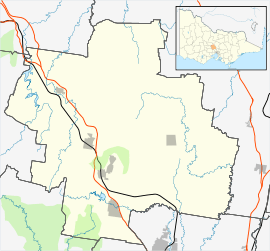
Romsey /ˈrɒmzi/ is a town in the local government area of the Shire of Macedon Ranges in the state of Victoria, Australia. The town is 61 kilometres (38 mi) north of Melbourne. At the 2011 census, Romsey had a population of 4,412.
History
The original location for the settlement known as Five Mile Creek was approximately 2 kilometres (1.2 mi) north of the present township. The restored Royal Mail Hotel still stands on this site although it is now a private residence.[2]
The Post Office opened on 16 January 1858, in the Royal Mail Hotel (then the Drovers and Carriers Arms), but was named Lancefield until 19 January 1860 and Five Mile Creek until March 1860.[3] The Post Office was moved closer to the centre of the present township in 1864.
The former Romsey station was a significant stopping point on the now dismantled Clarkefield-Lancefield railway between 1881 and 1956.
Today
Romsey has a skate park, one petrol station [Caltex], banks, two supermarkets, a pub and a primary school. The local Lions Park is built around Five Mile Creek, a small creek running through the town. After extensive renovations were carried out in the historic Shire of Romsey Council Chambers building and the old Romsey Post Office building, a public library operates in the former Council Chambers building, which opened in 2008, whilst the old post office building operates as part of the Romsey Service Centre for the local government.
Four Christian churches serve Romsey: the Anglican Parish of Lancefield and Romsey; St Mary's Catholic Parish of Romsey and Lancefield; Living Word Church; and the Romsey Uniting Church. The four churches gather together in an annual ecumenical service in winter, and take turns hosting a community carol service at Christmas.
Local sporting groups include Romsey Football Club competing in the Riddell District Football League.
Golfers play at the course of the Romsey Golf Club off Park Lane.[4]

 Romsey Airfield
See also
References
- ↑ Australian Bureau of Statistics (31 October 2012). "Romsey, Vic(SSC)". 2011 Census QuickStats. Retrieved 2012-10-24.
- ↑ Mitchell, Peter; Alan Jackson; Carol Moore; Gavin Smith (2004). Romsey: A Veritable Garden of Eden. Romsey: West Bourke Books Inc. ISBN 0-646-43570-1.
- ↑ Premier Postal History. "Post Office List". Retrieved 2008-04-11.
- ↑ Golf Select. "Romsey". Retrieved 2009-05-11.
Books on the district
| Wikimedia Commons has media related to Romsey, Victoria. |
- Mitchell, Peter; Alan Jackson; Carol Moore; Gavin Smith (2004). Romsey: A Veritable Garden of Eden. Romsey: West Bourke Books Inc. ISBN 0-646-43570-1.
- Reid, John (Ed.) (1992). When Memory Turns the Key: The History of the Shire of Romsey. Bacchus Marsh: Joval. ISBN 0-9588112-5-3.
- Smith, Gavin (1994). All Wild and Lonely Bush. Romsey: Shire of Romsey Book Committee. ISBN 0-646-23834-5.