Toolern Vale, Victoria
| Toolern Vale Victoria | |||||||||||||
|---|---|---|---|---|---|---|---|---|---|---|---|---|---|
 The state primary school at Toolern Vale | |||||||||||||
 Toolern Vale | |||||||||||||
| Coordinates | 37°36′29″S 144°35′35″E / 37.60806°S 144.59306°ECoordinates: 37°36′29″S 144°35′35″E / 37.60806°S 144.59306°E | ||||||||||||
| Population | 879 (2011 census)[1] | ||||||||||||
| Postcode(s) | 3337 | ||||||||||||
| Location | |||||||||||||
| LGA(s) | |||||||||||||
| State electorate(s) | Macedon | ||||||||||||
| Federal Division(s) | Gorton | ||||||||||||
| |||||||||||||
Toolern Vale is a town in Victoria, Australia, 39 km north-west of Melbourne's Central Business District. It is within the local government areas of the City of Melton and the Shire of Macedon Ranges. At the 2011 census, Toolern Vale had a population of 879.
Toolern Vale contains a primary school, CFA fire station, a war memorial and reserve with tennis courts, as well as a community hall often used for antique and collectables auctions.
Toolern Vale is renowned for the numerous horse studs, stables and training facilities which abound.
The area is often referred to as "Thoroughbred Country". VicRoads has issued special, gold and brown "Thoroughbred Country" licence plates which are often seen being spotted on vehicles from Toolern Vale.
The Post Office opened on 1 January 1871 and was known as Toolern until 1904.[2]
Melton Airfield
Melton Airfield is a small grass strip airfield located at the intersection of Coburns Road and Diggers Rest - Coimadai Road.
Gallery
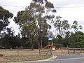 Park and playground
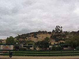
 The Toolern Vale General Store
 Melton Airfield
References
- ↑ Australian Bureau of Statistics (31 October 2012). "Toolern Vale (State Suburb)". 2011 Census QuickStats. Retrieved 2012-07-01.
- ↑ Premier Postal History, Post Office List, retrieved 2008-04-11
External links
| Wikimedia Commons has media related to Toolern Vale, Victoria. |