Ronald Reagan Cross County Highway
| Ronald Reagan Cross County Highway | |
|---|---|
 | |
| Route information | |
| Maintained by Ohio Department of Transportation, Hamilton County Engineer's Office | |
| Length: | 16.40 mi[1] (26.39 km) |
| Existed: | 1958[2] – present |
| Component highways: |
|
| Major junctions | |
| West end: |
|
| |
| East end: |
|
| Location | |
| Counties: | Hamilton |
| Highway system | |
|
County roads in Ohio | |
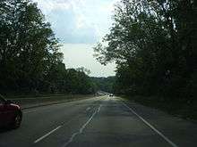
Ronald Reagan Cross County Highway, formerly and locally known as Cross County Highway,[3] is a west-east freeway in Hamilton County, Ohio, United States. It stretches 16.4 miles (26.4 km) from southern Colerain Township to Montgomery, connecting many of Cincinnati's northern suburbs to Interstate 71 and Interstate 75.[1] State Route 126 is routed over most of the highway, while the remainder is a county-maintained road.[4]
Cross County Highway was built by Hamilton County in seven stages from 1958 to 1997,[2] costing $144 million.[5] Highway revolts in Indian Hill and Crosby Township prevented it from crossing the entire county.[6][7] On March 17, 1993, it became the first highway to be named after former U.S. President Ronald Reagan.[8][9] Ronald Reagan Highway was mostly transferred to the state highway system in 1997.[10]
Route description
Ronald Reagan Highway begins as a 2.3-mile-long (3.7 km) county-maintained highway in Colerain Township, from Interstate 275 to Colerain Avenue (U.S. Route 27 / State Route 126) in the community of Groesbeck.[2] This westernmost portion is designated as County Road 453;[4] however, signs indicate this stretch solely by its name.
From Groesbeck, the highway carries State Route 126 along a path roughly parallel to the Norwood Lateral, State Route 562, to a junction with Montgomery Road (U.S. Route 22 / State Route 3) in Montgomery. A girder bridge over Hamilton Avenue (U.S. Route 127) in North College Hill is instrumented with over 640 sensors to serve as a field laboratory for University of Cincinnati researchers and Ohio Department of Transportation (ODOT) bridge engineers.[11] Ronald Reagan Highway has a complex junction with Interstate 75 in Cincinnati's Roselawn and Hartwell neighborhoods: southbound I-75 traffic must take Galbraith Road through Arlington Heights and Reading to access Ronald Reagan Highway, and westbound Ronald Reagan traffic must use the same route to reach northbound I-75.[4]
The short, easternmost stretch from Interstate 71 to Montgomery Road is a limited-access road, with I-71 ramps forming at-grade intersections with the highway. One of these intersections is unsignalized, requiring traffic from southbound I-71 to cross continuous westbound lanes of Ronald Reagan Highway and merge into continuous eastbound lanes of that highway. Ronald Reagan Highway ends abruptly at a junction with Montgomery Road. A short stub extends to the east. State Route 126 continues north- and eastward on Montgomery Road through Montgomery and Indian Hill.[4] A redwood sign commemorating the dedication of Ronald Reagan Cross County Highway stands at the highway's eastern terminus in the Montgomery Heritage District.[9][12]
The majority of Ronald Reagan Highway, between Interstates 275 and 71, is included in the National Highway System (NHS).[13] The NHS is a network of highways that are identified as being most important for the economy, mobility, and defense of the nation.[14] The entirety of Ronald Reagan Highway has two lanes in each direction, with speed limits ranging from 50 to 60 miles per hour (80 to 95 km/h).[15] ODOT's State Farm Safety Patrol vans provide assistance to stranded motorists along Cincinnati-area highways, including the entirety of Ronald Reagan Highway, on weekdays from 6:00 a.m. to 7:00 p.m.[16][17]
History
East Side planning and construction
Cross County Highway was conceived in the 1940s as a 5-mile-long (8.0 km) connector from the Mill Creek Expressway (Interstate 75) to the Blue Ash Airport, which was expected to become Cincinnati's metropolitan commercial airport.[10] In 1950, the concept was upgraded to an expressway;[6] five years later, it grew into a 22-mile-long (35 km) lateral that would span the proposed Circumferential Highway (Interstate 275).[5][10][18][19] The project, originally estimated at $30 million,[6] was intended to connect the east and west sides of town and relieve congestion on Galbraith Road (State Route 126).[20] In 1959, amid the success of the Greater Cincinnati Airport in Northern Kentucky, officials dropped plans to expand Blue Ash Airport and connect Cross County directly to the airport.[6]
The first leg of Cross County Highway, a 1.3-mile (2.1 km) stretch from Ridge Road to Galbraith Road, was built between 1957 and 1958 and cost $800,000. In 1965, a year after Hamilton County voters passed a one-mill tax levy for Cross County expansion, the highway was extended from Ridge Road 2.7 miles (4.3 km) east to Kenwood Road for $2.9 million. Then, in 1968, it was extended 0.7 miles (1.1 km) further east to Montgomery Road, through the back nine holes of the Swaim Fields golf course, for $1.8 million.[2][6][21]
In 1963, Hamilton County commissioners asked the Bureau of Public Roads to add the planned route of Cross County Highway to the Interstate Highway System. However, the designation of the Circle Freeway as Interstate 275 the previous fall meant that no additional Interstate mileage could be allocated to the state.[22] The county's master plan, released the following year, envisioned major junctions at the Circle Freeway and Blue Rock Road; a U.S. 27 Expressway paralleling Colerain Avenue that was never built; the Mill Creek Expressway (Interstate 75); and the Northeast Expressway (Interstate 71).[23]

Cross County Highway would have bypassed downtown Montgomery, extending eastward from Montgomery Road to connect with Remington Road halfway to Remington, thus providing better connectivity with Loveland and Milford.[23] However, this easternmost segment was abandoned after Indian Hill refused to pass a resolution of consent, in an effort to preserve the wealthy village's undeveloped greenbelt.[6][24] The highway's abrupt end in Montgomery contributed to a significant increase in traffic to that city: by 1978, Montgomery Road carried an estimated 18,000 cars per day.[25] In 1984, Montgomery city officials unsuccessfully asked the county to either extend the highway east through Indian Hill or truncate it at Interstate 71.[21] Ohio Department of Transportation (ODOT) straight-line diagrams continue to indicate the unbuilt Montgomery bypass as "future construction".[4]
West Side extensions
In 1975, the westernmost 2.3 miles (3.7 km) of Cross County, from Interstate 275 to Colerain Avenue, was completed for $8.5 million.[2] Two hundred homes were razed in Mount Healthy and North College Hill to make way for construction that would not begin until the mid-1990s.[18][26] Three county-proposed routes were rejected by the two villages. Mount Healthy objected to one proposed path because it would have cut through Arlington Memorial Gardens, a major cemetery.[6][27] In the meantime, the disconnected western segment saw virtually no traffic, encouraging a significant amount of graffiti on bridges and sound barriers.[28]
From 1986 to 1990, Cross County was extended from Vine Street (State Route 4) east to Interstate 75 and East Galbraith Road for $47.7 million. A second phase, completed in 1993, took the highway from Vine Street west to West Galbraith Road for a further $19 million.[2] At the time, these extensions were the most expensive highway project in state history. The project entailed rechanneling part of Mill Creek and building 18 bridges as well as several retaining walls and sound barriers.[6] The right-of-way extended through the north end of the Hamilton County Fairgrounds, forcing the race track's relocation.[29] Under the National Environmental Policy Act and Clean Water Act, portions of previously secured right of way were designated as wetland, forcing the county to secure additional land for environmental mitigation.[1]
Renaming and completion

On December 16, 1993, an all-Republican Board of County Commissioners, led by Commissioner John Dowlin, proposed naming Cross County Highway after Ronald Reagan, citing his strong showing in the county in the 1980 and 1984 presidential elections.[30] Albert Sabin, the Cincinnati medical researcher, had also been considered for the honor.[31] Reagan wrote to the Cincinnati Enquirer, thanking the county for its gesture and recounting his visit to a Ronald Reagan Pub in the Irish village of Ballyporeen:[32]
… Don't get me wrong: I'm very proud of that pub, and I know what an honor it is. But I must admit when I thought of something being named after me, I was thinking more along the lines of a building or a highway! I'm honored and touched by the news and pleased to be associated with the city of Cincinnati. Thank you all.— Ronald Reagan
The board officially renamed the highway on March 17, 1993, making it the first highway in the country to be named for Reagan. Since then, a number of highways and other landmarks have been named for him.[8][18] Following the commissioners' action, local Democrats unsuccessfully pushed to rename the highway for radio and television broadcaster Ruth Lyons,[33] while area residents contacted the Enquirer to suggest Sabin, Lyons, Paul Brown, or Ted Berry.[34] The county raised nearly $15,000 in private donations to install "Reagan Highway" signage. The former President's daughter, Maureen Reagan, dedicated the newly extended highway on September 13, 1994.[9][35][36]
Construction on the final 4.4-mile (7.1 km), $39.5 million segment began in October 1994 and completed in 1997.[28] With the highway's completion, travel time across the county dropped from 40 minutes to 17.[18] In recognition of County Engineer William Brayshaw's career-long work on the highway since the late 1950s, Hamilton County Commissioners temporarily renamed the highway in his honor for one day, November 5, 1997.[1][37]
On October 28, 1997, ODOT took over the highway, except for the segment west of Colerain Avenue.[10] State Route 126 was rerouted over the highway, while the former route along Kemper, Glendale Milford, Kenwood, and Cooper roads was returned to local authorities. As part of the rerouting, ODOT District 8 intended to replace the highway's name with the state route shield on all signage, a standard practice due to space constraints.[35] However, Republican ODOT director Jerry Wray overruled the district office, keeping the President's name alongside the shield.[36][38] Ronald Reagan Highway also became part of the regional ARTIMIS traffic management system in 1997.[39]
Since completion
| Traffic section | Volume | ||||
|---|---|---|---|---|---|
| 2013 | |||||
| Entrance from | 8,812 | ||||
| Cheviot Road | 27,521 | ||||
| 19,570 | |||||
| Pippin Road | 34,960 | ||||
| 48,550 | |||||
| Winton Road | 40,010 | ||||
| West Galbraith Road | 53,130 | ||||
| 46,720 | |||||
| 38,100 | |||||
| East Galbraith Road | 47,170 | ||||
| Ridge Road | 50,280 | ||||
| Plainfield Road | 48,500 | ||||
| Blue Ash Road / Kenwood Road | 49,000 | ||||
| 20,290 | |||||
| 12,850 | |||||
| |||||
In October 1998, Brayshaw formally requested that ODOT extend Ronald Reagan Highway westward through rural Crosby Township over Blue Rock Road and New Haven Road, to connect the highway to Interstate 74 in Harrison. The roads would be improved in the short term, then eventually widened to a limited-access roadway with four to five lanes. Opposition from Crosby Township residents and trustees scuttled the plan.[7][43][44] In 2001, Crosby Township again fought a plan by the county transportation improvement district to extend State Route 126 along the remainder of Ronald Reagan Highway, Blue Rock Road, and a new bypass around New Baltimore to a junction with State Route 128.[45]
The highway's oldest 3.7 miles (6.0 km) were upgraded to modern freeway standards from spring 2000 to summer 2001 for $17.6 million. In addition to repaving the highway, ODOT replaced the center guardrail with a Jersey barrier, replaced curbs with wide shoulders, lengthened on- and off-ramps, and installed new overhead guide signage.[46] West Side communities have seen significantly increased commercial development since the highway's completion, attributed in part to decreased congestion on surface streets.[15][47]
Accidents
The unsignalized intersection between eastbound Ronald Reagan Highway and the entrance ramp from southbound I-71 is the most crash-prone one-tenth-mile-long (0.16 km) stretch of roadway in the Greater Cincinnati area, with 666.39 collisions and 102.53 injuries and fatalities on average annually.[48] There have been proposals to signalize this dangerous intersection or replace it with a roundabout.[49][50] The intersection between the westbound exit ramp of Ronald Reagan Highway and Colerain Avenue had 20 collisions in 2014 (none of which involved injuries), making it the fifth most crash-prone intersection on a Hamilton County road that year.[51]
On August 15, 1998, a Cessna 152 departing from Blue Ash Airport bound for Cincinnati/Northern Kentucky International Airport ran out of fuel and collided with a car as it attempted an emergency landing on Ronald Reagan Highway, killing three.[52]
Exit list
The entire route is in Hamilton County. All exits are unnumbered.
| Location | mi[4][53][54] | km | Destinations | Notes |
|---|---|---|---|---|
| Colerain Township | 0.00 | 0.00 | Interchange at exit 31 on I-275; westbound exit and eastbound entrance only | |
| 0.85 | 1.37 | Blue Rock Road to | ||
| 2.68 7.04 | 4.31 11.33 | Eastern end of county maintenance and western end of state maintenance; official mileages switch from internal county measurements to SR 126 mileposts; access to Northgate Mall | ||
| Mount Healthy–North College Hill city line | 8.99 | 14.47 | ||
| Springfield Township | 10.76 | 17.32 | Winton Road | Eastbound exit and westbound entrance only; access to Winton Woods |
| 11.44 | 18.41 | Galbraith Road / Winton Road | ||
| Cincinnati | 13.54– 13.92 | 21.79– 22.40 | No access from I-75 southbound, from westbound SR 126 to I-75 northbound; exit 10A on I-75 | |
| Reading | 14.96 | 24.08 | Eastbound exit and westbound entrance only | |
| 15.38 | 24.75 | Galbraith Road to | Westbound exit and eastbound entrance only | |
| Amberley | 16.25 | 26.15 | Ridge Road | |
| Blue Ash | 18.13 | 29.18 | Plainfield Road / Hunt Road | Access to University of Cincinnati Blue Ash College via Plainfield Road and former Cincinnati–Blue Ash Airport via Reed Hartman Highway |
| 18.77– 19.01 | 30.21– 30.59 | Blue Ash Road / Kenwood Road | ||
| Montgomery–Sycamore Township line | East end of freeway | |||
| 19.59 | 31.53 | Exit 14 on I-71 | ||
| Montgomery | 20.20 | 32.51 | Interchange; SR 126 continues north on Montgomery Road | |
1.000 mi = 1.609 km; 1.000 km = 0.621 mi
| ||||
See also
-
 Cincinnati portal
 -
 U.S. Roads portal
 - Roads in Cincinnati
References
- 1 2 3 4 Howard, Allen (October 28, 1997). "Brayshaw's baby finally finds way across county". The Cincinnati Enquirer. Retrieved October 10, 2015.
- 1 2 3 4 5 6 Hunter, Ginny (September 9, 1997). "Reagan Highway inches toward completion". The Cincinnati Post. Archived from the original on January 17, 2005. Retrieved October 10, 2015.
- ↑ Hayutin, Marnie (2006). "Cincinnati USA 101". Cincinnati USA 2006 City Guide. Emmis Communications. p. 144. Retrieved October 18, 2015 – via Google Books.
- 1 2 3 4 5 6 "SR 126" (PDF). Straight Line Diagrams. Ohio Department of Transportation Office of Technical Services. January 2002. p. 3. Retrieved October 12, 2015.
- 1 2 "A Cross County connection". The Cincinnati Post (Editorial). October 28, 1997. Archived from the original on September 21, 2004. Retrieved October 10, 2015.
- 1 2 3 4 5 6 7 8 Kemme, Steve (October 25, 1987). "The road still not taken". The Cincinnati Enquirer. pp. B1, B8 – via Newspapers.com. (subscription required (help)).
- 1 2 Michaud, Anne (October 16, 1998). "Trustee opposes extending Reagan Highway". The Cincinnati Enquirer. Retrieved October 11, 2015.
- 1 2 "Highway renamed to honor Reagan". The Blade. Toledo, Ohio. Associated Press. March 18, 1993. p. 7 – via Google News Archive.
- 1 2 3 Swint, David L. (September 14, 1994). "Reagan dedicates road to dad". The Cincinnati Enquirer. p. B1 – via Newspapers.com. (subscription required (help)).
- 1 2 3 4 Griggs, France (October 27, 1997). "Cross County speeds miles, spans years". The Cincinnati Post. Archived from the original on February 27, 2005. Retrieved October 10, 2015.
- ↑ Helmicki, Arthur; Hunt, Victor (2003). "Life Time Monitoring of a Highway Bridge" (PDF). Moving Forward. Ohio Department of Transportation, Division of Planning, Statewide Planning & Research Section. 3. Insert 1. Retrieved October 12, 2015.
- ↑ Forgrave, Reid (June 7, 2004). "Beloved leader left legacy here". The Cincinnati Enquirer. Retrieved October 10, 2015.
- ↑ National Highway System: Cincinnati, Ohio (PDF) (Map). Federal Highway Administration. December 2003. Retrieved March 29, 2012.
- ↑ "National Highway System". Federal Highway Administration. August 26, 2010. Retrieved March 29, 2012.
- 1 2 Albert, Tanya (October 25, 1998). "Cross-county highway helps boost business". The Cincinnati Enquirer. Retrieved October 11, 2015.
- ↑ Wert, Mark (August 4, 2014). "Like a good neighbor (you know the rest)". The Cincinnati Enquirer. Retrieved October 18, 2015.
- ↑ "State Farm Safety Patrol Service Areas". Ohio Department of Transportation. Retrieved October 18, 2015.
- 1 2 3 4 Pulfer, Laura (October 28, 1997). "Teflon road, urban fable". The Cincinnati Enquirer. Retrieved October 10, 2015.
- ↑ "Cross-County Road Is Nearer; Cemetery Plat Hurdle Cleared". The Cincinnati Enquirer. August 15, 1956. p. 1. Retrieved October 15, 2015 – via Newspapers.com. (subscription required (help)).
- ↑ "County Plans Road Link; Mile To Cost $650,000". The Cincinnati Enquirer. December 4, 1956. p. 1. Retrieved October 15, 2015 – via Newspapers.com.
- 1 2 Rose, Mary Lou; Conklin, Juanita, eds. (1995). History of Montgomery, Ohio, 1795–1995 (PDF). Montgomery, Ohio: Montgomery Historical Society. p. 88. LCCN 95-080247.
- ↑ "Cross-County Road Is Urged". The Cincinnati Enquirer. January 29, 1963. p. 12. Retrieved October 15, 2015 – via Newspapers.com. (subscription required (help)).
- 1 2 "Motorways" (PDF). Hamilton County Master Plan (PDF). Regional Planning Commission of Hamilton County, Ohio. December 1964. pp. 75–76. Retrieved October 14, 2015.
- ↑ Andry, Al (October 2, 1997). "Mayor: Highway comes up short". East Central Zone. The Cincinnati Post. Retrieved October 10, 2015 – via HighBeam Research. (subscription required (help)).
- ↑ McKay, Bob (April 1978). "The Montgomery Boom". Cincinnati. Vol. 11 no. 7. Greater Cincinnati Chamber of Commerce. pp. SS-19–SS-30 – via Google Books.
- ↑ Wilson, Sue Korn; Tamarkin, Kathleen Mulloy (2008). Mt. Healthy. Images of America. Mount Pleasant, South Carolina: Arcadia Publishing. p. 84. ISBN 978-0-7385-6156-1 – via Google Books.
[The Aiken] home was demolished in the mid-1970s to make room for the Ronald Reagan Cross County Highway.
- ↑ "Mt. Healthy Nixes Latest Plan For Cross-County Expressway". The Cincinnati Enquirer. July 6, 1966. p. 10. Retrieved October 15, 2015 – via Newspapers.com. (subscription required (help)).
- 1 2 "Removing graffiti phase of Cincinnati highway project". The Daily News. Bowling Green, Kentucky. Associated Press. March 28, 1997. p. 11A – via Google News Archive.
- ↑ Hoffman, Steve (August 1972). "The Carthage Fair". Cincinnati. Vol. 5 no. 11. Greater Cincinnati Chamber of Commerce. p. 35. Retrieved October 18, 2015 – via Google Books.
- ↑ Green, Richard (December 17, 1992). "Commissioners honor ex-President Reagan". The Cincinnati Enquirer. p. B1. Retrieved October 14, 2015 – via Newspapers.com. (subscription required (help)).
- ↑ Bonfield, Tim (July 5, 1999). "Sabin has been snubbed before". The Cincinnati Enquirer. Retrieved October 11, 2015.
- ↑ Reagan, Ronald (December 17, 1992). "Message from Reagan". The Cincinnati Enquirer (Letter). p. B1. Retrieved October 14, 2015 – via Newspaper.com. (subscription required (help)).
- ↑ Houston, Lynda (April 18, 1993). "'Ruth Lyons Highway' dead ends in Green Twp.". Extra. The Cincinnati Enquirer. p. 5. Retrieved October 14, 2015 – via Newspapers.com. (subscription required (help)).
- ↑ Houston, Lynda (April 4, 1993). "Readers criticize naming highway for Reagan". Extra. The Cincinnati Enquirer. p. 1. Retrieved October 14, 2015 – via Newspapers.com. (subscription required (help)).
- 1 2 Michaud, Anne (April 15, 1997). "Ohio wants to dump 'Reagan' for SR 126". The Cincinnati Enquirer. Retrieved October 10, 2015.
- 1 2 Staff and wire reports (April 16, 1997). "'Reagan' rescued". News. The Cincinnati Post. Retrieved October 10, 2015 – via HighBeam Research. (subscription required (help)).
- ↑ Staff report (November 10, 1997). "The king of Cross County". News. The Cincinnati Post. Retrieved October 10, 2015 – via HighBeam Research. (subscription required (help)).
- ↑ Michaud, Anne (April 16, 1997). "Reagan Highway signs take U-turn". The Cincinnati Enquirer. Retrieved October 10, 2015.
- ↑ Staff report (August 30, 1997). "Smart highways late, over estimate". The Cincinnati Post. Archived from the original on February 23, 2005. Retrieved October 10, 2015.
- ↑ "2013 Hamilton County Traffic Survey Report" (PDF). Ohio Department of Transportation, Office of Technical Services, Division of Planning. 2013. pp. 9–10. Retrieved October 14, 2015.
- ↑ "ODOT Local Traffic Counts – Hamilton" (Microsoft Excel spreadsheet). Ohio Department of Transportation, Division of Planning, Office of Technical Services. March 5, 2014. Cell H99. Retrieved October 16, 2015.
- ↑ "Transportation Information Mapping System (TIMS)". Ohio Department of Transportation. Retrieved October 17, 2015.
- ↑ "Resolution Authorizing an Agreement Between the Board of County Commissioners of Hamilton County and the Hamilton County Engineer for the Transferring of Funds for the Construction of Improvements to the Fort Washington Way Project". Commissioners Minutes. County of Hamilton Board of County Commissioners. 270. Image 3782. June 17, 1998. Retrieved October 18, 2015.
- ↑ Michaud, Anne (October 15, 1998). "North Bend proposed as bridge site". The Cincinnati Enquirer. Retrieved October 12, 2015.
- ↑ Monk, Dan (May 7, 2001). "Crosby development fight is sign of times". Cincinnati Business Courier. American City Business Journals. Retrieved October 18, 2015.
- ↑ Moores, Lew (November 12, 2000). "Ronald Reagan Highway: Relief is on the way". The Cincinnati Enquirer. Retrieved October 11, 2015.
- ↑ Hemmer, Andy (December 15, 1997). "New road to riches". Cincinnati Business Courier. American City Business Journals. Retrieved October 18, 2015.
- ↑ Caproni, Erin (November 6, 2014). "These are the most dangerous roads in Greater Cincinnati". Cincinnati Business Courier. American City Business Journals. Retrieved October 18, 2015.
- ↑ Wadas, Amy (January 3, 2013). "ODOT planning major project on Ronald Reagan Highway at I-71 interchange". 9 News. WCPO-TV. Retrieved October 17, 2015.
- ↑ Fightmaster, Leah (March 1, 2012). "Madeira man suggests 'roundabout' solution for intersection". The Cincinnati Enquirer. Retrieved October 11, 2015. (subscription required (help)).
- ↑ "2014 Crash Analysis Report" (PDF). Hamilton County Engineer's Office. March 26, 2015. p. 3. Retrieved October 13, 2015.
- ↑ O'Neill, Tom (August 17, 1998). "Friendship, careers lost in van-plane crash". The Cincinnati Enquirer. Retrieved October 10, 2015.
- ↑ "Inspection of Blue Rock Road Bridge, Cleves Warsaw Road Bridge, and Cross County over Blue Rock Road Bridge" (Letter). Letter to Steve Mary. April 5, 1996. Incorporated into "Consulting Engineering Agreement with Burgess & Niple, Limited, Bridge Inspections Project No. E960008". Commissioners Minutes. County of Hamilton Board of County Commissioners. 262. Image 2257. May 1, 1996. Retrieved October 13, 2015.
- ↑ "Roadway Description Inventory Report - DESTAPE - Hamilton" (PDF). Ohio Department of Transportation. June 24, 2015. pp. 38–41. Retrieved October 12, 2015.
External links
| Wikimedia Commons has media related to Ronald Reagan Cross County Highway. |
- Ronald Reagan Cross County Highway by Jake Mecklenborg