Roopville, Georgia
| Roopville, Georgia | |
|---|---|
| Town | |
|
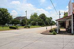
Downtown Roopville | |
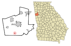 Location in Carroll County and the state of Georgia | |
| Coordinates: 33°27′24″N 85°7′52″W / 33.45667°N 85.13111°WCoordinates: 33°27′24″N 85°7′52″W / 33.45667°N 85.13111°W | |
| Country | United States |
| State | Georgia |
| County | Carroll |
| Area | |
| • Total | 0.8 sq mi (2.0 km2) |
| • Land | 0.8 sq mi (2.0 km2) |
| • Water | 0 sq mi (0 km2) |
| Elevation | 1,247 ft (380 m) |
| Population (2010) | |
| • Total | 218 |
| • Density | 276/sq mi (106.6/km2) |
| Time zone | Eastern (EST) (UTC-5) |
| • Summer (DST) | EDT (UTC-4) |
| ZIP code | 30170 |
| Area code(s) | 770 |
| FIPS code | 13-66696[1] |
| GNIS feature ID | 0321890[2] |
Roopville is a town in Carroll County, Georgia, United States. The population was 218 at the 2010 census.[3]
Geography
Roopville is located in southern Carroll County at 33°27′24″N 85°7′52″W / 33.45667°N 85.13111°W (33.456731, -85.131219),[4] along U.S. Route 27, which leads 10 miles (16 km) north to Carrollton, the county seat, and south 6 miles (10 km) to Centralhatchee.
According to the United States Census Bureau, the town has a total area of 0.77 square miles (2.0 km2), all land.[3]
Demographics
| Historical population | |||
|---|---|---|---|
| Census | Pop. | %± | |
| 1890 | 123 | — | |
| 1900 | 109 | −11.4% | |
| 1910 | 173 | 58.7% | |
| 1920 | 200 | 15.6% | |
| 1930 | 260 | 30.0% | |
| 1940 | 230 | −11.5% | |
| 1950 | 202 | −12.2% | |
| 1960 | 203 | 0.5% | |
| 1970 | 221 | 8.9% | |
| 1980 | 229 | 3.6% | |
| 1990 | 248 | 8.3% | |
| 2000 | 177 | −28.6% | |
| 2010 | 218 | 23.2% | |
| Est. 2015 | 225 | [5] | 3.2% |
As of the census[1] of 2000, there were 177 people, 75 households, and 57 families residing in the town. The population density was 224.1 people per square mile (86.5/km²). There were 78 housing units at an average density of 98.8 per square mile (38.1/km²). The racial makeup of the town was 83.05% White, 15.82% African American, and 1.13% from two or more races.
There were 75 households out of which 26.7% had children under the age of 18 living with them, 60.0% were married couples living together, 10.7% had a female householder with no husband present, and 22.7% were non-families. 20.0% of all households were made up of individuals and 14.7% had someone living alone who was 65 years of age or older. The average household size was 2.36 and the average family size was 2.69.
In the town the population was spread out with 20.3% under the age of 18, 6.2% from 18 to 24, 24.9% from 25 to 44, 29.9% from 45 to 64, and 18.6% who were 65 years of age or older. The median age was 43 years. For every 100 females there were 98.9 males. For every 100 females age 18 and over, there were 90.5 males.
The median income for a household in the town was $32,917, and the median income for a family was $30,625. Males had a median income of $35,227 versus $20,938 for females. The per capita income for the town was $16,521. About 12.7% of families and 17.4% of the population were below the poverty line, including 38.5% of those under the age of eighteen and 12.8% of those sixty five or over.
Notable person
- Keith Jackson, sportscaster
Notable resident
- Donna Fiducia, News / Media Personality
References
- 1 2 "American FactFinder". United States Census Bureau. Retrieved 2008-01-31.
- ↑ "US Board on Geographic Names". United States Geological Survey. 2007-10-25. Retrieved 2008-01-31.
- 1 2 "Geographic Identifiers: 2010 Demographic Profile Data (G001): Roopville town, Georgia". U.S. Census Bureau, American Factfinder. Retrieved July 18, 2014.
- ↑ "US Gazetteer files: 2010, 2000, and 1990". United States Census Bureau. 2011-02-12. Retrieved 2011-04-23.
- ↑ "Annual Estimates of the Resident Population for Incorporated Places: April 1, 2010 to July 1, 2015". Retrieved July 2, 2016.
- ↑ "Census of Population and Housing". Census.gov. Retrieved June 4, 2015.
Municipalities and communities of Carroll County, Georgia, United States | ||
|---|---|---|
| Cities |  | |
| Towns | ||
| Unincorporated community | ||
| Footnotes | ‡This populated place also has portions in an adjacent county or counties | |