Rose City, Michigan
| Rose City, Michigan | |
|---|---|
| City | |
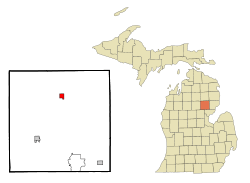 Location of Rose City, Michigan | |
| Coordinates: 44°25′16″N 84°6′55″W / 44.42111°N 84.11528°WCoordinates: 44°25′16″N 84°6′55″W / 44.42111°N 84.11528°W | |
| Country | United States |
| State | Michigan |
| County | Ogemaw |
| Area[1] | |
| • Total | 1.09 sq mi (2.82 km2) |
| • Land | 1.08 sq mi (2.80 km2) |
| • Water | 0.01 sq mi (0.03 km2) |
| Elevation | 958 ft (292 m) |
| Population (2010)[2] | |
| • Total | 653 |
| • Estimate (2012[3]) | 647 |
| • Density | 604.6/sq mi (233.4/km2) |
| Time zone | Eastern (EST) (UTC-5) |
| • Summer (DST) | EDT (UTC-4) |
| ZIP code | 48654 |
| Area code(s) | 989 |
| FIPS code | 26-69680[4] |
| GNIS feature ID | 636193[5] |
Rose City is a city in Ogemaw County in the U.S. state of Michigan. The population was 653 at the 2010 census. Houghton Creek, a tributary of the Rifle River, runs through part of the city limits.
Geography
According to the United States Census Bureau, the city has a total area of 1.09 square miles (2.82 km2), of which 1.08 square miles (2.80 km2) is land and 0.01 square miles (0.03 km2) is water.[1]
Demographics
| Historical population | |||
|---|---|---|---|
| Census | Pop. | %± | |
| 1910 | 542 | — | |
| 1920 | 331 | −38.9% | |
| 1930 | 338 | 2.1% | |
| 1940 | 355 | 5.0% | |
| 1950 | 446 | 25.6% | |
| 1960 | 435 | −2.5% | |
| 1970 | 530 | 21.8% | |
| 1980 | 661 | 24.7% | |
| 1990 | 686 | 3.8% | |
| 2000 | 721 | 5.1% | |
| 2010 | 653 | −9.4% | |
| Est. 2015 | 633 | [6] | −3.1% |
2010 census
As of the census[2] of 2010, there were 653 people, 238 households, and 154 families residing in the city. The population density was 604.6 inhabitants per square mile (233.4/km2). There were 288 housing units at an average density of 266.7 per square mile (103.0/km2). The racial makeup of the city was 96.9% White, 0.2% African American, 1.2% Native American, 0.3% Asian, 0.5% from other races, and 0.9% from two or more races. Hispanic or Latino of any race were 1.7% of the population.
There were 238 households of which 35.7% had children under the age of 18 living with them, 36.1% were married couples living together, 21.4% had a female householder with no husband present, 7.1% had a male householder with no wife present, and 35.3% were non-families. 30.7% of all households were made up of individuals and 14.3% had someone living alone who was 65 years of age or older. The average household size was 2.36 and the average family size was 2.87.
The median age in the city was 44.6 years. 23.3% of residents were under the age of 18; 7.4% were between the ages of 18 and 24; 19.6% were from 25 to 44; 25% were from 45 to 64; and 24.8% were 65 years of age or older. The gender makeup of the city was 48.4% male and 51.6% female.
2000 census
As of the census[4] of 2000, there were 721 people, 241 households, and 155 families residing in the city. The population density was 665.7 per square mile (257.8/km²). There were 283 housing units at an average density of 261.3 per square mile (101.2/km²). The racial makeup of the city was 96.26% White, 0.14% African American, 0.83% Native American, 0.97% from other races, and 1.80% from two or more races. Hispanic or Latino of any race were 1.39% of the population.
There were 241 households out of which 35.3% had children under the age of 18 living with them, 40.7% were married couples living together, 21.2% had a female householder with no husband present, and 35.3% were non-families. 30.7% of all households were made up of individuals and 13.3% had someone living alone who was 65 years of age or older. The average household size was 2.51 and the average family size was 3.16.
In the city the population was spread out with 26.4% under the age of 18, 6.8% from 18 to 24, 23.3% from 25 to 44, 17.2% from 45 to 64, and 26.4% who were 65 years of age or older. The median age was 39 years. For every 100 females there were 82.1 males. For every 100 females age 18 and over, there were 75.2 males.
The median income for a household in the city was $25,192, and the median income for a family was $31,042. Males had a median income of $24,861 versus $18,417 for females. The per capita income for the city was $10,684. About 18.3% of families and 24.7% of the population were below the poverty line, including 33.5% of those under age 18 and 3.1% of those age 65 or over.
History
Rose City began as the town of Churchill in 1875, when Allen S. Rose moved to Michigan from New York State and built a general store. When the railroad came through in 1892, it was renamed Rose City for the founder, though it wasn't incorporated as a city until 1905. It is supported by some small businesses and manufacturing facilities (particularly plastics, machinery and auto parts production), but has survived over the years primarily as a result of tourism and the attraction of the many lakes and streams in the scenic surrounding area. The Rifle River State Recreation Area is less than three miles from the city limits.[8]
Government
Rose City is governed by a mayor and a six-member city council.[9]
References
- 1 2 "US Gazetteer files 2010". United States Census Bureau. Retrieved 2012-11-25.
- 1 2 "American FactFinder". United States Census Bureau. Retrieved 2012-11-25.
- ↑ "Population Estimates". United States Census Bureau. Retrieved 2013-06-03.
- 1 2 "American FactFinder". United States Census Bureau. Retrieved 2008-01-31.
- ↑ U.S. Geological Survey Geographic Names Information System: Rose City, Michigan
- ↑ "Annual Estimates of the Resident Population for Incorporated Places: April 1, 2010 to July 1, 2015". Retrieved July 2, 2016.
- ↑ "Census of Population and Housing". Census.gov. Retrieved June 4, 2015.
- ↑ Rose City is also part of the Ogemaw Heights High School district. Rose City-Lupton article at InfoMI.com
- ↑ City Government - Rose City, Michigan at InfoMI.com
External links
Municipalities and communities of Ogemaw County, Michigan, United States | ||
|---|---|---|
| Cities | 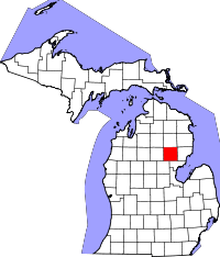 | |
| Village | ||
| Townships | ||
| CDPs | ||