Rosebud, Texas
| Rosebud, Texas | |
|---|---|
| City | |
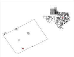
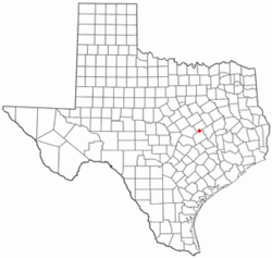 Location of Rosebud, Texas | |
 | |
| Coordinates: 31°4′31″N 96°58′32″W / 31.07528°N 96.97556°WCoordinates: 31°4′31″N 96°58′32″W / 31.07528°N 96.97556°W | |
| Country |
|
| State |
|
| County |
|
| Area | |
| • Total | 0.8 sq mi (2.0 km2) |
| • Land | 0.8 sq mi (2.0 km2) |
| • Water | 0.0 sq mi (0.0 km2) |
| Elevation | 397 ft (121 m) |
| Population (2010) | |
| • Total | 1,412 |
| • Density | 1,804/sq mi (696.6/km2) |
| Time zone | Central (CST) (UTC-6) |
| • Summer (DST) | CDT (UTC-5) |
| ZIP code | 76570 |
| Area code(s) | 254 |
| FIPS code | 48-63188[1] |
| GNIS feature ID | 1366870[2] |
| Website |
www |
Rosebud is a city in Falls County, Texas, United States. The population was 1,412 at the 2010 census.[3] Rosebud is the birthplace of NFL running back LaDainian Tomlinson.
Geography
Rosebud is located in southwestern Falls County at 31°4′31″N 96°58′32″W / 31.07528°N 96.97556°W (31.075209, -96.975581).[4] U.S. Route 77 passes through the center of town as 5th Street, leading north 36 miles (58 km) to Waco and south 15 miles (24 km) to Cameron. Texas State Highway 53 leads west 24 miles (39 km) to Temple, intersecting US 77 just north of Rosebud.
According to the United States Census Bureau, the city has a total area of 0.77 square miles (2.0 km2), all of it land.[3]
Climate
The climate in this area is characterized by hot, humid summers and generally mild to cool winters. According to the Köppen Climate Classification system, Rosebud has a humid subtropical climate, abbreviated "Cfa" on climate maps.[5]
Demographics
| Historical population | |||
|---|---|---|---|
| Census | Pop. | %± | |
| 1910 | 1,472 | — | |
| 1920 | 1,516 | 3.0% | |
| 1930 | 1,565 | 3.2% | |
| 1940 | 1,842 | 17.7% | |
| 1950 | 1,730 | −6.1% | |
| 1960 | 1,644 | −5.0% | |
| 1970 | 1,597 | −2.9% | |
| 1980 | 2,076 | 30.0% | |
| 1990 | 1,638 | −21.1% | |
| 2000 | 1,493 | −8.9% | |
| 2010 | 1,412 | −5.4% | |
| Est. 2015 | 1,373 | [6] | −2.8% |
As of the census[1] of 2000, there were 1,493 people, 571 households, and 379 families residing in the city. The population density was 1,919.2 people per square mile (739.0/km²). There were 673 housing units at an average density of 865.1 per square mile (333.1/km²). The racial makeup of the city was 59.14% White, 18.29% African American, 0.13% Native American, 0.07% Asian, 0.27% Pacific Islander, 19.16% from other races, and 2.95% from two or more races. Hispanic or Latino of any race were 29.74% of the population.
There were 571 households out of which 31.7% had children under the age of 18 living with them, 45.4% were married couples living together, 17.0% had a female householder with no husband present, and 33.6% were non-families. 32.0% of all households were made up of individuals and 20.3% had someone living alone who was 65 years of age or older. The average household size was 2.53 and the average family size was 3.21.
In the city the population was spread out with 28.8% under the age of 18, 6.6% from 18 to 24, 21.8% from 25 to 44, 20.8% from 45 to 64, and 22.0% who were 65 years of age or older. The median age was 40 years. For every 100 females there were 90.9 males. For every 100 females age 18 and over, there were 78.1 males.
The median income for a household in the city was $24,063, and the median income for a family was $33,300. Males had a median income of $25,662 versus $18,462 for females. The per capita income for the city was $13,577. About 21.0% of families and 24.5% of the population were below the poverty line, including 30.5% of those under age 18 and 22.7% of those age 65 or over.
Notable people
- Kenneth Allen McDuff, serial killer who was executed on November 17, 1998
- LaDainian Tomlinson, running back in the National Football League for 11 seasons
References
- 1 2 "American FactFinder". United States Census Bureau. Retrieved 2008-01-31.
- ↑ "US Board on Geographic Names". United States Geological Survey. 2007-10-25. Retrieved 2008-01-31.
- 1 2 "Geographic Identifiers: 2010 Demographic Profile Data (G001): Rosebud city, Texas". U.S. Census Bureau, American Factfinder. Retrieved August 22, 2016.
- ↑ "US Gazetteer files: 2010, 2000, and 1990". United States Census Bureau. 2011-02-12. Retrieved 2011-04-23.
- ↑ Climate Summary for Rosebud, Texas
- ↑ "Annual Estimates of the Resident Population for Incorporated Places: April 1, 2010 to July 1, 2015". Retrieved July 2, 2016.
- ↑ "Census of Population and Housing". Census.gov. Retrieved June 4, 2015.
External links
- City of Rosebud official website
- Rosebud, Texas from the Handbook of Texas Online
Municipalities and communities of Falls County, Texas, United States | ||
|---|---|---|
| Cities | 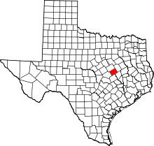 | |
| CDP | ||
| Other unincorporated communities | ||
| Ghost towns | ||
| Footnotes | ‡This populated place also has portions in an adjacent county or counties | |