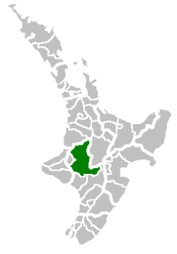
Ruapehu District
| Ruapehu District | |
|---|---|
| Territorial authority of New Zealand | |
 Location of the Ruapehu District | |
| Country | New Zealand |
| Island | North Island |
| Region | Manawatu-Wanganui |
| Named for | Mount Ruapehu |
| Seat | Taumarunui |
| Towns | |
| Government | |
| • Mayor | Don Cameron |
| • Deputy Mayor | Marion Gillard |
| • Chief Executive | Clive Manley |
| Area | |
| • Total | 6,370 km2 (2,460 sq mi) |
| Highest elevation | 2,797 m (9,177 ft) |
| Population (2013 census) | |
| • Total | 11,844 |
| • Density | 1.9/km2 (4.8/sq mi) |
| Time zone | NZST (UTC+12) |
| • Summer (DST) | NZDT (UTC+13) |
| Area code(s) |
07 (northern and central) 06 (southern) |
| Website | http://www.ruapehudc.govt.nz |
Ruapehu District is a territorial authority in the centre of New Zealand's North Island.
It has an area of 6,730 square kilometers and had a population of 11,844 at the 2013 census, down 12.7% from the 2006 census.[1]
Features
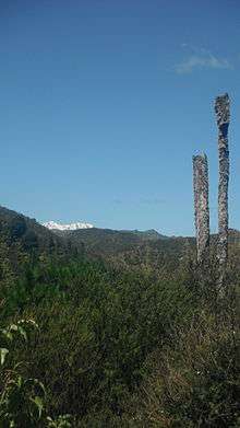
The district is landlocked, and contains the western half of the Tongariro National Park, including most of Mount Ruapehu and the western sides Mount Ngauruhoe and Mount Tongariro, as well as part of the Whanganui National Park. The district is also home to the world famous Raurimu Spiral on the North Island Main Trunk railway line.
The tourist towns of Whakapapa Village, National Park and Ohakune are located near Mount Ruapehu in the south east of the district, and Waiouru, with an elevation of 815 metres, is in the extreme south east of the district and houses the large Waiouru Army Camp. The southern section of the infamous Desert Road section of State Highway 1 runs through the east of the district, from Waiouru to Rangipo.
Local representation
Ruapehu District Council
The Ruapehu District Council was established in 1989, replacing the former Taumarunui Borough Council, Taumarunui County Council and part of the Rangitikei County Council.[2] The council is made up of 12 elected councillors including a mayor and deputy mayor. The district is also served by 2 Community Boards and a Ward Committee with the same functions and powers as the Community Boards.
Mayor
The current mayor of the Ruapehu District is Don Cameron, with Marion Gillard as the deputy mayor.
Council
Taumarunui/Ohura ♮ Ward Committee; 6 members; 5 councillors from Taumarunui, and 1 Ohura Ward Councillors.
Waimarino-Waiouru Community Board; 6 members; 2 Ward Councillors (appointed); 4 elected community representatives.
National Park Community Board; 5 members; 1 Ward Councillor; 4 elected community representatives.
♮ The Taumarunui/Ohura Ward Committee is the community board for Taumarunui and Ohura Wards and the council has given it the same powers and functions as the community boards.[3]
References
- ↑ "2013 Census map – population and dwelling". Stats.govt.nz. Retrieved 2015-07-10.
- ↑ "Council Introduction - Council - Ruapehu District Council". Ruapehudc.govt.nz. 1989-11-01. Retrieved 2015-07-10.
- ↑
External links
- Ruapehu District Council
- Map of the District
- Ruapehu District Community Outcomes
- All 73 District's LTCCP 2006-2016
- Ruapehu Districts RTO 'Visit Ruapehu'
Wards of Ruapehu District Council | ||
|---|---|---|
| ||
Coordinates: 38°48′14″S 175°15′43″E / 38.804°S 175.262°E