Palmerston North
| Palmerston North Te Papaioea (Māori) | ||
|---|---|---|
| Metropolitan Area | ||
|
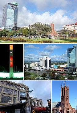
Clockwise from top: The Square, Central Business District, All Saints Church, City Library, The Square Clock Tower | ||
| ||
| Nickname(s): Palmy, Student City, Rose City, Palmy North | ||
|
Motto: Palmam Qui Meruit Ferat Let him who has earned it, bear the reward[1][2] | ||
 Palmerston North | ||
| Coordinates: 40°21.3′S 175°36.7′E / 40.3550°S 175.6117°ECoordinates: 40°21.3′S 175°36.7′E / 40.3550°S 175.6117°E | ||
| Country |
| |
| Island | North Island | |
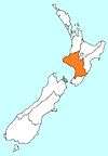
| Region | Manawatu-Wanganui | |
| Territorial authority | Palmerston North City Council | |
| Borough proclaimed | 1877 | |
| City proclaimed | 1930 | |
| Electorates | Palmerston North, Rangitīkei; (Māori): Te Tai Hauāuru | |
| Government | ||
| • Mayor | Grant Smith | |
| • Deputy Mayor | Tangi Utikere | |
| Area | ||
| • Territorial | 395 km2 (153 sq mi) | |
| Highest elevation | 760 m (2,490 ft) | |
| Lowest elevation | 10 m (30 ft) | |
| Population (June 2016)[3] | ||
| • Territorial | 86,300 | |
| • Density | 220/km2 (570/sq mi) | |
| • Urban | 84,300 | |
| • Demonym | Palmerstonian | |
| Time zone | NZST (UTC+12) | |
| • Summer (DST) | NZDT (UTC+13) | |
| Post codes | 4410, 4412, 4414, 4471, 4472, 4475, 4810, 4820 | |
| Area code(s) | 06 | |
| Local iwi | Ngāti Rangitāne | |
| Website |
pncc | |
Palmerston North (/ˌpɑːmərstənˈnɔːrθ/ PAH-mər-stən-NORTH) (Māori: Te Papaioea or transliterated Māori: Pamutana), commonly referred to by locals as Palmerston, or colloquially Palmy, is the main city of the Manawatu-Wanganui region of the North Island of New Zealand.
Palmerston North is located inland, in the eastern Manawatu Plains, near the north bank of the Manawatu River. The city is 35 km (22 mi) from the river's mouth and 12 km (7 mi) from the end of the Manawatu Gorge. It is about 140 km (87 mi) north of the capital, Wellington.
The official limits of the city take in rural areas to the south, north-east, north-west and west of the main urban area, extending to the Tararua Ranges; including the town of Ashhurst at the mouth of the Manawatu Gorge, the villages of Bunnythorpe and Longburn in the north and west respectively. The city covers a land area of 395 square kilometres (98,000 acres).[4]
The city's location was once little more than a clearing in a forest and occupied by small communities of indigenous Māori, who called it Papaioea, believed to mean "How beautiful it is".[5] In the mid 19th century, it was discovered and settled by Europeans (mostly of British and Scandinavian origin). On foundation, the settlement was bestowed the name Palmerston, in honour of Viscount Palmerston, a former Prime Minister of Great Britain. The suffix "North" was added in 1871 by the Post Office to distinguish the settlement from Palmerston in the South Island. The Māori transliteration of Palmerston North, is Pamutana (Nota). However, Te Papaioea is the preferred Māori name.[6]
The city is the country's seventh largest and eighth largest urban area, with an urban population of 84,300 (June 2016).[3]
Physical environment
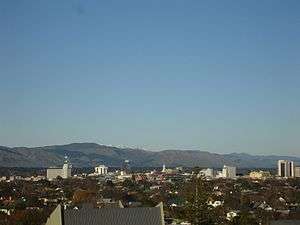
Although the land Palmerston North is situated on is bounded by the lofty Ruahine and Tararua ranges in the east and south respectively, the city has a predominantly flat appearance. The occasional rise in elevation occurs further away from the river and is especially pronounced in the north and northeast, and also on the south side of the river. The typical urban area elevation ranges between 20–40 metres (65–130 ft) above sea level.
The highest point is 760 metres (2,493 ft) above sea level. This is in the Tararua ranges, south-east of Scotts Road.[7]
The lowest Point is 10 metres (33 ft) above sea level. This is at the river bank near Te Puna Road. Incidentally, both these locations are in the south-west of the city, by Linton.
There are 5.54 square kilometres (1,369 acres) dedicated to public reserves.
The length of the Manawatu river within the city boundary is 29.9 kilometres (18.6 mi) and its tributary at Ashhurst, the Pohangina, is 2.6 kilometres (1.6 mi).
Climate
Palmerston North's climate is temperate with maximum daytime temperatures averaging 22 °C (72 °F) in summer and 12 °C (54 °F) in winter. On average temperatures rise above 25 °C (77 °F) on 20 days of the year. Annual rainfall is approximately 960 mm (37.8 in) with rain occurring approximately 5% of the time. There are on average 200 rain-free days each year.
In the ranges that flank the city there is often sustained wind, especially in spring. Much of this land is within the city boundaries and these ranges have the reputation of providing the most consistent wind in the country.
Close to the city is the largest electricity-generating series of wind farms in the southern hemisphere, with 286 turbines in the Tararua and Ruahine Ranges providing power for approximately 50,000 homes.
| Climate data for Palmerston North (1981–2010) | |||||||||||||
|---|---|---|---|---|---|---|---|---|---|---|---|---|---|
| Month | Jan | Feb | Mar | Apr | May | Jun | Jul | Aug | Sep | Oct | Nov | Dec | Year |
| Average high °C (°F) | 23.0 (73.4) |
23.5 (74.3) |
21.5 (70.7) |
18.6 (65.5) |
15.8 (60.4) |
13.3 (55.9) |
12.7 (54.9) |
13.5 (56.3) |
15.3 (59.5) |
16.7 (62.1) |
18.3 (64.9) |
20.9 (69.6) |
17.8 (64) |
| Daily mean °C (°F) | 17.8 (64) |
18.3 (64.9) |
16.4 (61.5) |
13.6 (56.5) |
11.4 (52.5) |
9.1 (48.4) |
8.6 (47.5) |
9.2 (48.6) |
11.0 (51.8) |
12.4 (54.3) |
13.8 (56.8) |
16.2 (61.2) |
13.1 (55.6) |
| Average low °C (°F) | 12.5 (54.5) |
13.0 (55.4) |
11.2 (52.2) |
8.6 (47.5) |
6.9 (44.4) |
4.9 (40.8) |
4.6 (40.3) |
5.0 (41) |
6.6 (43.9) |
8.1 (46.6) |
9.3 (48.7) |
11.5 (52.7) |
8.5 (47.3) |
| Average precipitation mm (inches) | 55.0 (2.165) |
67.8 (2.669) |
51.8 (2.039) |
65.9 (2.594) |
71.5 (2.815) |
95.1 (3.744) |
82.5 (3.248) |
76.9 (3.028) |
86.1 (3.39) |
96.4 (3.795) |
80.9 (3.185) |
87.5 (3.445) |
918.2 (36.15) |
| Average precipitation days (≥ 1.0 mm) | 7.1 | 6.9 | 7.7 | 8.2 | 9.9 | 12.2 | 11.6 | 13.0 | 11.9 | 11.8 | 10.3 | 11.1 | 121.7 |
| Average relative humidity (%) | 75.3 | 77.7 | 79.4 | 81.2 | 85.8 | 86.8 | 86.8 | 84.6 | 79.7 | 80.5 | 76.7 | 76.0 | 80.9 |
| Mean monthly sunshine hours | 212.4 | 191.0 | 173.5 | 145.6 | 109.3 | 79.1 | 103.8 | 119.9 | 124.2 | 142.6 | 165.3 | 176.7 | 1,743.5 |
| Source: NIWA Climate Data[8] | |||||||||||||
Demographics
| Historical population | ||
|---|---|---|
| Year | Pop. | ±% p.a. |
| 1996 | 76,000 | — |
| 2001 | 75,900 | −0.03% |
| 2006 | 79,100 | +0.83% |
| 2013 | 81,500 | +0.43% |
| Source: [9] | ||
At the 2006 census, Palmerston North had a population of 75,543, an increase of 3507 people (4.9%) since the 2001 census. There were 27,849 occupied dwellings, 1,662 unoccupied dwellings, and 189 dwellings under construction.[10] In the last census in 2013 the population had risen to 80,079.[11]
Palmerston North's ethnicity was made up of (national figure in brackets): 71.4% European (67.6%), 15.4% Māori (14.7%), 7.4% Asian (9.2%), 3.7% Pacific Islanders (6.9%), 1.1% Middle Eastern/Latin American/African (0.9%), 12.5% 'New Zealanders' (11.1%), and 0.05% Other (0.04%).[10]
Of the population, 36,345 (48.1%) were male and 39,192 (51.9%) female.[10]
The city had a median age of 32.4 years, 2.5 years below the national median age of 35.9 years. People aged 65 years and over made up 11.6% of the population, compared to 12.3% nationally, and people under 15 years made up 20.3% of the population, compared to 21.5% nationally. Due to Palmerston North being a university city, approximately 36% of the population is aged between 15.0 and 24.9 years.[10]
The average annual income of all people 15 years and over was $23,100, compared with $24,400 nationally. Of those, 44.9% earned under $20,000, compared with 43.2% nationally, while 15.4% earned over $50,000, compared to 18.0% nationally.[10]
Palmerston North City had an unemployment rate of 5.3% of people 15 years and over, compared to 5.1% nationally.[10]
Economy
Although Palmerston North has 1.9% of the population of New Zealand, 2.5% of the nation's employees work in the city. The important sectors are tertiary education, research and central government (Defence force).[12]
The largest industry in terms of employees is the health and community services industry, which employs 14.9% of employees in the city.
The retail trade industry employs 13.3% of employees in the city.[13] This reflects the city's role as an important retail service centre in the Lower North Island.
The tertiary education sector provides NZ$500 million a year to the local economy[12] and the education sector accounted for 11.3%[13] of the Palmerston North workforce in February 2006.
Palmerston North has economic strengths in research, especially in the bio-industry, defence, distribution and smart business sectors. The city is home to more than 70 major educational and research institutions, including New Zealand's fastest expanding university, Massey University; the Massey University Sport and Recreation Institute at the Massey University campus, Turitea; Universal College of Learning (UCOL) and Linton Army Camp.
Business innovation
Palmerston North has a long history of innovation in the business sector. A number of firms founded in or near the city have become nationally or internationally renowned, one of the largest and well known, GSK (GlaxoSmithKline).[14] Glaxo had its beginnings in Bunnythorpe, now a part of Palmerston North.
Companies with National Head Offices based in Palmerston North:
- Toyota New Zealand
- Higgins Group
- FMG Insurance
- New Zealand Pharmaceuticals Limited
- Plumbing World Limited
- Steelfort Engineering Limited
- Hino Distributors (NZ) Ltd
- Hunting and Fishing New Zealand
- CB Norwood Distributors Ltd
- Sime Darby Commercial (NZ) Ltd
- Motor Truck Distributors (NZ) Ltd (National distributors of Mack, Renault and Volvo Trucks & Buses)
- Truck Stops (NZ) Ltd
- OBO
Education
Palmerston North is an important base for tertiary institutions, the home campuses of Massey University, Universal College of Learning (UCOL) and Institute of the Pacific United (IPU)[15] are here. A large proportion of Palmerston North's population consists of students attending these institutions or the various Papaioea Campuses of Te Wananga o Aotearoa during the student year.
- Tertiary Education Institutions
| School Name | Location |
|---|---|
| Massey University | Turitea |
| Universal College of Learning | Palmerston North Central |
| Institute of the Pacific United | Aokautere |
| Te Wānanga o Aotearoa | Various locations around Palmerston North |
| The Design School | The Square Palmerston North |
- Primary and Secondary Schools
Health
Hospitals
The main hospital in Palmerston North is Palmerston North Hospital. It is the seat of the MidCentral District Health Board. There were two private hospitals, Aorangi and Southern Cross. In 2012 these two private surgical hospitals merged and are now known as Crest Hospital.
Integrated Health Centres
Many local general practitioners are pooling together and investing in integrated health centres.
- Kauri Health Centre in Roslyn
- The Palms Health Centre near CBD
Policing
Palmerston North
The Palmerston North Police are responsible for law enforcement in the city area. The main Police Station is in the central business district, a short distance down the road from The Plaza. Community Police centres exist in Ashhurst, Highbury, Linton, Massey University (Turitea) and Roslyn.
In the years between 2006 and 2010 the crime rate in Palmerston North was similar to that of New Zealand as a whole. Overall, the number of offences, as recorded by the Palmerston North Police stations has declined (2012).[16] Violent crime has increased by 5% in the past year but this is compared with an 11% rise nationally. Satisfaction with safety in public places at night has remained at its 2007 level.[17]
Central District
The Central District covers the Ruapehu District in the north, to Otaki in the south and includes Taranaki, Wanganui, Manawatu, Horowhenua and Tararua. The Central District's Headquarters are in Palmerston North.[18]
Justice
Palmerston North Courthouse seats a High/District Court and is located at Main Street (east).[19]
Religion
Palmerston North has a number of religious institutions and a high percentage of worship against the national average. The high number of Christian fellowship in Palmerston North has been reflected in the adornment of the Christian cross on the city's clock tower.
Roman Catholicism
.JPG)
Palmerston North is a cathedral city, and the seat of the Roman Catholic Diocese of Palmerston North. The Cathedral of the Holy Spirit, Palmerston North is its cathedral. The Bishop of Palmerston North is Charles Drennan.
Anglican Communion

In the Anglican Communion, Palmerston North is under the jurisdiction of the Diocese of Wellington, whose Bishop is Justin Duckworth.
Palmerston North also is in the Anglican Hui Amorangi of (Te Pīhopatanga o) Te Ūpoko o Te Ika. The current Pīhopa is Rev. Muru Walters.
Other denominations
There are also many other churches with denominations such as Adventist (Mosaic Community Church and Palmerston North Seventh Day Adventist Church), Apostolic, Assembly of God (AOG), Baptist, Brethren, Christian Scientist, Church of Christ, Church of Jesus Christ of Latter Day Saints, Jehovah's Witnesses, Lutheran, Methodist, Pentecostal, Presbyterian and Religious Society of Friends.
Sikhism
There are Sikh gurdwara near the CBD and in Awapuni.
Islam
There is an Islamic centre in West End and an Islamic prayer centre at Massey University.
City facilities and attractions
Palmerston North has a number of facilities and attractions. It is also the gateway to attractions in other parts of the region, such as Tongariro National Park, Ruahine and Tararua Ranges. When Palmerston North Airport serviced international flights, the city was also an international gateway to Hawke's Bay, Wanganui and Taranaki.
The Plaza
The Plaza is the largest shopping centre in the Manawatu-Wanganui region and a key shopping centre in the lower North Island, boasting over 100 stores. It was built in about the 1980s and then upgraded again in around the late 2000s to what it is now.
Downtown
Downtown on Broadway combines retail and boutique shopping and Downtown Cinemas.
The Square
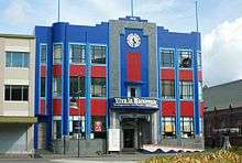
Originally part of the Papaioea clearing, The Square is a seven-hectare park of lawn, trees, lakes, fountains, and gardens in the centre of the city. It is the city's original park and also the centrepoint from whence the city's main streets are arranged.
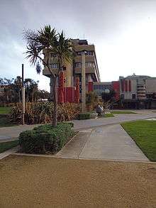
The Square contains the city's war memorial and a memorial dedicated to Te Peeti Te Awe Awe, the Rangitāne chief instrumental in the sale of Palmerston North district to the government in 1865.[20] Near the centre of the park is the Clock Tower with its illuminated cross and coloured lights. Also here is the city's iSite, the Civic Building (seat of the City Council), the City Library, Square Edge and the commercial heart of Palmerston North's CBD. Retail stores (including the Plaza) and eateries line the road surrounding the park.
In around 1878, a Māori contingent, including Te Awe Awe, gathered together to choose a Māori name for The Square. They chose Te Marae o Hine, meaning "The Courtyard of the Daughter of Peace". This name reflected their hope all people of all races would live together in enduring peace.
.JPG)
.JPG)
Parks
Victoria Esplanade Gardens
Victoria Esplanade Gardens are located along the northern bank of the Manawatu River, west of Fitzherbert Avenue. The esplanade gardens include serene native bush surrounding family-friendly facilities, an aviary, a café, a duck pond, the Palmerston North Esplanade Scenic Railway featuring a 2.2 km track through native bush, the Peter Black Conservatory and walking tracks within the bush. The Dugald McKenzie Rose Garden is attached to the esplanade gardens.[21] The Gardens were opened to commemorate the 60th Jubilee of Queen Victoria's reign (1897).
Other parks
Nearby the Esplanade are the multi sport playing fields of Ongley and Manawaroa Parks, the twin turf hockey fields and Fitzherbert Park, the premier cricket ground. Elsewhere in the city are parks for sports like rugby, such as Coronation Park, Bill Brown Park and Colquhoun Park (also used for softball/baseball); and football: Skoglund Park (home of the Central Football Federation) and Celaeno Park. Memorial Park has a football pitch, and also has family-friendly facilities.
Aquatic Centres
The Lido Aquatic Centre is Palmerston North's largest. It provides outdoor facilities including a family leisure pool, a 50 m pool for competitive swimming and a dive pool. Indoor facilities include another family lesiure pool, spa pool, heated pool and a cafe. The Lido provides swimming lessons to anyone in need but most of the time it is for youth under 18.
Freyberg Community Pool is an all-year indoor swimming pool complex located next to Freyberg High School in Roslyn.
Libraries
Palmerston North has a main public library with five branches and one mobile library. The central Palmerston North Library is located in the Square and houses the main collections. The other four are located in Ashhurst, Awapuni, Linton, Roslyn and Te Pātikitiki (Highbury).
Youth Space
Near the Square is the Youth Space, opened in September 2011 as a dedicated place for Palmerston North's many young people to congregate in a safe environment.[22] Youth space is free to all, and provides table-tennis, gaming consoles, musical instruments, library books, iPads, a kitchen, and other services.
Windfarms
The Tararua and Ruahine ranges are noted for being windy, and an ideal location for harnessing the power of the wind. The Tararua, Te Rere Hau and Te Apiti Windfarms realise this.
Te Apiti windfarm is the northernmost of the three windfarms in the area, situated on the brow of a hill in the Ruahine range chain next the Manawatu River. It has 55 turbines, each with blade lengths of 35 metres. Meridian Energy is the owner of Te Apiti.
The Tararua windfarm consists of 134 wind turbines with blade lengths of 23.5 and 45 metres. Trust Power owns the Tararua Windfarm. Part of this windfarm is in the area of Palmerston North City Council boundary.
Te Rere Hau Wind Farm is the furthest south of the three farms, located on the Tararua ranges. There are 97 turbines on the farm, standing 30 metres tall with a blade length of 16.5 metres. Te Rere Hau is owned by New Zealand Windfarms Ltd.
Culture
Arts
Te Manawa is the cultural museum of art, science and history. Attached to Te Manawa is the New Zealand Rugby Museum. There are many small independent galleries. Many of New Zealand's best-known artists came from or live in Palmerston North. The list includes Rita Angus, John Bevan Ford, Shane Cotton, Paul Dibble, Pat Hanly, Brent Harris, Bob Jahnke, John Panting, Carl Sydow and Tim Wilson.[23]
Performing arts
Palmerston North houses multiple theatres which regularly host musical performances, theatrical plays and formal events. These theatres include
- Regent on Broadway Theatre is a 1393-seat multipurpose performing arts facility.[24]
- Centrepoint Theatre is a prominent professional theatre and the only one outside the main centres of New Zealand.[25]
- Globe Theatre is a small community theatre of about 100 seats, built in about 1984. It is currently undergoing redevelopment, with the addition of another 100 seat auditorium.
Top comics including John Clarke, Jon Bridges, Jeremy Corbett, Tom Scott all come from Palmerston North as do stage, television and film performers Paul Barrett, Shane Cortese, Kate Louise Elliott, Simon Ferry, Greg Johnson, Jeff Kingsford-Brown and Alison Quigan.[23]
Cuisine
Palmerston North is reputed to have the highest number of restaurants, eateries and café bars per capita in New Zealand.[26] There is a vast selection of ethnic food options including Thai, French, Chinese, Indian, Korean, Japanese, Cambodian, Mongolian, Italian, Irish, American, Pacific rim and New Zealand cuisines.[27]
Music
Palmerston North has a thriving musical scene with many national and international acts touring through the town, and many local acts performing regularly.
Local groups include the Manawatu Sinfonia and Manawatu Youth Orchestra (MYO) who perform throughout the year. The Manawatu Youth Orchestra celebrated its 50th year in September 2011.
Events
- February: Esplanade Day
- February–March: Summer Shakespeare
- March: Festival of Cultures
- March: Women's Lifestyle Expo
- June: Manawatu Wedding Expo
- September: International Spring Festival
- September: Swampfest[28]
- November: Tour de Manawatu Charity Cycle Challenge
Sport
Participation in sport is an important and popular pastime in Palmerston North. Representation at a national level is predominantly provincial based, meaning most sports teams representing Palmerston North also draw their players from other towns from around Manawatu.
The premier multi-sports venue in Palmerston North is Arena Manawatu (previously known as Palmerston North Showgrounds). For sponsorship purposes is known as Central Energy Trust Arena. The main stadium (Arena One) is the home of the Manawatu Turbos rugby union team and the Robertson Holden International Speedway. There are indoor venues at Arena Manawatu where netball, basketball, volleyball and Badminton are played.
Other important venues include Memorial Park, Fitzherbert Park, Celaeno Park, Manawaroa/Ongley Park, Skoglund Park, Vautier Park and Massey University sports fields.
| Club | Sport | League | Venue |
|---|---|---|---|
| Manawatu Turbos | Rugby Union | Mitre 10 Cup | CET Arena |
| Manawatu Cyclones | Rugby Union | Farah Palmer Cup | CET Arena |
| Hurricanes | Rugby Union | Super Rugby | CET Arena # |
| Manawatu Matadors (Current Champions) | Hockey | Central Hockey League | Endevour Trust Twin Turfs |
| Central Pulse | Netball | ANZ Championship | CET Arena 2# |
| Central Districts | Cricket | Plunket Shield, Ford Trophy, T20 | Fitzherbert Park# |
- # : not based in Manawatu, however home ground when playing in Manawatu.
Transport
Palmerston North is a significant road and rail junction. As such, it is an important distribution hub for the Central and lower North Island, with many freight distribution centres based here.
Road
The city's main roads are all in dual carriageway format and arranged in a grid pattern, with four streets of significance radiating from The Square in the CBD. They are:
| Street name | State Highway | Significance |
|---|---|---|
| Rangitikei Street | to Grey St intersection | the main portal to and from the north. |
| Main Street East | from Princess St intersection | the main portal to and from the east (from Ashhurst and Napier). |
| Main Street West | leads to Pioneer Highway and then | main portal to and from the west |
| Fitzherbert Avenue | leads to Tennent Drive which becomes | the main portal to and from the south, crossing the Fitzherbert Bridge. This is the only bridge close to the city that crosses the Manawatu River. (The other bridge is State Highway 3 in Ashhurst, before the Manawatu Gorge 14 km (9 mi) away.) |
State Highways
State Highway![]()
State Highway 3 is the main state highway in Palmerston North. State Highway 1, New Zealand's main highway, passes about 25 km (16 mi) to the west of the city.
State Highway![]()
State Highway 54 starts at Kairanga-Bunnythorpe Road, which forms part of the boundary between Palmerston North City and Manawatu District.
State Highway ![]()
Pioneer Highway is the main western portal for traffic from State Highway 1, Foxton, Levin and Shannon. This road becomes State Highway 56 at the western urban limit of Palmerston North, however changes which shifted the boundary to include the most part of Longburn means that a small portion of the highway falls under the City Council's area.
State Highway![]()
State Highway 57 is an alternative road from west of the Manawatu Gorge along the southern side (left bank) of the Manawatu River (the highway ends south of Levin).
Other Roads of Significance
In the north, Milson Line, Railway Road, Roberts Line (North) and Stoney Creek Road provide alternative entries from Feilding and rural northern Manawatu. Tremaine Avenue, Kelvin Grove Road and Featherston Street are important west-east cross city routes.
In the south, Church Street, Ferguson Street, College Street, Te Awe Awe Street and Park Road are important west-east cross city routes.
In the west, the main north-south arterial is Botanical Road. It's counterparts in the east are Ruahine Street, Albert Street, Vogel Street and Roberts Line (South).
Cycling
Palmerston North is perceived as being better for cycling than most New Zealand cities, with 2001 figures putting it a close second only to Blenheim in terms of bicycle modal share.[29] The Manawatu River Pathway is great for family or beginners riders, as it is all flat to mildly contoured, with some limestone sections, as well as wide cement paths. The track has many access points to this trail, which runs for over 9 km between Maxwells Line in the West to Riverside Drive in the East. A new 3 km section has been added between Ashhurst and Raukawa Road, with plans to link this to the existing path over the next two years, making over 22 km of scenic tracks to explore alongside the river.
Palmerston North has a fairly comprehensive 65 km[30] on-road bicycle lane network, particularly in high traffic areas, to make it safer for people to get around the city by bike.[31]
Criticism The cycle lane network has been criticised for a number of reasons. Motor traffic is often too fast, and there is no physical barrier between bicyclists and motorists. Most bicycle lanes in the city are marked out with parking spaces for motorist parking, making those lanes 'pointless' and raising the risk of motorists opening car doors into the path of passing bicyclists.[32]
Rebecca Oaten, the so-called 'Helmet Lady' who campaigned nationwide in the late 1980s for a New Zealand bicycle helmet law, is from Palmerston North.[33]
Bus
Urban Services are coordinated by Horizons Regional Council, through Masterton-based bus company, Tranzit.
Seven urban buses leave the terminal in Main Street East (in front of Palmerston North Courthouse) at least every half-hour. The buses are assigned to loop routes servicing different parts of the city.
Buses are provided for students of Massey University and IPU.
Daily services run to the nearby towns of Linton, Ashhurst, Feilding (via Airport) and Marton.
Across the North Island Inter-regional routes are operated by Intercity, Tranzit and Nakedbus. Intercity's routes run south (to Wellington), north (towards Auckland, via Wanganui, Rotorua and Taupo, or Napier) and east (to Masterton) from the bus terminal in The Square, Palmerston North. Naked Bus runs from outside thePalmerston North City i-SITE in the Square.
Air
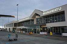
Palmerston North Airport is located in the suburb of Milson, on the outskirts of the city. It is approximately 5.5 km (3.4ml) from the central business district and is a regional gateway to the central North Island region.[34] The airport has regular services to domestic destinations including Auckland, Christchurch, Hamilton, Nelson and Wellington.[35] Flights are currently served by Air New Zealand Link, Jetstar and Originair.[36]
The airport is presently the operational base of the Massey University School of Aviation.[37] The airport is also an freight hub for Parcelair.[38]
Rail
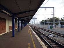
Palmerston North is an important passenger and freight stop on the North Island Main Trunk Railway. There are only two passenger trains run by KiwiRail: the weekday-only Capital Connection commuter train once a day to and from Wellington, and is a stop for the Northern Explorer to and from Auckland and Wellington.
Until 1964, the railway ran through the city centre, with Palmerston North Railway Station in The Square. The station was moved and the track diverted 2.5 km (2 mi) to the north by the Milson Deviation in 1959–1963; work on the deviation had started in 1926.
Near the current railway station, the North Island Main Trunk railway is joined by the Palmerston North - Gisborne Line, which runs through the Manawatu Gorge to Woodville and Hawke's Bay. A connection to the Wairarapa Line is at Woodville.
Media
The major daily newspaper is the Manawatu Standard. Weekly community newspapers include the Tribune and the Guardian.
Most radio stations are based outside the city, however some on the nationwide networks have studios in Palmerston North. Local radio stations include More FM (formerly "2XS") featuring the popular "Mike West in the Morning" breakfast show from 6am-10am.[39] Sister station The Breeze also has a local breakfast show from 6am-10am hosted by Burnzee.[40] Radio Control is the local alternative student radio station, featuring local personality Abi Symes on "The Continental Breakfast" from 7 am to 9 am. Access Manawatu 999AM is a local community station and Kia Ora FM is the local Iwi station.
History
Ngāti Rangitāne were the local Māori iwi (tangata whenua) living in the area known as Te Ahu-ā-Tūranga,[41] when a trader, Jack Duff, became the earliest known European to explore the area c.1830. He came on a whaling ship, and explored possibly as far inland as the site of Woodville. He reported his discovery on arrival back to Porirua. Colonel Wakefield heard of the potential that the Manawatu had for development and visited in 1840. In 1846 Stephen Charles Hartley, another trader, heard from tangata whenua of a clearing in the Papaioea forest and he proceeded through the dense bush and forest and discovered it for Europeans.[5]
In 1858, the Government began negotiations with local iwi to purchase land in Manawatu. There is dispute at the time between rival iwi Ngāti Rangitāne and Ngāti Raukawa as to who has the right to sell. The dispute is resolved in favour of Rangitāne.
On a visit in 1859, John Tiffin Stewart, an employee of the Wellington Provincial Council,[42] was shown the Papaioea clearing by Rangitāne chief, Te Hirawanu, and noted its suitability for a "good site for a township".[43]
In 1864, Te Ahu-a-Turanga Block was sold by Rangitāne to the Government for £12,000, in an effort to open the Manawatu to settlement.
Stewart returned in 1866 on behalf of the Wellington Provincial Council (under whose jurisdiction the new purchase fell) and made the original survey and subdivision in the Papaioea forest clearing. The settlement, named Palmerston to commemorate the recently deceased Prime Minister of Great Britain, was laid out according to Stewart's plan consisting of a series of wide and straight streets in a rectangular pattern. The focal point was an open space of 17 acres (7 ha) subsequently known as The Square. On 3 October 1866, Palmerston was formally endorsed after Isaac Earl Featherston (Wellington Provincial Superintendent) signed a proclamation defining the boundaries of the settlement. The first sections were sold after.
Among the first settlers included Scandinavians, who arrived in 1871. They established settlements at Awapuni and Whakarongo/Stoney Creek.
Later the same year, the suffix 'North' was added to distinguish the settlement of the same name in the South Island. In 1872 a petition was launched to change the name of the settlement. A public meeting in 1873 ends with no clear decision on the name.
The railway line was laid through the Square in 1875. The foundation stone for the original All Saints Church was laid by Louisa Snelson on 29 September 1875.[44]
In 1876, Palmerston North became a Local Board District, within the Wellington Provincial Council. This existed until the abolition of the provinces later the same year.
Also in the same year, the council set aside land north of the Manawatu River for the purposes of a reserve. In 1890, this land was again set aside and would become in 1897, the Victoria Esplanade.
By 1877, when the Borough Council came into existence, Palmerston North was an isolated village in the midst of the native forest that covered inland Manawatu. By 1878, the population was approximately 800 people and sawmilling was the main industry of the district. As the settlement grew, the forest diminished to make way for farms and housing, and today virtually no remnant of it survives.
The arrival of the railway in 1886 saw an increase in the speed of growth and the town was at the centre of a lucrative agricultural district. The opening of the nearby Longburn Freezing Works provided employment, while the Borough Council instigated more infrastructural schemes such as the sewerage system. The Railway through the Manawatu Gorge to Napier was completed in 1891.
In 1893, Rangitāne sold the Hokowhitu block, increasing the area of land available for settlement. In the same year, the Public Hospital opened in a wooden building on Terrace Street (now Ruahine Street). The hospital required significant fundraising. At the end of the decade, the Boer War broke out in South Africa and men from Palmerston North were among the volunteers.[45]
By 1900 the population had reached 6,000.[46]
In the 1910s Palmerston North's growth was steady. The population in 1911 about 10,991 (excluding Māori).[47] The city was affected by World War I, with Awapuni Racecourse being used as an army training camp in 1914. During the course of the war, the Borough Council renamed all German-sounding and foreign street names. When the war finished in 1918, celebrations were delayed due to the Influenza epidemic.
In 1930, the population reached the 20,000 threshold and Palmerston North was officially proclaimed a city, the 7th in New Zealand. Development was slow due to the great depression and World War II. An airport was established at Milson in 1936, which is now Palmerston North Airport.
From 1938, the first Labour government (1935–1949) initiated state housing programmes in West End (Savage Crescent precinct) and Roslyn.
In 1940 the Māori Battalion was formed in Palmerston North and trained at the Showgrounds (now Arena Manawatu).
In 1941, the Manawatu River flooded again, having last flooded in 1902. Large parts of Hokowhitu and Awapuni were underwater, with residents evacuating to higher ground (peaked at 5.8m).
In 1942, Linton Army Camp was established. After the war, the city'so growth was rapid. By 1950, the city'so boundaries had extended to include Milson and Kelvin Grove. In 1953, the boundaries would further extend to include Awapuni, which in the same year, was again flooded by the Manawatu River, along with Hokowhitu. It was the largest flood since 1902.
Although work had started in 1926, it was not until 1959 the Milson Deviation of the North Island Main Trunk was opened. This meant future trains would pass to the north of the city, instead of through the Square. Later in 1963, the railway station at Tremaine Avenue opens. The last trains passed through the Square in 1964.
In 1961, the Highbury was added to the council area. In 1963, Massey University College of Manawatu was formed by the amalgamation of the Massey Agricultural College with the Palmerston North University College. In 1964, it becomes Massey University of Manawatu, an autonomous tertiary learning institution with the power to grant its own degrees.
In 1967, city boundaries were again extended to include land in Aokautere, Kelvin Grove, Milson, Amberley (Westbrook) and Awapuni as part of future growth for the next 25 years.
In 1970, the Rugby Museum was established and a tribute to the founding father of rugby in New Zealand, Charles Munro, was opened at Massey University.
In 1971, a competition to design a civic building for the vacant railway land at the Square, is won by Wellington architects, Maurice and John Patience. The resulting building was finished in 1979. In 1976, the Manawatu and Oroua rivers flood, 24-hour rainfall records in Feilding and Palmerston North are exceeded and some residents from both locations are evacuated.
In 1977, Palmerston North City Council celebrated its Centenary of Municipal government. The Queen and the Duke of Edinburgh are among visitors to Palmerston North.
On 1 November 1989, New Zealand local government authorities were reorganised. Palmerston North City boundaries were extended to include Ashhurst, Linton and Turitea through amalgamation of parts of the former Kairanga County, Oroua County and Ashhurst Town Council.
On 1 July 2012, Bunnythorpe, Longburn, part of the area around Kairanga and an area around Ashhurst were joined to Palmerston North City Council area.
Governance
Palmerston North City Council
Palmerston North is governed by a city council which consists of a mayor and 15 councillors.
Previously for representation purposes, the city was divided into five wards (previously 6, however, 2 wards amalgamated). In April 2013, the Local Government Commission abolished the wards and therefore the city will elect its council on a city-wide basis.
Elections for Mayor and local government occur nationwide every three years, with the next election to take place in 2019. The 2013 election saw the Single Transferable Voting (STV) system introduced, replacing plurality voting (First past the post-FPP).
Current City Council (2016):
| Mayor | Grant Smith[48] |
| Councillors – City Wide | Aleisha Rutherford
Susan Baty |
The Council's functions are broken down into seven units:
- City Future
- Customer Service
- City Corporate
- City Enterprise
- Library & Community Services
- City Networks
The Chief Executive is Paddy Clifford.[50]
Horizons (Manawatu-Wanganui) Regional Council
Palmerston North is the seat of the council.
For electoral and regional representation purposes, Palmerston North City makes up the Palmerston North constituency and is represented by 4 councillors:
Palmerston North Constituency Councillors as at 2016 election:
- Wiremu Te Awe Awe
- Pat Kelly
- Paul Rieger
- Rachel Keedwell
Central Governance
Palmerston North in the parliamentary term spanning 2014 to 2017, is represented by 3 electorate MPs and 2 List MPs in Parliament.
Palmerston North
The boundaries of the electorate of Palmerston North have changed often since the introduction of MMP. It has been previously larger than now and formerly extended over the Manawatu River into the southern suburbs. A 2007 redraw transferred the southern suburbs to Rangitikei, in return for Kelvin Grove and Milson, making Palmerston North a completely urban electorate. Currently Palmerston North is surrounded by the Rangitikei electorate. Since 2008, the Palmerston North electorate has been held by Iain Lees-Galloway of Labour.
Rangitīkei
The large electorate of Rangitīkei extends south to Palmerston North's southern and eastern parts, the mostly rural former Ashhurst-Fitzherbert ward. Rangitīkei therefore completely surrounds the electorate of Palmerston North (the only electorate thus surrounded completely by another). The electorate was formerly represented (1998–2011) by Simon Power (National) and has been represented by former Manawatu District Mayor Ian McKelvie (National) since the New Zealand general election at the end of that year.
Te Tai Hauāuru
One of the seven Māori electorates, Te Tai Hauāuru includes all of the Palmerston North area. The electorate is currently held by Adrian Rurawhe of the Labour Party.
List members
The previous mayor of Palmerston North Jono Naylor made himself available to stand as a candidate for the Palmerston North electorate, representing the National Party. Though he did not win the seat, his party's strong vote return on election night secured his seat in Parliament. Naylor subsequently resigned as mayor.
The other new MP is Darroch Ball of New Zealand First. A strong return for his party on election night secured his seat in Parliament.
Sister Cities
Palmerston North has two sister cities:[51]
Personalities
- Grant Robertson, Labour MP; born in Palmerston North. Current MP for Wellington Central.
- Shane Cortese, actor
- Joseph Nathan, founder of Glaxo
- Alan Loveday, violinist
- Ross Taylor - current New Zealand Black Caps captain and Central Districts batsman (cricket)
- Murray Ball, cartoonist
Named after the city
- An NAC Vickers Viscount (ZK-NAI) was named "City of Palmerston North". This aircraft was withdrawn from NAC service in 1975.[52]
- An Ansett New Zealand de Havilland Canada Dash 8 (ZK-NES) was also named "City of Palmerston North", staying in service until the airline's demise.[53]
References
- ↑ "Palmerston North – Heraldry of the World". Ngw.nl. Retrieved 19 June 2015.
- ↑ "Palmam qui meruit ferat meaning". Latin-dictionary.org. Retrieved 19 June 2015.
- 1 2 "Subnational Population Estimates: At 30 June 2016 (provisional)". Statistics New Zealand. 21 October 2016. Retrieved 21 October 2016. For urban areas, "Subnational population estimates (UA, AU), by age and sex, at 30 June 1996, 2001, 2006-16 (2017 boundary)". Statistics New Zealand. 21 October 2016. Retrieved 21 October 2016.
- ↑ "Palmerston North". Palmerston North City Council. Retrieved 20 November 2016.
- 1 2 "PALMERSTON NORTH – Te Ara Encyclopedia of New Zealand". Teara.govt.nz. 11 August 1930. Retrieved 19 June 2015.
- ↑ "List of Place Names – Māori Language Resources – Te Taura Whiri i te Reo Māori – Māori Language Commission". Tetaurawhiri.govt.nz. Retrieved 19 June 2015.
- ↑ "PNCC Landscape Values and Planning Provisions:Te Mata Landscape Assessment" (PDF). Palmerston North City Council. Retrieved 4 October 2015.
- ↑ "Climate Data and Activities". NIWA. Retrieved 19 October 2013.
- ↑ "Infoshare; Group: Population Estimates – DPE; Table: Estimated Resident Population for Urban Areas, at 30 June (1996+) (Annual-Jun)". Statistics New Zealand. Retrieved 17 June 2015.
- 1 2 3 4 5 6 Quickstats about Palmerston North City
- ↑ 2013 Census usually resident population counts
- 1 2 Archived 13 May 2012 at the Wayback Machine.
- 1 2 Archived 10 April 2008 at the Wayback Machine.
- ↑ Archived 23 September 2012 at the Wayback Machine.
- ↑ "IPC Tertiary Institute – Home". Ipc.ac.nz. Retrieved 19 June 2015.
- ↑ "Palmerston North Community Profile : For the Community Response Model Forum" (PDF). Communityresponse.org.nz. Retrieved 19 June 2015.
- ↑ Archived 7 October 2011 at the Wayback Machine.
- ↑ "Central Police District | New Zealand Police". Police.govt.nz. Retrieved 19 June 2015.
- ↑ "Finding your local court – Ministry of Justice, New Zealand". Justice.govt.nz. Retrieved 19 June 2015.
- ↑ "Te Aweawe, Te Peeti – Biography – Te Ara Encyclopedia of New Zealand". Dnzb.govt.nz. Retrieved 19 June 2015.
- ↑ "Dugald Mackenzie Rose Garden – Palmerston North – The New Zealand Rose Society". Nzroses.org.nz. 14 January 2011. Retrieved 19 June 2015.
- ↑ Archived 4 November 2012 at the Wayback Machine.
- 1 2 "Palmerston North Artists". Creativegiants.co.nz. Retrieved 19 June 2015.
- ↑ "The Regent on Broadway – Home". Regent.co.nz. Retrieved 19 June 2015.
- ↑ "About Us – Centrepoint Theatre". Centrepoint.co.nz. Retrieved 19 June 2015.
- ↑ "Locality Guide – Palmerston North LJ Hooker Palmerston North". Palmerstonnorth.ljhooker.co.nz. Retrieved 19 June 2015.
- ↑ Archived 24 October 2012 at the Wayback Machine.
- ↑ Archived 2 June 2010 at the Wayback Machine.
- ↑ Hamilton Alternatives to Roading Study (HARTS). "Assessment of Walking and Cycling". October 2005. Retrieved 1 September 2011.
- ↑ Horizons Regional Council. "Annual Report on the Implementation of the Regional Land Transport Strategy", 2009–10. September 2010. Retrieved 1 September 2011.
- ↑ "Cycling Facilities". Palmerston North City Council. 2010. Retrieved 31 August 2011.
- ↑ "Cyclist injured in cycle lane – Palmerston North". CAN – Cycling Advocates Network. 17 August 2008. Retrieved 31 August 2011.
- ↑ "Helmets 'may be deterring cyclists'". Stuff.co.nz. 23 October 2008. Retrieved 29 September 2011.
- ↑ "Airport Info". Palmerston North Airprot. 2015. Retrieved 3 October 2015.
- ↑ "Route Map". Air New Zealand. 2015. Retrieved 3 October 2015.
- ↑ "New airline Originair set to go". Stuff.co.nz. 25 June 2015. Retrieved 29 August 2015.
- ↑ "About the school of Education". Massey University. 2015. Retrieved 3 October 2015.
- ↑ "About us". Fieldair- Aircraft Engineering. 2015. Retrieved 3 October 2015.
- ↑ "More FM Shows". Morefm.co.nz. 14 September 2014. Retrieved 19 June 2015.
- ↑ "Breakfast – Manawatu – Shows". Thebreeze.co.nz. 14 September 2014. Retrieved 19 June 2015.
- ↑
- ↑ "Topic: John Tiffin Stewart". Kete Horowhenua. Retrieved 4 July 2008.
- ↑ "Our Region". Ourregion.co.nz. Retrieved 19 June 2015.
- ↑ "All Saints' Church". Manawatu Times. XL (13536). 28 October 1916. p. 7. Retrieved 18 June 2016.
- ↑ Archived 9 February 2013 at the Wayback Machine.
- ↑ "1890s". Palmerston North City Council. Retrieved 4 July 2008.
- ↑ "1910s". Palmerston North City Council. Retrieved 13 November 2012.
- 1 2 www.terabyte.co.nz, Terabyte |. "Palmerston North – Mayor and Elected Members". www.pncc.govt.nz. Retrieved 22 February 2016.
- ↑ Archived 28 October 2013 at the Wayback Machine.
- ↑ "Paddy Clifford – Chief Executive". Palmerston North City Council. Retrieved 28 December 2015.
- ↑ "Sister cities". Palmerston North City Council. Retrieved 23 November 2014.
- ↑ "Viscount c/n 248". Vickers Viscount Network. Retrieved 1 January 2015.
- ↑ "Kiwi Aircraft Images". Kiwiaircraftimages.com. Retrieved 1 January 2015.
External links
| Wikivoyage has a travel guide for Palmerston_North. |
Official websites
- Official Website of Palmerston North City & Manawatu
- Palmerston North City Council
- Street Maps and Property Information
Unofficial portals