Rubirizi
| Rubirizi | |
|---|---|
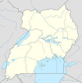 Rubirizi Location in Uganda | |
| Coordinates: 00°15′54″S 30°06′00″E / 0.26500°S 30.10000°E | |
| Country |
|
| Region | Western Region |
| Sub-Region | Ankole sub-region |
| District | Rubirizi District |
| Elevation | 4,300 ft (1,300 m) |
| Population (2014 Census) | |
| • Total | 8,140 |
Rubirizi, sometimes spelled Rubiriizi, is a town in Rubirizi District, Ankole sub-region, Western Uganda. The town is the main municipal, administrative and commercial center of Rubirizi District. The district is named after the town.
Location
Rubirizi lies just south of the Equator, along the Ntungamo-Kasese Highway. This location is approximately 90 kilometres (56 mi), by road, northwest of Mbarara, the largest city in Ankole sub-region.[1] This location lies approximately 350 kilometres (220 mi), by road, southwest of Kampala, the capital of Uganda and the largest city in that country.[2] The coordinates of the town are: 00° 15' 54S, 30° 06' 00E (Latitude:-0.2650; Longitude: 30.1000).[3]
Population
The 2014 population census, estimated the population of Rubirizi as 8,140.
Points of interest
The following points of interest are found within the town limits or close to its edges:
- The headquarters of Rubirizi District Administration
- The offices of Rubirizi Town Council
- Rubirizi Central Market - The largest fresh-produce market in the town.
- The Ntungamo-Kasese Highway - The highway passes through the town in a north to south direction.
- A branch of Bank of Africa
See also
References
- ↑ "Road Distance Between Mbarara And Rubirizi With Map". Globefeed.com. Retrieved 14 April 2014.
- ↑ "Map Showing Kampala And Rubirizi With Distance Marker". Globefeed.com. Retrieved 14 April 2014.
- ↑ "Location of Rubirizi At Google Maps". Google Maps. Retrieved 14 April 2014.
External links
Capital: Rubirizi | |
| Counties and sub-counties |
|
| Towns and villages | |
| Geography | |
| Economy |
|
| Transport | |
| Notable landmarks |
|
| Notable people | |
Coordinates: 00°15′54″S 30°06′00″E / 0.26500°S 30.10000°E