Rudd Township, Floyd County, Iowa
| Rudd Township | |
|---|---|
| Township | |
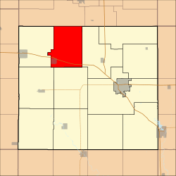 Location in Floyd County | |
| Coordinates: 43°09′45″N 92°51′36″W / 43.16250°N 92.86000°WCoordinates: 43°09′45″N 92°51′36″W / 43.16250°N 92.86000°W | |
| Country |
|
| State |
|
| County | Floyd |
| Area | |
| • Total | 35.24 sq mi (91.28 km2) |
| • Land | 35.24 sq mi (91.28 km2) |
| • Water | 0 sq mi (0 km2) 0% |
| Elevation | 1,148 ft (350 m) |
| Population (2000) | |
| • Total | 693 |
| • Density | 19.7/sq mi (7.6/km2) |
| Time zone | CST (UTC-6) |
| • Summer (DST) | CDT (UTC-5) |
| ZIP codes | 50435, 50461, 50471 |
| GNIS feature ID | 0468646 |
Rudd Township is one of twelve townships in Floyd County, Iowa, USA. As of the 2000 census, its population was 693.[1]
Geography
According to the United States Census Bureau, Rudd Township covers an area of 35.24 square miles (91.28 square kilometers).
Cities, towns, villages
Adjacent townships
- Floyd Township (east)
- Ulster Township (south)
- Rockford Township (southwest)
- Rock Grove Township (west)
- Cedar Township, Mitchell County (northwest)
Cemeteries
The township contains Evergreen Cemetery.
Major highways
Airports and landing strips
- Folkerts Airport
School districts
- Osage Community School District
- Rudd-Rockford-Marble Rk Community School District
Political districts
- Iowa's 4th congressional district
- State House District 14
- State Senate District 7
References
- United States Census Bureau 2008 TIGER/Line Shapefiles
- United States Board on Geographic Names (GNIS)
- United States National Atlas
External links
 |
Cedar Township, Mitchell County | |
| |
| Rock Grove Township | |
Floyd Township | ||
| ||||
| | ||||
| Rockford Township | Ulster Township |
Municipalities and communities of Floyd County, Iowa, United States | ||
|---|---|---|
| Cities | ||
| Townships | ||
| CDP | ||
| Other unincorporated communities | ||
| Footnotes | ‡This populated place also has portions in an adjacent county or counties | |
This article is issued from Wikipedia - version of the 11/16/2013. The text is available under the Creative Commons Attribution/Share Alike but additional terms may apply for the media files.