Saint-Eugène, Quebec
Not to be confused with the former Saint-Eugène in Chaudière-Appalaches that amalgamated into L'Islet in 2000.
Not to be confused with the former Saint-Eugène in Saguenay–Lac-Saint-Jean that was renamed Saint-Eugène-d'Argentenay in 1997.
| Saint-Eugène | |
|---|---|
| Municipality | |
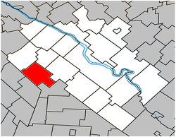 Location within Drummond RCM. | |
 Saint-Eugène Location in southern Quebec. | |
| Coordinates: 45°48′N 72°42′W / 45.800°N 72.700°WCoordinates: 45°48′N 72°42′W / 45.800°N 72.700°W[1] | |
| Country |
|
| Province |
|
| Region | Centre-du-Québec |
| RCM | Drummond |
| Constituted | October 31, 1879 |
| Government[2][3] | |
| • Mayor | Gilles Watier |
| • Federal riding | Drummond |
| • Prov. riding | Johnson |
| Area[2][4] | |
| • Total | 76.20 km2 (29.42 sq mi) |
| • Land | 75.67 km2 (29.22 sq mi) |
| Population (2011)[4] | |
| • Total | 1,131 |
| • Density | 14.9/km2 (39/sq mi) |
| • Pop 2006-2011 |
|
| • Dwellings | 502 |
| Time zone | EST (UTC−5) |
| • Summer (DST) | EDT (UTC−4) |
| Postal code(s) | J0C 1J0 |
| Area code(s) | 819 |
| Highways |
|
| Website |
www |
Saint-Eugène is a municipality in the Centre-du-Québec region of Quebec. The population as of the Canada 2011 Census was 1,131.
Demographics
Population
Population trend:[5]
| Census | Population | Change (%) |
|---|---|---|
| 2011 | 1,131 | |
| 2006 | 1,133 | |
| 2001 | 1,084 | |
| 1996 | 1,058 | |
| 1991 | 982 | N/A |
Language
Mother tongue language (2006)[6]
| Language | Population | Pct (%) |
|---|---|---|
| French only | 1,105 | 97.79% |
| English only | 0 | 0.00% |
| Both English and French | 10 | 0.88% |
| Other languages | 15 | 1.33% |
See also
References
- ↑ Reference number 56466 of the Commission de toponymie du Québec (French)
- 1 2 Ministère des Affaires municipales, des Régions et de l'Occupation du territoire: Saint-Eugène
- ↑ Parliament of Canada Federal Riding History: DRUMMOND (Quebec)
- 1 2 2011 Statistics Canada Census Profile: Saint-Eugène, Quebec
- ↑ Statistics Canada: 1996, 2001, 2006, 2011 census
- ↑ 2006 Statistics Canada Community Profile: Saint-Eugène, Quebec
 |
Saint-Guillaume | Saint-Edmond-de-Grantham | | |
| Saint-Hugues | |
Saint-Germain-de-Grantham | ||
| ||||
| | ||||
| Sainte-Hélène-de-Bagot | Saint-Nazaire-d'Acton |
| Cities | |
|---|---|
| Municipalities | |
| Parishes | |
| Villages | |
| |
This article is issued from Wikipedia - version of the 11/8/2014. The text is available under the Creative Commons Attribution/Share Alike but additional terms may apply for the media files.