Wickham, Quebec
| Wickham | |
|---|---|
| Municipality | |
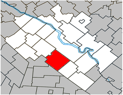 Location within Drummond RCM. | |
 Wickham Location in southern Quebec. | |
| Coordinates: 45°45′N 72°30′W / 45.750°N 72.500°WCoordinates: 45°45′N 72°30′W / 45.750°N 72.500°W[1] | |
| Country |
|
| Province |
|
| Region | Centre-du-Québec |
| RCM | Drummond |
| Constituted | December 23, 1972 |
| Government[2][3] | |
| • Mayor | Carole Côté |
| • Federal riding | Drummond |
| • Prov. riding | Johnson |
| Area[2][4] | |
| • Total | 99.10 km2 (38.26 sq mi) |
| • Land | 98.75 km2 (38.13 sq mi) |
| Population (2011)[4] | |
| • Total | 2,470 |
| • Density | 25.0/km2 (65/sq mi) |
| • Pop 2006-2011 |
|
| • Dwellings | 994 |
| Time zone | EST (UTC−5) |
| • Summer (DST) | EDT (UTC−4) |
| Postal code(s) | J0C 1S0 |
| Area code(s) | 819 |
| Highways |
|
| Website |
www |
Wickham is a municipality located in the Centre-du-Québec region of Quebec. The population as of the Canada 2011 Census was 2,470.
Demographics
Population
Population trend:[5]
| Census | Population | Change (%) |
|---|---|---|
| 2011 | 2,470 | |
| 2006 | 2,503 | |
| 2001 | 2,516 | |
| 1996 | 2,376 | |
| 1991 | 2,191 | N/A |
Language
Mother tongue language (2006)[6]
| Language | Population | Pct (%) |
|---|---|---|
| French only | 2,415 | 96.79% |
| English only | 10 | 0.40% |
| Both English and French | 0 | 0.00% |
| Other languages | 70 | 2.81% |
See also
References
- ↑ Reference number 67118 of the Commission de toponymie du Québec (French)
- 1 2 Ministère des Affaires municipales, des Régions et de l'Occupation du territoire: Wickham
- ↑ Parliament of Canada Federal Riding History: DRUMMOND (Quebec)
- 1 2 2011 Statistics Canada Census Profile: Wickham, Quebec
- ↑ Statistics Canada: 1996, 2001, 2006, 2011 census
- ↑ 2006 Statistics Canada Community Profile: Wickham, Quebec
 |
Saint-Germain-de-Grantham | Drummondville | | |
| Saint-Nazaire-d'Acton | |
|||
| ||||
| | ||||
| Saint-Théodore-d'Acton | Lefebvre |
| Cities | |
|---|---|
| Municipalities | |
| Parishes | |
| Villages | |
| |
This article is issued from Wikipedia - version of the 5/8/2013. The text is available under the Creative Commons Attribution/Share Alike but additional terms may apply for the media files.