St. David, Arizona
| St. David, Arizona | |
|---|---|
| CDP | |
 Location in Cochise County and the state of Arizona | |
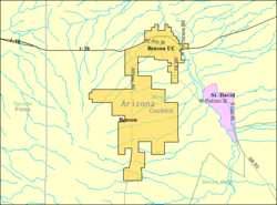 Detailed location (pink), shown in relation to Benson (yellow) | |
 St. David, Arizona Location in the United States | |
| Coordinates: 31°53′53″N 110°13′5″W / 31.89806°N 110.21806°WCoordinates: 31°53′53″N 110°13′5″W / 31.89806°N 110.21806°W | |
| Country | United States |
| State | Arizona |
| County | Cochise |
| Founded | 1877 |
| Area | |
| • Total | 5.3 sq mi (13.8 km2) |
| • Land | 5.3 sq mi (13.8 km2) |
| • Water | 0.0 sq mi (0.0 km2) |
| Elevation | 3,691 ft (1,125 m) |
| Population (2010) | |
| • Total | 1,699 |
| • Density | 329.1/sq mi (126.4/km2) |
| Time zone | MST (no DST) (UTC-7) |
| FIPS code | 04-62280 |
| GNIS feature ID | 0010700 |
St. David is a census-designated place (CDP) in Cochise County, Arizona, United States. The population was 1,699 at the 2010 census.[1]
History
St. David was established as a result of the Mormon Battalion having earlier passed through the San Pedro River valley in 1846. One of the founders of St. David, Philemon C. Merrill, was a member of the battalion.[2] The Mormon settlers of 1877 were part of a group that originally was to settle Lehi, Arizona.[3] The town was named after David W. Patten, an early Mormon apostle that was killed in the 1838 Battle of Crooked River in Missouri. The early St. David settlers played an important role in establishing the subsequent surrounding settlements, such as Fort Huachuca and Tombstone, as they did much of the logging in the Huachuca Mountains to provide lumber for the construction of those locations.[4]
As a tight-knit Mormon community, St. David managed better than other small towns in Cochise County during the Great Depression.[5]
An influx of non-Mormons, principally from Oklahoma and Texas, occurred when St. David became the site for Civilian Conservation Corps Camp SCS-19-A from 1935 to 1940. Works included soil erosion and flood control projects.[6]
The first natural gas lines brought into Cochise County were brought into St. David.[7]
Geography
St. David is located at 31°53′53″N 110°13′5″W / 31.89806°N 110.21806°W (31.898039, -110.218034).[8]
According to the United States Census Bureau, the CDP has a total area of 5.3 square miles (14 km2), all of it land.
The portion of Arizona State Route 80 that runs east-west through town uses the earlier Patten Street alignment, with the center of town located at the intersection of Patten and Miller Lane.
Demographics
As of the census[9] of 2000, there were 1,744 people, 666 households, and 462 families residing in the CDP. The population density was 327.7 people per square mile (126.6/km²). There were 892 housing units at an average density of 167.6/sq mi (64.7/km²). The racial makeup of the CDP was 93.00% White, 0.40% Black or African American, 0.29% Native American, 0.46% Asian, 0.23% Pacific Islander, 3.04% from other races, and 2.58% from two or more races. 9.81% of the population were Hispanic or Latino of any race.
There were 666 households out of which 28.1% had children under the age of 18 living with them, 59.3% were married couples living together, 8.1% had a female householder with no husband present, and 30.5% were non-families. 26.9% of all households were made up of individuals and 17.0% had someone living alone who was 65 years of age or older. The average household size was 2.60 and the average family size was 3.16.
In the CDP the age distribution of the population shows 28.3% under the age of 18, 5.4% from 18 to 24, 18.2% from 25 to 44, 23.3% from 45 to 64, and 24.8% who were 65 years of age or older. The median age was 44 years. For every 100 females there were 96.4 males. For every 100 females age 18 and over, there were 98.6 males.
The median income for a household in the CDP was $30,840, and the median income for a family was $32,292. Males had a median income of $31,641 versus $21,339 for females. The per capita income for the CDP was $12,872. About 8.7% of families and 12.1% of the population were below the poverty line, including 13.6% of those under age 18 and 3.8% of those age 65 or over.
Education
In 1878 a one-room schoolhouse was built from stone, but it was destroyed in the 1887 Sonora earthquake. The 500-pound bell from that schoolhouse is now on display at the current school.[10] In 1938 a brick school house was built, it still stands today and is on the National Register of Historic Places. It is one of the oldest standing structures in the area. The St. David School District is also the oldest in the San Pedro Valley. The annual San Pedro Valley Fair has been held at the St. David High School since 1934.[11] In 2008 St. David held a celebration its 130 anniversary during the 75th San Pedro Valley Fair with a Town Reunion at the St. David School.[12] Another popular cultural event held at the school is the annual 1880s Historic Costume Ball, which is patterned after a typical postbellum Indian War-era military ball.[4]
Notable residents
See also
References
- ↑ Website Services & Coordination Staff(WSCS). "2010 Census Interactive Population Search". Retrieved 28 December 2014.
- ↑ Bernal, Adam (10 December 2008). "Retracing history: Mormon Battalion's journey revisited". San Pedro Valley News-Sun. Retrieved 15 February 2010.
- ↑ "A Brief History of Mesa, Arizona: Lehi Settlement and Fort Utah". mesalibrary.org. Retrieved 15 February 2010.
- 1 2 Kartchner, Sue (24 February 2009). "Popular costume ball set Saturday". San Pedro Valley News-Sun. Retrieved 15 February 2010.
- ↑ Rogers, W. Lane (September 2, 2008). "For Sale - This Place - And Cow". Arizona Range News. Retrieved 15 February 2010.
- ↑ Sharon E. Hunt. "CCC Company 3840". Retrieved 15 February 2010.
- ↑ Grimes, Thelma (30 January 2007). "Pioneer, newspaper publisher dies". San Pedro Valley News-Sun. Retrieved 15 February 2010.
- ↑ "US Gazetteer files: 2010, 2000, and 1990". United States Census Bureau. 2011-02-12. Retrieved 2011-04-23.
- ↑ "American FactFinder". United States Census Bureau. Retrieved 2008-01-31.
- ↑ Grimes, Thelma (13 April 2005). "St. David school bell site dedicated". San Pedro Valley News-Sun. Retrieved 15 February 2010.
- ↑ Higgenbotham, Ron (27 August 2008). "San Pedro Valley Fair has long history". San Pedro Valley News-Sun. Retrieved 15 February 2010.
- ↑ Bernal, Adam (27 August 2008). "St. David reunion, fair top festivities". San Pedro Valley News-Sun. Retrieved 15 February 2010.
External links
Municipalities and communities of Cochise County, Arizona, United States | ||
|---|---|---|
| Cities |  | |
| Towns | ||
| CDPs | ||
| Unincorporated communities |
| |
| Ghost towns |
| |