Willcox, Arizona
| Willcox | |
|---|---|
| City | |
| Willcox, Arizona | |
|
Willcox Town Hall, a former Southern Pacific Railroad station | |
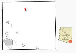 Location in Cochise County and the state of Arizona | |
 Willcox Location in the United States | |
| Coordinates: 32°15′20″N 109°50′8″W / 32.25556°N 109.83556°WCoordinates: 32°15′20″N 109°50′8″W / 32.25556°N 109.83556°W | |
| Country | United States |
| State | Arizona |
| County | Cochise |
| Founded | 1880 |
| Incorporated | 1915 |
| Government | |
| • Mayor | Sam Lindsey |
| Area | |
| • Total | 6.3 sq mi (16.3 km2) |
| • Land | 6.1 sq mi (15.9 km2) |
| • Water | 0.1 sq mi (0.3 km2) |
| Elevation | 4,167 ft (1,270 m) |
| Population (2010)[1] | |
| • Total | 3,757 |
| • Estimate (2014)[2] | 3,607 |
| • Density | 611/sq mi (235.9/km2) |
| Time zone | MST (no DST) (UTC-7) |
| ZIP codes | 85643-85644 |
| Area code | 520 |
| FIPS code | 04-83090 |
| Website | City of Willcox |

Willcox is a city in Cochise County, Arizona, United States. As of the 2010 census, the population of the city was 3,757.[1]
History
Originally known as "Maley", the town was founded in 1880 as a whistlestop on the Southern Pacific Railroad. It was renamed in honor of a visit by General Orlando B. Willcox in 1889. In the early 20th century, Willcox had the distinction of being a national leader in cattle production. Agriculture remains important to the local economy, but Interstate 10 has replaced the railroad as the major transportation link, and much of the economy is now tied to the highway, which runs immediately north of the town.
Willcox is the birthplace of Rex Allen, known as "The Arizona Cowboy", who wrote and recorded many songs, starred in several Westerns during the early 1950s and in the syndicated television series Frontier Doctor (1958–1959). Willcox was among the locations of 26 Men (1957–1959), another syndicated series that depicted true stories of the Arizona Rangers starring Tristram Coffin and Kelo Henderson.
Geography
Willcox is located in northern Cochise County at 32°15′20″N 109°50′8″W / 32.25556°N 109.83556°W (32.255622, -109.835520)[3] in the Sulphur Springs Valley. Interstate 10 serves the city with three exits and leads 35 miles (56 km) southwest to Benson, Arizona, and 74 miles (119 km) east to Lordsburg, New Mexico.
According to the United States Census Bureau, the city has a total area of 6.3 square miles (16.3 km2), of which 6.1 square miles (15.9 km2) is land and 0.12 square miles (0.3 km2), or 2.13%, is water.
Climate
| Climate data for Willcox, Arizona | |||||||||||||
|---|---|---|---|---|---|---|---|---|---|---|---|---|---|
| Month | Jan | Feb | Mar | Apr | May | Jun | Jul | Aug | Sep | Oct | Nov | Dec | Year |
| Record high °F (°C) | 81 (27) |
88 (31) |
92 (33) |
97 (36) |
105 (41) |
110 (43) |
110 (43) |
106 (41) |
105 (41) |
101 (38) |
91 (33) |
81 (27) |
110 (43) |
| Average high °F (°C) | 61 (16) |
65 (18) |
71 (22) |
79 (26) |
88 (31) |
96 (36) |
96 (36) |
93 (34) |
90 (32) |
80 (27) |
70 (21) |
60 (16) |
79 (26) |
| Average low °F (°C) | 28 (−2) |
31 (−1) |
35 (2) |
40 (4) |
49 (9) |
57 (14) |
65 (18) |
64 (18) |
57 (14) |
44 (7) |
33 (1) |
27 (−3) |
44 (7) |
| Record low °F (°C) | −1 (−18) |
2 (−17) |
6 (−14) |
9 (−13) |
11 (−12) |
27 (−3) |
42 (6) |
41 (5) |
30 (−1) |
15 (−9) |
8 (−13) |
−7 (−22) |
−7 (−22) |
| Average precipitation inches (mm) | 1.09 (27.7) |
0.96 (24.4) |
0.68 (17.3) |
0.33 (8.4) |
0.39 (9.9) |
0.46 (11.7) |
2.61 (66.3) |
2.53 (64.3) |
1.18 (30) |
1.16 (29.5) |
0.71 (18) |
1.25 (31.8) |
13.35 (339.3) |
| Average snowfall inches (cm) | 0.90 (2.29) |
0.90 (2.29) |
0.70 (1.78) |
0.20 (0.51) |
0 (0) |
0 (0) |
0 (0) |
0 (0) |
0 (0) |
0 (0) |
0.10 (0.25) |
1.50 (3.81) |
4.30 (10.92) |
| Source: [4] | |||||||||||||
Willcox Wine Country
Willcox is home to Arizona's upcoming wine country. Grape varietals grown include Petit Sirah, Malvasia Bianca, Sangiovese, Chenin Blanc, Syrah, Columbard, Sauvignon Blanc, Corvina, Merlot, Malbec, Tannat, Cabernet Franc, Chardonnay, Tempranillo, Cabernet Sauvignon and Mourvedre. The Willcox wine region produces 74% of the wine grapes grown in the state of Arizona.[5]
Demographics
| Historical population | |||
|---|---|---|---|
| Census | Pop. | %± | |
| 1890 | 396 | — | |
| 1910 | 1,632 | — | |
| 1920 | 905 | −44.5% | |
| 1930 | 806 | −10.9% | |
| 1940 | 884 | 9.7% | |
| 1950 | 1,266 | 43.2% | |
| 1960 | 2,441 | 92.8% | |
| 1970 | 2,568 | 5.2% | |
| 1980 | 3,243 | 26.3% | |
| 1990 | 3,122 | −3.7% | |
| 2000 | 3,733 | 19.6% | |
| 2010 | 3,757 | 0.6% | |
| Est. 2015 | 3,552 | [6] | −5.5% |
| U.S. Decennial Census[7] 2014 Estimate[2] | |||
As of the census[8] of 2000, there were 3,733 people, 1,383 households, and 947 families residing in the city. The population density was 622.3 people per square mile (240.2/km²). There were 1,652 housing units at an average density of 275.4 per square mile (106.3/km²). The racial makeup of the city was 74.95% White, 0.70% Black or African American, 1.61% Native American, 0.83% Asian, 0.05% Pacific Islander, 17.63% from other races, and 4.23% from two or more races. 41.71% of the population were Hispanic or Latino of any race.
There were 1,383 households out of which 34.3% had children under the age of 18 living with them, 51.6% were married couples living together, 12.2% had a female householder with no husband present, and 31.5% were non-families. 27.5% of all households were made up of individuals and 13.2% had someone living alone who was 65 years of age or older. The average household size was 2.65 and the average family size was 3.25.
In the city the age distribution of the population shows 29.4% under the age of 18, 8.1% from 18 to 24, 24.4% from 25 to 44, 22.2% from 45 to 64, and 16.0% who were 65 years of age or older. The median age was 37 years. For every 100 females there were 95.9 males. For every 100 females age 18 and over, there were 92.5 males.
The median income for a household in the city was $24,334, and the median income for a family was $31,411. Males had a median income of $30,281 versus $15,532 for females. The per capita income for the city was $11,815. About 21.6% of families and 27.0% of the population were below the poverty line, including 36.6% of those under age 18 and 24.6% of those age 65 or over.
Seventeen miles north of Willcox on what was once the York ranch, there are now miles of apple orchards and pistachio groves.
Notable people
- Rex Allen (1920–1999), film and television actor, singer and songwriter
- Lilly McElroy (born 1980), photographer
- Chalky Wright (1912-1957), boxing champion in International Boxing Hall of Fame
See also
References
- 1 2 "American FactFinder". United States Census Bureau. Retrieved 2014-08-31.
- 1 2 "Population Estimates". United States Census Bureau. Retrieved July 12, 2015.
- ↑ "US Gazetteer files: 2010, 2000, and 1990". United States Census Bureau. 2011-02-12. Retrieved 2011-04-23.
- ↑ http://wwworigin.weather.com/weather/wxclimatology/monthly/USAZ0263
- ↑ "Wines of Wilcox". Wines of Wilcox. Wines of Wilcox. Retrieved 10 August 2015.
- ↑ "Annual Estimates of the Resident Population for Incorporated Places: April 1, 2010 to July 1, 2015". Retrieved July 2, 2016.
- ↑ United States Census Bureau. "Census of Population and Housing". Retrieved August 31, 2014.
- ↑ "American FactFinder". United States Census Bureau. Retrieved 2008-01-31.
External links
| Wikivoyage has a travel guide for Willcox. |
- City of Willcox official website
- Arizona Range News - newspaper
- Arizona Range News Archives
- Willcox, AZ Pinterest
Municipalities and communities of Cochise County, Arizona, United States | ||
|---|---|---|
| Cities |  | |
| Towns | ||
| CDPs | ||
| Unincorporated communities |
| |
| Ghost towns |
| |