St. John, Kansas
| St. John, Kansas | |
|---|---|
| City | |
 Location within Stafford County and Kansas | |
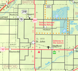 KDOT map of Stafford County (legend) | |
| Coordinates: 38°0′8″N 98°45′36″W / 38.00222°N 98.76000°WCoordinates: 38°0′8″N 98°45′36″W / 38.00222°N 98.76000°W[1] | |
| Country | United States |
| State | Kansas |
| County | Stafford |
| Government | |
| • Type | Mayor–Council |
| Area[2] | |
| • Total | 1.88 sq mi (4.87 km2) |
| • Land | 1.88 sq mi (4.87 km2) |
| • Water | 0 sq mi (0 km2) |
| Elevation[1] | 1,903 ft (580 m) |
| Population (2010)[3] | |
| • Total | 1,295 |
| • Estimate (2015)[4] | 1,225 |
| • Density | 690/sq mi (270/km2) |
| Time zone | Central (CST) (UTC-6) |
| • Summer (DST) | CDT (UTC-5) |
| ZIP code | 67576 |
| Area code | 620 |
| FIPS code | 20-62275 [1] |
| GNIS feature ID | 0473574 [1] |
| Website | StJohnKansas.com |
St. John is a city in and the county seat of Stafford County, Kansas, United States.[1] As of the 2010 census, the city population was 1,295.[5]
History
The first settlement in what is today St. John was made in 1875 when William Bickerton of the Church of Jesus Christ founded a religious colony named Zion Valley.[6] By 1879, Zion Valley had grown into a small town, and the residents renamed it St. John, after then governor John P. St. John, in order to gain favor in winning the county seat of Stafford County.[7]
In 2015, due to diligent work of local citizens and former local graduates, the official government listing of locations has been corrected to spell the town correctly as "St. John" instead of "Saint John" that was incorrectly changed by the United States Postal Service in the 1970s.[8]
Geography
St. John is located at 38°0′8″N 98°45′36″W / 38.00222°N 98.76000°W (38.0022371, -98.7600887).[1] According to the United States Census Bureau, the city has a total area of 1.88 square miles (4.87 km2), all of it land.[2]
Demographics
| Historical population | |||
|---|---|---|---|
| Census | Pop. | %± | |
| 1880 | 56 | — | |
| 1890 | 865 | 1,444.6% | |
| 1900 | 869 | 0.5% | |
| 1910 | 1,785 | 105.4% | |
| 1920 | 1,671 | −6.4% | |
| 1930 | 1,552 | −7.1% | |
| 1940 | 1,735 | 11.8% | |
| 1950 | 1,735 | 0.0% | |
| 1960 | 1,753 | 1.0% | |
| 1970 | 1,477 | −15.7% | |
| 1980 | 1,501 | 1.6% | |
| 1990 | 1,357 | −9.6% | |
| 2000 | 1,318 | −2.9% | |
| 2010 | 1,295 | −1.7% | |
| Est. 2015 | 1,225 | [4] | −5.4% |
| U.S. Decennial Census | |||
2010 census
As of the census[3] of 2010, there were 1,295 people, 534 households, and 336 families residing in the city. The population density was 688.8 inhabitants per square mile (265.9/km2). There were 642 housing units at an average density of 341.5 per square mile (131.9/km2). The racial makeup of the city was 92.4% White, 0.2% African American, 1.2% Native American, 0.8% Asian, 4.2% from other races, and 1.2% from two or more races. Hispanic or Latino of any race were 15.1% of the population.
There were 534 households of which 30.3% had children under the age of 18 living with them, 51.5% were married couples living together, 7.9% had a female householder with no husband present, 3.6% had a male householder with no wife present, and 37.1% were non-families. 34.8% of all households were made up of individuals and 18.2% had someone living alone who was 65 years of age or older. The average household size was 2.38 and the average family size was 3.09.
The median age in the city was 42.7 years. 25.9% of residents were under the age of 18; 7.4% were between the ages of 18 and 24; 20.5% were from 25 to 44; 26.2% were from 45 to 64; and 19.9% were 65 years of age or older. The gender makeup of the city was 49.4% male and 50.6% female.
2000 census
As of the census[9] of 2000, there were 1,318 people, 569 households, and 337 families residing in the city. The population density was 732.1 people per square mile (282.7/km²). There were 686 housing units at an average density of 381.1 per square mile (147.1/km²). The racial makeup of the city was 96.36% White, 0.38% African American, 0.23% Asian, 2.12% from other races, and 0.91% from two or more races. Hispanic or Latino of any race were 3.57% of the population.
There were 569 households out of which 28.5% had children under the age of 18 living with them, 50.8% were married couples living together, 5.6% had a female householder with no husband present, and 40.6% were non-families. 38.1% of all households were made up of individuals and 18.3% had someone living alone who was 65 years of age or older. The average household size was 2.26 and the average family size was 3.01.
In the city the population was spread out with 26.3% under the age of 18, 5.0% from 18 to 24, 25.9% from 25 to 44, 21.2% from 45 to 64, and 21.6% who were 65 years of age or older. The median age was 40 years. For every 100 females there were 88.3 males. For every 100 females age 18 and over, there were 85.1 males.
The median income for a household in the city was $31,050, and the median income for a family was $41,761. Males had a median income of $27,986 versus $23,152 for females. The per capita income for the city was $17,889. About 7.3% of families and 9.1% of the population were below the poverty line, including 8.7% of those under age 18 and 10.1% of those age 65 or over.
Education
St. John is home to St. John/Hudson High School. The mascot is a Tiger.
References
- 1 2 3 4 5 6 Geographic Names Information System (GNIS) details for St. John, Kansas; United States Geological Survey (USGS); October 13, 1978.
- 1 2 "US Gazetteer files 2010". United States Census Bureau. Retrieved 2012-07-06.
- 1 2 "American FactFinder". United States Census Bureau. Retrieved 2012-07-06.
- 1 2 "Annual Estimates of the Resident Population for Incorporated Places: April 1, 2010 to July 1, 2015". Retrieved July 2, 2016.
- ↑ "2010 City Population and Housing Occupancy Status". U.S. Census Bureau. Retrieved March 27, 2011.
- ↑ Kansas State Historical Society (1916). Biennial Report of the Board of Directors of the Kansas State Historical Society. Kansas State Printing Plant. p. 302.
- ↑ Entz, Gary (2002). "Zion Valley: The Mormon Origins of St. John, Kansas" in Kansas History. Topeka, KS: Kansas State Historical Society. pp. 98–117.
- ↑ "Saint" finally gone from St.John; The Wichita Eagle; July 30, 2015
- ↑ "American FactFinder". United States Census Bureau. Retrieved 2008-01-31.
Further reading
- City
- Cole, Clelland, and Helen Malin Reuber. No Cyclone Shall Destroy: The Story of St. John, Kansas. Ardmore, Pa: Dorrance & Co., 1981.
- Gary R. Entz, "Zion Valley: The Mormon Origins of St. John, Kansas," Kansas History 24 (summer 2001), 98-117. (Download 1MB PDF eBook)
- Gary R. Entz, "The Bickertonites: Schism and Reunion in a Restoration Church, 1880-1905", Journal of Mormon History 32 (fall 2006): 1-44. (Download 4MB PDF eBook)
- Kansas
- History of the State of Kansas; William G. Cutler; A.T. Andreas Publisher; 1883. (Online HTML eBook)
- Kansas : A Cyclopedia of State History, Embracing Events, Institutions, Industries, Counties, Cities, Towns, Prominent Persons, Etc; 3 Volumes; Frank W. Blackmar; Standard Publishing Co; 944 / 955 / 824 pages; 1912. (Volume1 - Download 54MB PDF eBook),(Volume2 - Download 53MB PDF eBook), (Volume3 - Download 33MB PDF eBook)
External links
| Wikimedia Commons has media related to St. John, Kansas. |
- City
- Schools
- USD 350, local school district
- Historical
- The Glass Photographic Negatives of William Gray on YouTube, from Hatteberg's People on KAKE TV news
- Pumpkin Farmer is the Mayor on YouTube, from Hatteberg's People on KAKE TV news
- Maps
- St. John City Map, KDOT
Municipalities and communities of Stafford County, Kansas, United States | ||
|---|---|---|
| Cities |  | |
| Unincorporated communities | ||