Salar de Atacama

Salar de Atacama is the largest salt flat in Chile.[1] It is located 55 km (34 mi) south of San Pedro de Atacama, is surrounded by mountains, and has no drainage outlets. In the east it is enclosed by the main chain of the Andes, while to the west lies a secondary mountain range of the Andes called Cordillera de Domeyko. Large volcanoes dominate the landscape, including the Licancabur, Acamarachi, Aguas Calientes and the Láscar. The last is one of the most active volcanoes in Chile. All of them are located along the eastern side of the Salar de Atacama, forming a generally north-south trending line of volcanoes that separate it from smaller endorheic basins.[2]
Features
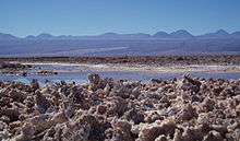
The salt flat encompasses 3,000 km2 (1,200 sq mi),[3][4] is about 100 km (62 mi) long[1] and 80 km (50 mi) wide, which makes it the third largest in the world, after Salar de Uyuni in Bolivia (10,582 km2 (4,086 sq mi)).[5] and Salinas Grandes in Argentina (6,000 km2 (2,300 sq mi)).[6] Its average elevation is about 2,300 m above sea level.[1] The topography of the core portion of the salar exhibits a high level of roughness, the result of evaporation and ephemeral surface water,[7] unlike the most other salt flats, as for example the Salar de Uyuni, which is periodically covered with shallow water.
Some areas of the salt flat form part of Los Flamencos National Reserve. The Laguna Cejar is a sink hole lake in the Salar de Atacama, 18 km from San Pedro, Chile. It has a salt concentration that ranges from 5 to 28% (50 to 280 parts per thousand), producing at the higher end of the range an effect of floating like the Dead Sea.[8]
Tectonic setting
At present the Salar de Atacama depression conforms a subsiding sedimentary basin. Comparing with neighboring areas of the Andes the Salar de Atacama depression is a major topographical anomaly. The Salar de Atacama depression is thought to be caused by a lithospheric block that due to its high density has remained at lower position than the rest of the Andes. The high density would derive from the times the Salar de Atacama depression was a westward rift arm of the Salta Rift Basin located further east in Argentine territory.[9]
Hydrology
Salar de Atacama basin is bordered on the north by the Salado River basin,[10] which is a sub-basin of the Loa River basin. To the east, the drainage divide approximately coincides with the international border with Bolivia until the Portezuelo del Cajón. The dividing range includes the volcanoes Cerros de Tocorpuri, Sairecabur, Curiquinca, Licancabur and Juriques.[10] Going southward, the water divide runs along a chain of volcanoes that lie entirely in Chilean territory. To the west, the Cordillera Domeyko separates the Salar de Atacama basin from arheic areas.
Its main tributaries are the San Pedro and Vilama rivers, which originate to the north of the salt flat.[10]
Lithium production
Salar de Atacama is the world's largest and purest active source of lithium,[11] containing 27% of the world's lithium reserve base,[12] and as of 2008 provided almost 30% of the world's lithium carbonate supply, followed by China with 23%.[11][12] High lithium concentration in its brine (2,700 parts per million), a high rate of evaporation (3,500 mm per year), and extremely low annual rainfall (<30 mm average per year) make Atacama's finished lithium carbonate easier and cheaper to produce than what could be produced in the neighboring Salar de Uyuni, which is estimated to have half of the lithium reserves in the world. Salar de Atacama's evaporation rate is the highest in the lithium industry, followed by Puna de Atacama, Argentina (2,600 mm per year), and the Salar de Uyuni (1,300–1,700 mm per year).[13]
Gallery
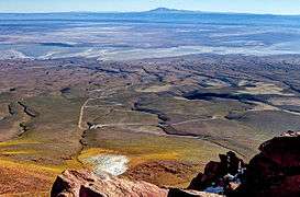 Photograph was taken from 4660 meters above sea level
 Laguna Cejar
 Andean flamingos
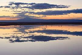 Sunset over Salar de Atacama
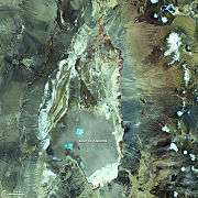 Nasa photograph
 Salar de Atacama, 2300 meters above sea level
References
- 1 2 3 "The Optical/Infrared Astronomical Quality of High Atacama Sites." (PDF). Retrieved 2007-04-24.
- ↑ Cade-Idepe, Consultores in Ingenieria. "Cuenca Salar de Atacama. Diagnostico y clasificacion de los cursos y cuerpos de agua segun objetivos de calidad." (PDF) (in Spanish). Gobierno de Chile, Ministerio de Obras Publicas. Retrieved 5 February 2013.
- ↑ Díaz del Río, Bonilla Parra & Peralta Toro 1972.
- ↑ Alonso & Risacher 1996, pp. 113–122.
- ↑ "Salar de Uyuni, Bolivia". NASA Earth Observatory. Retrieved 2007-12-01.
- ↑ Conrado Juan Rosacher (September 2002). "Áreas Naturales Protegidas. Salinas Grandes de Córdoba, Aspectos Ambientales" (PDF) (in Spanish). Argentina.
- ↑ Kampf et al. Adkins, pp. 236–252.
- ↑ Crespo, Julio E. (2002). "Artemia in Chile: Genetic Characterisation by mtDNA RFLP Analysis". Aristotle University of Thessaloniki. p. 6. Retrieved 4 February 2013. (Called Laguna Cejas in this document.)
- ↑ Reutter, Klaus-J.; Charrier, Reynaldo; Götze, Hans-J.; Schurr, Bernd; Wigger, Peter; Scheuber, Ekkehard; Giese, Peter; Reuther, Claus-Dieter; Schmidt, Sabine; Rietbrock, Andreas; Chong, Guillermo; Belmonte-Pool, Arturo (2006). "The Salar de Atacama Basin: a Subsiding Block within the Western Edge of the Altiplano-Puna Plateau". In Oncken, Onno; Chong, Guillermo; Franz, Gerhard; Giese, Peter; Götze, Hans-Jürgen; Ramos, Víctor A.; Strecker, Manfred R.; Wigger, Peter. The Andes: Active Subduction Orogeny (PDF). p. 303–325. ISBN 3-540-24329-1.
- 1 2 3 Niemeyer, Hans (1980). "Hoyas hidrográficas de Chile. Segunda Región" (in Spanish). Ministerio de Obras Públicas. Dirección General de Aguas. Retrieved 22 April 2012.
- 1 2 Fletcher 2011.
- 1 2 Brendan I. Koerner (November 24, 2008). "The Saudi Arabia of Lithium". Forbes. Retrieved 2011-05-12.
- ↑ Fletcher 2011, pp. 186–187.
Bibliography
- Gerardo Díaz del Río; Ramiro Bonilla Parra; Fernando Peralta Toro (1972). Geología de superficie, sub-superficie y geoquímica del Salar de Atacama (in Spanish). Chile: CORFO. Departamento de Recursos Hidráulicos.
- Seth Fletcher (2011). Bottled Lightning: Superbatteries, Electric Cars, and the New Lithium Economy. New York: Hill and Wang. ISBN 978-0-8090-3053-8.
- H. Alonso; F. Risacher (1996). "Geoquímica del Salar de Atacama, parte 1: origen de los componentes y balance salino". Revista Geológica de Chile (in Spanish). 23 (2).
- Stephanie Kampf; S. Tyler; C. Ortiz; J. F. Muñoz; P. Adkins (2005). "Evaporation and land surface energy budget at the Salar de Atacama, Northern Chile". Journal of Hydrology. 310 (1–4). doi:10.1016/j.jhydrol.2005.01.005.
External links
| Wikimedia Commons has media related to Salar de Atacama. |
Coordinates: 23°30′S 68°15′W / 23.500°S 68.250°W