Tocorpuri
| Cerros de Tocorpuri | |
|---|---|
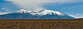 View from the south-west. | |
| Highest point | |
| Elevation | 5,808 m (19,055 ft) |
| Coordinates | 22°26′20″S 67°53′15″W / 22.43889°S 67.88750°WCoordinates: 22°26′20″S 67°53′15″W / 22.43889°S 67.88750°W |
| Geography | |
| Location | Bolivia-Chile |
| Parent range | Andes |
| Geology | |
| Mountain type | Stratovolcano |
| Last eruption | Unknown |
Cerros de Tocorpuri is a volcanic complex located along the border between Bolivia and Chile. Cerros de Tocorpuri's summit crater has a diameter of 1.4 km. On its west side lies a rhyolite lava dome called Cerro La Torta (Cake Hill), named so because of its cylindrical cake shape. Cerro La Torta has a volume of about 5 cu km and the height of this lava dome above the surrounding terrain is about 450 m. Its steep sides are covered with scree and its top surface is bumpy-ridged.
The complex is located at about 30 km. from the El Tatio geothermal field.
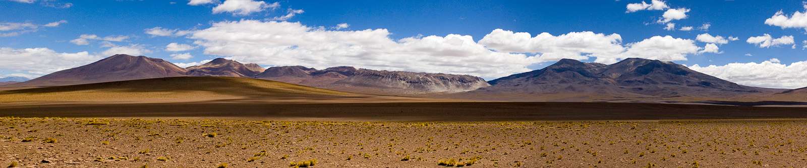
FLTR: Tatio Volcano, Cerros de Tatio, Cerro La Torta, Cerros de Tocorpuri. Camera location: 22°33′12″S 67°51′14″W / 22.55333°S 67.85389°W
See also
- Cerro Chascon-Runtu Jarita complex
- List of volcanoes in Bolivia
- List of volcanoes in Chile
- Putana Volcano
- Sairecabur
- Laguna Colorada
References
- González-Ferrán, Oscar (1995). Volcanes de Chile. Santiago, Chile: Instituto Geográfico Militar. p. 640 pp. ISBN 956-202-054-1.(Spanish)
External links
| Wikimedia Commons has media related to Tocorpuri. |
This article is issued from Wikipedia - version of the 11/27/2016. The text is available under the Creative Commons Attribution/Share Alike but additional terms may apply for the media files.