Salem, South Dakota
| Salem, South Dakota | |
|---|---|
| City | |
| Motto: "A City To Grow In......." | |
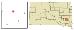 Location in McCook County and the state of South Dakota | |
| Coordinates: 43°43′34″N 97°23′12″W / 43.72611°N 97.38667°WCoordinates: 43°43′34″N 97°23′12″W / 43.72611°N 97.38667°W | |
| Country | United States |
| State | South Dakota |
| County | McCook |
| Incorporated | 1888[1] |
| Government | |
| • Mayor | Robin Rayman |
| Area[2] | |
| • Total | 1.24 sq mi (3.21 km2) |
| • Land | 1.24 sq mi (3.21 km2) |
| • Water | 0 sq mi (0 km2) |
| Elevation | 1,522 ft (464 m) |
| Population (2010)[3] | |
| • Total | 1,347 |
| • Estimate (2015)[4] | 1,325 |
| • Density | 1,086.3/sq mi (419.4/km2) |
| Time zone | Central (CST) (UTC-6) |
| • Summer (DST) | CDT (UTC-5) |
| ZIP code | 57058 |
| Area code(s) | 605 |
| FIPS code | 46-57340 |
| GNIS feature ID | 1257765[5] |
| Website | http://www.salemsd.com |
Salem is a city in and the county seat of McCook County, South Dakota, United States.[6] The population was 1,347 at the 2010 census. The current mayor is Kenneth Scott, a long-time resident.
History
Salem was founded in 1880 and named for the postmaster's hometown of Salem, Massachusetts.[7] Salem at one time was called Melas ('Melas' is Salem spelled backwards). This was to prevent confusion with the now non-existent community of Salena, South Dakota.[8]
Geography
Salem is located at 43°43′34″N 97°23′12″W / 43.72611°N 97.38667°W (43.725989, -97.386533).[9]
According to the United States Census Bureau, the city has a total area of 1.24 square miles (3.21 km2), all of it land.[2]
Salem has been assigned the ZIP code 57058 and the FIPS place code 57340.
Demographics
| Historical population | |||
|---|---|---|---|
| Census | Pop. | %± | |
| 1890 | 429 | — | |
| 1900 | 741 | 72.7% | |
| 1910 | 1,097 | 48.0% | |
| 1920 | 1,187 | 8.2% | |
| 1930 | 1,115 | −6.1% | |
| 1940 | 1,185 | 6.3% | |
| 1950 | 1,119 | −5.6% | |
| 1960 | 1,188 | 6.2% | |
| 1970 | 1,391 | 17.1% | |
| 1980 | 1,486 | 6.8% | |
| 1990 | 1,289 | −13.3% | |
| 2000 | 1,371 | 6.4% | |
| 2010 | 1,347 | −1.8% | |
| Est. 2015 | 1,325 | [10] | −1.6% |
| U.S. Decennial Census[11] 2015 Estimate[4] | |||
2010 census
As of the census[3] of 2010, there were 1,347 people, 567 households, and 362 families residing in the city. The population density was 1,086.3 inhabitants per square mile (419.4/km2). There were 667 housing units at an average density of 537.9 per square mile (207.7/km2). The racial makeup of the city was 98.8% White, 0.1% African American, 0.1% Native American, 0.6% from other races, and 0.4% from two or more races. Hispanic or Latino of any race were 1.9% of the population.
There were 567 households of which 29.1% had children under the age of 18 living with them, 53.3% were married couples living together, 7.2% had a female householder with no husband present, 3.4% had a male householder with no wife present, and 36.2% were non-families. 33.2% of all households were made up of individuals and 18.2% had someone living alone who was 65 years of age or older. The average household size was 2.27 and the average family size was 2.90.
The median age in the city was 44.3 years. 24.4% of residents were under the age of 18; 4% were between the ages of 18 and 24; 22.4% were from 25 to 44; 23.8% were from 45 to 64; and 25.4% were 65 years of age or older. The gender makeup of the city was 48.6% male and 51.4% female.
2000 census
|
|
As of the census of 2000, there were 1,371 people, 588 households, and 372 families residing in the city. The population density was 1,346.3 people per square mile (519.0/km²). There were 640 housing units at an average density of 628.5 per square mile (242.3/km²). The racial makeup of the city was 98.69% White, 0.07% African American, 0.44% Native American, 0.29% Asian, and 0.51% from two or more races. Hispanic or Latino of any race were 0.51% of the population.
Of the 588 households, 28.9% had children under the age of 18 living with them, 54.8% were married couples living together, 6.3% had a female householder with no husband present, and 36.7% were non-families. 34.2% of all households were made up of individuals and 21.6% consisted of a lone resident 65 years of age or older. The average household size was 2.23 and the average family size was 2.85.
In the city the population was spread out with 22.5% under the age of 18, 6.6% from 18 to 24, 23.6% from 25 to 44, 21.6% from 45 to 64, and 25.7% who were 65 years of age or older. The median age was 43 years. For every 100 females there were 92.3 males. For every 100 females age 18 and over, there were 88.1 males.
As of 2000 the median income for a household in the city was $34,500, and the median income for a family was $44,167. Males had a median income of $29,350 versus $20,227 for females. The per capita income for the city was $19,596. 3.4% of the population and 1.9% of families were below the poverty line. 2.9% of those under the age of 18 and 4.4% of those 65 and older were living below the poverty line.
References
- ↑ "SD Towns" (PDF). South Dakota State Historical Society. Retrieved 2010-02-15.
- 1 2 "US Gazetteer files 2010". United States Census Bureau. Retrieved 2012-06-21.
- 1 2 "American FactFinder". United States Census Bureau. Retrieved 2012-06-21.
- 1 2 "Population Estimates". United States Census Bureau. Retrieved June 7, 2016.
- ↑ "US Board on Geographic Names". United States Geological Survey. 2007-10-25. Retrieved 2008-01-31.
- ↑ "Find a County". National Association of Counties. Retrieved 2011-06-07.
- ↑ Hellmann, Paul T. (May 13, 2013). Historical Gazetteer of the United States. Routledge. p. 997. Retrieved 30 November 2013.
- ↑ "Salem Community Profile". Retrieved 2008-11-05.
- ↑ "US Gazetteer files: 2010, 2000, and 1990". United States Census Bureau. 2011-02-12. Retrieved 2011-04-23.
- ↑ "Annual Estimates of the Resident Population for Incorporated Places: April 1, 2010 to July 1, 2015". Retrieved July 2, 2016.
- ↑ United States Census Bureau. "Census of Population and Housing". Retrieved September 23, 2013.
- ↑ "1500' TV Tower". Prairie Aerial. November 10, 2014. Retrieved April 17, 2015.
Municipalities and communities of McCook County, South Dakota, United States | ||
|---|---|---|
| Cities | 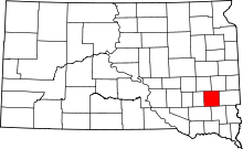 | |
| Unincorporated community | ||