San Fernando, Romblon
| San Fernando | ||
|---|---|---|
| Municipality | ||
| ||
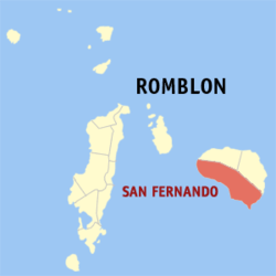 Map of Romblon with San Fernando highlighted | ||
.svg.png) San Fernando Location within the Philippines | ||
| Coordinates: 12°19′N 122°36′E / 12.317°N 122.600°ECoordinates: 12°19′N 122°36′E / 12.317°N 122.600°E | ||
| Country | Philippines | |
| Region | MIMAROPA (Region IV-B) | |
| Province | Romblon | |
| District | Lone district | |
| Founded | 1636 | |
| Reestablished | January 1, 1947 | |
| Barangays | 12 | |
| Government[1] | ||
| • Type | Mayor-council | |
| • Mayor | Salem R. Tansingco (NP)[2] | |
| • Vice Mayor | Arben Rosas (NP)[3] | |
| • Councilors[4] |
Rene Baranda Rodelio Relox Romel Repil Domingo Marin Bubot Renion Adeterio Mostaza Valentin Lotec III Samuel Roda | |
| Area[5] | ||
| • Total | 196.87 km2 (76.01 sq mi) | |
| Highest elevation | 2,058 m (6,752 ft) | |
| Population (2015)[6] | ||
| • Total | 23,271 | |
| • Density | 120/km2 (310/sq mi) | |
| Time zone | PST (UTC+8) | |
| Zip Code | 5513 | |
| Dialing code | 42 | |

San Fernando is a fourth class municipality in the province of Romblon, Philippines.
History
Early history
The town of San Fernando was established in 1636 as Visita de Cauit in what is today Barangay Azagra. It is one of two visitas in Sibuyan Island, the other being Cajidiocan. In 1744, Cajiodiocan was turned into a pueblo (town) which included Visita de Cauit.[7][8]
The first villages or barrios of Visita de Cauit were Pag-alad, Cangumba, Mabolo or San Roque, Canjalon, España or Canago, Agtiwa, Cangumon and Otod. After Romblon was made a separate district in 1853, and the local government reorganization of 1855, 17 new pueblos were created including Visita de Cauit. On 3 February 1868, Pueblo de Cauit was renamed Pueblo de Azagra. One of Azagra's villages, Visita de Pag-alad was renamed Visita de San Fernando in 1882, in honor of Ferdinand Magellan.[7][8]
Modern era
When civilian government was introduced to the province by the Americans on 16 March 1901, Azagra was one of 11 new municipalities created. However, by the end of the year, the seat of the municipality was transferred from Azagra to San Fernando village, thereby, changing the town's name.[7][8]
On 8 June 1940, the passage of Commonwealth Act No. 581, sponsored by Congressman Leonardo Festin, created the special municipality of Sibuyan. It abolished San Fernando and was annexed to the new town whose seat of government was in Cajidiocan. On 26 May 1946, the special municipality of Sibuyan was abolished by Republic Act No. 38, authored by Congressman Modesto Formelleza and enacted on 1 January 1947. It effectively restored San Fernando into its former status as an independent municipality.[7][8]
In 1958, San Fernando High School, the town's highest institution of learning was converted into a national school for arts and trades known as Romblon National Vocation School under Republic Act No. 2428.[7][8]
MV Princess of the Stars sinking
On 21 June 2008, MV Princess of the Stars, the flagship inter-island ferry of Sulpicio Lines sank in the waters of San Fernando after during the onslaught of Typhoon Fengshen (locally known as Typhoon Frank).[9] Of the ship's 862 passengers and crew, only 48 survived while 67 were confirmed dead and 747 remain missing. A massive search-and-rescue, and then recovery and salvage operation, took place in the waters of San Fernando to remove remaining dead bodies and potentially dangerous cargo from the sunken ship. The wreck of the MV Princess of the Star still remains in the town's coastal waters.[10][11]
Geography
San Fernando is a coastal town which lies on the south-western portion of the Sibuyan Island and is the biggest among the three towns comprising the island, the other two being Magdiwang and Cajidiocan. It has a total land area of 190,608.231 km2. making it the largest municipality in the province, surpassing Odiongan by more than 11 km2. I The municipality has an irregular coastline broken by beautiful, long stretches of sandy beaches.
The municipality has high and steep mountain ranges as it is located at the foot of Romblon's tallest peak, Mount Guiting-Guiting. Other mountains are Mount Sibuyan and Mount Conico. Much of its territory is part of Mount Guiting-Guiting Natural Park made up of lush tropical rainforest where unique flora and fauna thrive, giving Sibuyan the nickname, "The Galapagos of the Philippines".
Barangays
San Fernando is politically subdivided into 12 barangays.
| Population census of San Fernando | ||
|---|---|---|
| Year | Pop. | ±% p.a. |
| 1960 | 10,659 | — |
| 1970 | 13,448 | +2.35% |
| 1980 | 14,778 | +0.95% |
| 1990 | 17,768 | +1.86% |
| 1995 | 18,551 | +0.81% |
| 2000 | 21,214 | +2.92% |
| 2007 | 22,325 | +0.71% |
| 2010 | 22,466 | +0.23% |
| 2015 | 23,271 | +0.67% |
| Source: National Statistics Office[6] | ||
- Agtiwa
- Azagra
- Campalingo
- Canjalon
- España
- Mabini
- Mabulo
- Otod
- Panangcalan
- Pili
- Poblacion
- Taclobo
Demographics
According to the 2015 census, San Fernando has a population of 23,271 people.[6] The variant Romblomanon language locally called Sibuyanon dialect (Sibuyanon Magdiwang-España Style) is the native language in 4 eastern barangays of the municipality, while the rest speaks Sibuyanon (Sibujanon Azagra-San Fernando Style).
Local government
Pursuant to Chapter II, Title II, Book III of Republic Act 7160 or the Local Government Code of 1991,[12] the municipal government is composed of a mayor (alkalde), a vice-mayor (bise alkalde) and members (kagawad) of the legislative branch Sangguniang Bayan alongside a secretary to the said legislature, all of which are elected to a three-year term and are eligible to run for three consecutive terms.
| Period | Mayor | Vice mayor |
|---|---|---|
| 30 June 2010 - 30 June 2013 | Dindo Rios (NPC)(UNA) | Jesusima Castro (NPC)(LP)(UNA) |
The incumbent mayor of San Fernando, Romblon, is Salem R. Tansingco and the incumbent vice mayor is Arben Rosas.[15]
Economy
The municipality has various establishments including general merchandise stores, construction and welding shops, furniture outlets, funeral homes, rice mills, bakeshops, catering services, and cable TV stations. Fishing and Agriculture provides the main source of livelihood for the residents in San Fernando. The Sibuyan Sea and Cresta de Gallo serve as a fishing grounds due to its abundant marine animals like mackerel, sea quartz, tuna, dilis, tanguigue, lapu-lapu, and tropical fish to name a few.The Agriculture sector of San Fernando is Mainly Rice and Corn Planting.
Infrastructure
Education
The San Fernando branch of Romblon State University offers a number of tertiary education courses for the local residents as well as students coming from all over the island.
Utilities
National Power Corporation operates a 650-kW plant and 1,025-kW substation in San Fernando. ROMELCO, the local electric cooperative, also implements power in 39.93 percent of households. For its water supply, the town uses the Cantingas irrigation system, which services some 384 hectares of farmland. Some households depend on individual potable distribution which comes from jet pumps, deep wells, and springs.[7]
Transportation and communication
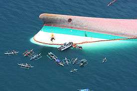
Shipping access to San Fernando is through the Port of Azagra. The ship MV Princess Annabelle docks at its pier twice a week from Port of Batangas. From Azagra jeepneys and tricycles are always available to carry passengers to town center or to the other places on the island when a ship is scheduled to arrive.
Liberty Phones, PLDT, and RCPI offers telecommunication services in San Fernando. Cellular phone services from Smart and Globe are now available as well. Terrestrial and cable television services have become available too. The Sibuyan Circumferential Road is the main thoroughfare that traverses the coastline of San Fernando. This road connects San Fernando with the other Sibuyan Island towns of Cajidiocan and Magdiwang. Means of transportation include jeepneys, light vehicles, truck, motorcycles, and tricycles.[7]
Tourism
Because of its untouched mountainous landscape, several rivers and freshwater lakes can be found in San Fernando.[7][8] These include:
- Cresta de Gallo: A five-hectare kidney-shaped islet with verdant terrain sloping down to the powdery white sand beach and surrounded by beautiful corral reefs. The beach is rich with different species of marine life and an ideal place for swimming and scuba diving.
- Busay Falls: A scenic spot with a natural pool located some 2.5 kilometers from Poblacion at Barangay Panangcalan. The upper portion is the water reservoir serving the Poblacion.
- Cantingas River: The pride of Barangay Taclobo is a natural swimming pool with a crystal water. The river is odorless, tasteless, and ever-flowing cold where one could quench his thirst while swimming. It has a cottage with a conference hall.
- Lamao Lake: A seven-hectare natural lake in Barangay Azagra.
- Lagting Falls: This scenic hideaway with a basin-like natural pool is located in Barangay Taclobo, some 3 kilometers away from Poblacion. This falls is a refreshing place to immerse during this hot summer. It has two natural swimming pools with clean water and has several cottages available around the area
- Dagubdob Falls: A falls in Sitio Olango in Barangay Espana that is near in the mountain.
References
- ↑ "Municipalities". Quezon City, Philippines: Department of the Interior and Local Government. Retrieved 31 January 2013.
- ↑ http://www.gmanetwork.com/news/eleksyon2016/results/local/REGION+IV-B/ROMBLON/SAN+FERNANDO?tfb_a
- ↑ http://www.gmanetwork.com/news/eleksyon2016/results/local/REGION+IV-B/ROMBLON/SAN+FERNANDO?tfb_a
- ↑ http://ph.rappler.com/local/region/Mimaropa/Romblon/San-Fernando
- ↑ "Province: Romblon". PSGC Interactive. Makati City, Philippines: National Statistical Coordination Board. Retrieved 31 January 2013.
- 1 2 3 "Total Population by Province, City, Municipality and Barangay: as of May 1, 2010" (PDF). 2010 Census of Population and Housing. National Statistics Office. Retrieved 31 January 2013.
- 1 2 3 4 5 6 7 8 Fabula, Milex (2001). "Profile: San Fernando, Romblon". Romblon Travel Guide. Retrieved 13 August 2014.
- 1 2 3 4 5 6 "San Fernando, Romblon". The Official Website of the Provincial Government of Romblon. Retrieved 13 August 2014.
- ↑ "Hundreds missing as ship capsizes". BBC News. 22 June 2008. Retrieved 22 June 2008.
- ↑ "700 people aboard drifting ferry in Philippines". Radio Australia. 22 June 2008. Archived from the original on 18 December 2012.
- ↑ Ortiz, Margaux; Salaverria, Leila (24 June 2008). "Ill-starred ship pride of Sulpicio". Philippine Daily Inquirer. Retrieved 18 December 2012.
- ↑ "An Act Providing for a Local Government Code of 1991". 8th Congress of the Republic of the Philippines. Retrieved 21 April 2014.
- ↑ http://election-results.rappler.com/2013/region-4b/romblon/san-fernando
- ↑ http://www.gmanetwork.com/news/eleksyon2016/results/local/REGION+IV-B/ROMBLON/SAN+FERNANDO?tfb_a
- ↑ http://ph.rappler.com/local/region/Mimaropa/Romblon/San-Fernando
External links
- Philippine Standard Geographic Code
- Philippine Census Information
- Local Governance Performance Management System
 |
Magdiwang / Cajidiocan | | ||
| Sibuyan Sea | |
Sibuyan Sea | ||
| ||||
| | ||||
| Sibuyan Sea |