Sandy Hook, Virginia
| Sandy Hook, Virginia | |
|---|---|
| Unincorporated community | |
 Sandy Hook, Virginia  Sandy Hook, Virginia | |
| Coordinates: 37°45′10″N 77°54′45″W / 37.75278°N 77.91250°WCoordinates: 37°45′10″N 77°54′45″W / 37.75278°N 77.91250°W | |
| Country | United States |
| State | Virginia |
| County | Goochland |
| Elevation | 358 ft (109 m) |
| Time zone | Eastern (EST) (UTC-5) |
| • Summer (DST) | EDT (UTC-4) |
| ZIP code | 23153 |
| Area code(s) | 804 |
| GNIS feature ID | 1500025[1] |
Sandy Hook is an unincorporated community in Goochland County, Virginia, United States. Sandy Hook is located on U.S. Route 522 5 miles (8.0 km) north-northwest of Goochland. Sandy Hook has a post office with ZIP code 23153.[2]
One version of the etymological history of the name "Sandy Hook" has it that at a prominent local bend on Route 522 (opposite what is now "Wood's Store", and probably before the road was surfaced), heavy rain would leave a silty, sandy residue on the road. At these times, the local population would refer to this bend as "the sandy hook" in giving directions.
Sandy Hook is one of the seven original villages in Goochland County.
References
Municipalities and communities of Goochland County, Virginia, United States | ||
|---|---|---|
| CDP | 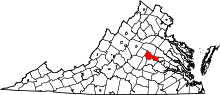 | |
| Unincorporated communities | ||
This article is issued from Wikipedia - version of the 7/27/2016. The text is available under the Creative Commons Attribution/Share Alike but additional terms may apply for the media files.