Sento Sé
| Sento Sé Município de Sento Sé | |||
|---|---|---|---|
| Municipality | |||
| |||
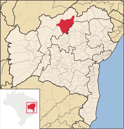 Location of Sento Sé in Bahia | |||
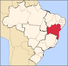
 Sento Sé Location of Sento Sé in Brazil | |||
| Coordinates: 09°44′45″S 41°53′06″W / 9.74583°S 41.88500°WCoordinates: 09°44′45″S 41°53′06″W / 9.74583°S 41.88500°W | |||
| Country |
| ||
| Region | Northeast | ||
| State |
| ||
| Founded | 1832 | ||
| Government | |||
| • Mayor | Ednaldo dos Santos Barros (PSDB, 2013-2016) | ||
| Area | |||
| • Total | 12,698.76 km2 (4,903.02 sq mi) | ||
| Population (2014) | |||
| • Total | 41,102 | ||
| • Density | 3.2/km2 (8.4/sq mi) | ||
| Demonym(s) | Sentoseense | ||
| Time zone | BRT (UTC-3) | ||
| Website |
www | ||


Sento Sé is a municipality in the state of Bahia in the North-East region of Brazil. It covers 12,698.76 km2 (4,903.02 sq mi), and has a population of 41,102 with a population density of 1.28 inhabitants per square kilometer. Sento Sé is located 689 kilometres (428 mi) from the state capital of Salvador.[1][2]
Sento Sé has a peculiar history. It is among the five cities that had to be flooded because of construction of the Sobradinho Dam. The new Sento Sé erected in 1976, was being gradually populated by residents of the former headquarters, which plunged into the waters.
See also
References
- ↑ "Dados Básicos" (in Portuguese). Sento Sé, Bahia, Brazil: Prefeitura Municipal de Sento Sé. 2015. Retrieved 2015-08-22.
- ↑ "Sento Sé" (in Portuguese). Brasília, Brazil: Instituto Brasileiro de Geografia e Estatística. 2015. Retrieved 2015-06-14.
This article is issued from Wikipedia - version of the 5/14/2016. The text is available under the Creative Commons Attribution/Share Alike but additional terms may apply for the media files.