Shaniko, Oregon
| Shaniko, Oregon | |
|---|---|
| City | |
|
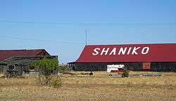
City name written on barn in Shaniko | |
| Nickname(s): Oregon's Best Known Ghost Town | |
 Location in Oregon | |
| Coordinates: 45°0′11″N 120°45′11″W / 45.00306°N 120.75306°WCoordinates: 45°0′11″N 120°45′11″W / 45.00306°N 120.75306°W | |
| Country | United States |
| State | Oregon |
| County | Wasco |
| Incorporated | 1901 |
| Government | |
| • Mayor | Goldie Roberts[1] |
| Area[2] | |
| • Total | 0.50 sq mi (1.29 km2) |
| • Land | 0.50 sq mi (1.29 km2) |
| • Water | 0 sq mi (0 km2) |
| Elevation | 3,343 ft (1,019 m) |
| Population (2010)[3] | |
| • Total | 36 |
| • Estimate (2012) | 37[4] |
| • Density | 72.0/sq mi (27.8/km2) |
| Time zone | Pacific (UTC-8) |
| • Summer (DST) | Pacific (UTC-7) |
| ZIP code | 97057 |
| Area code(s) | 541 |
| FIPS code | 41-66700[3] |
| GNIS feature ID | 1126791[5] |
| Website | http://www.shaniko.com |
Shaniko (/ˈʃæn.ɨ.koʊ/, SHAN-i-koh) is a city located in Wasco County, Oregon, United States, on U.S. Route 97 and about 8 miles (13 km) north of Antelope. The population was 36 at the 2010 census.
Geography
Shaniko is in Wasco County, in north-central Oregon, at the intersection of U.S. Route 97 and Oregon Route 218.[6] The city is 69 miles (111 km) north of Redmond and 131 miles (211 km) east of Portland.[7] According to the United States Census Bureau, the city has a total area of 0.50 square miles (1.29 km2), all of it land.[2]
The city is at an elevation of 3,343 feet (1,019 m).[5] On the high plateau on which Shaniko was built, the soil is thin and the vegetation sparse, consisting mainly of sagebrush, bunchgrass, and occasional junipers.[8] Many peaks of the Cascade Range, including Hood, Jefferson, Adams, St. Helens and Rainier, are visible from the city.[9]
History
The first European Americans came to the Shaniko area after the discovery of gold in Canyon City, Oregon, in 1862.[10] The route to Canyon City started at the early settlement of The Dalles, 190 miles (310 km) away.[10] Camps were made wherever water could be found.[10] One camp, which became the farming community of Bakeoven, was closely associated with the future town of Shaniko, while another camp, Cross Hollow, was within the present Shaniko city limits.[10] In 1867, following complaints of hostile Indians and fear of robbery of those transporting gold, the State of Oregon received a grant from the United States government to build a military wagon road from The Dalles to Fort Boise, Idaho.[10] Following this road, homesteaders began claiming land in Central Oregon that had been fairly inaccessible.[10]
One of these settlers was August Scherneckau, who came to the area after the Civil War,[11] in 1874.[10] The spelling of the town's name reflects local pronunciation of Scherneckau's name.[11] The town was originally called Cross Hollows, and a post office by that name was established in May 1879 with Scherneckau as postmaster.[11] Cross Hollows post office closed in 1887, and Shaniko post office opened in 1900.[11]
The town's heyday was the first decade of the 20th century, when Shaniko served as a transportation hub spurred by the presence of the Columbia Southern Railway, a subsidiary of Union Pacific Railroad, which built a branch from Biggs Junction to a terminus in Shaniko.[10] That branch was completed in May 1900.[10] At the time, the city was known as the "Wool Capital of the World", and it was the center of 20,000 square miles (52,000 km2) of wool, wheat, cattle and sheep production, with no other such center east of the Cascade Range in Oregon.[10] The region served by the city even stretched into Idaho, south to Klamath Falls, Oregon, and beyond, because of rail connections to the main line.[10]
The residents of Shaniko voted to incorporate Shaniko and elected a mayor, F. T. Hurlbert, and other city officials on January 1, 1902. It was Wasco County's fifth largest city, boasting the largest wool warehouse in the state, from which 4 million pounds (1.8 kt) (2,000 tons) were marketed in 1901. It was surrounded by cattle ranches, which produced livestock for shipment that filled 400 railroad cars that year.[9]
By 1911, the Oregon–Washington Railroad and Navigation Company, another Union Pacific subsidiary, began using an alternate route linking Portland to Bend by way of the Deschutes River canyon. The new line, advertised as the "direct, quick and natural route",[12] diverted traffic from the Columbia Southern, and Shaniko begin to decline. Passenger service to Shaniko ended in the early 1930s, and the entire line was shut down by 1966.[12] By 1982 Shaniko was nearly a ghost town.[10]
Demographics
| Historical population | |||
|---|---|---|---|
| Census | Pop. | %± | |
| 1900 | 72 | — | |
| 1910 | 495 | 587.5% | |
| 1920 | 124 | −74.9% | |
| 1930 | 100 | −19.4% | |
| 1940 | 55 | −45.0% | |
| 1950 | 61 | 10.9% | |
| 1960 | 39 | −36.1% | |
| 1970 | 58 | 48.7% | |
| 1980 | 30 | −48.3% | |
| 1990 | 26 | −13.3% | |
| 2000 | 26 | 0.0% | |
| 2010 | 36 | 38.5% | |
| Est. 2015 | 37 | [13] | 2.8% |
| source:[3][14] | |||
As of the census of 2010, there were 36 people, 17 households, and 11 families residing in the city. The population density was 72 inhabitants per square mile (27.8/km2). There were 24 housing units at an average density of 48 per square mile (18.5/km2). The racial makeup of the city was 75% White, 8.3% Asian, and 16.7% from two or more races. Hispanic or Latino of any race were 8.3% of the population.[3]
There were 17 households of which about 18% had children under the age of 18 living with them, about 53% were married couples living together, about 6% had a female householder with no husband present, about 6% had a male householder with no wife present, and about 35% were non-families. About 29% of all households were made up of individuals and about 18% had someone living alone who was 65 years of age or older. The average household size was 2.12 and the average family size was 2.55.[3]
The median age in the city was about 55 years. About 17% of residents were under the age of 18; about 3% were between the ages of 18 and 24; 19.5% were from 25 to 44; about 28% were from 45 to 64; and about 33% were 65 years of age or older. The gender makeup of the city was about 58% male and 42% female.[3]
Points of interest
Historic buildings
Shaniko and environs contain an individual historic building and two historic districts listed on the National Register of Historic Places (NRHP):
- Columbia Southern Hotel[15]
- Imperial Stock Ranch Headquarters Complex[16]
- Shaniko Historic District, including the Columbia Southern Hotel, the city hall and jailhouse, a schoolhouse, and 42 other properties, some of which have been renovated. The NRHP nomination form for the district provides historical details, references, images, and descriptions.[8]
References
- ↑ "Incorporated Cities: Shaniko". Oregon Blue Book. Oregon Secretary of State. 2013. Retrieved August 13, 2013.
- 1 2 "U.S. Gazetteer: 2010, 2000, and 1990". United States Census Bureau. Retrieved August 13, 2013.
- 1 2 3 4 5 6 "American FactFinder". U.S. Census Bureau. Retrieved August 8, 2013.
- ↑ "Population Estimates". United States Census Bureau. Retrieved June 2, 2013.
- 1 2 "Shaniko". Geographic Names Information System. United States Geological Survey. November 28, 1989. Retrieved August 11, 2013.
- ↑ Oregon Atlas & Gazetteer (7th ed.). Yarmouth, Maine: DeLorme. 2008. p. 76. ISBN 978-0-89933-347-2.
- ↑ "Shaniko Community Profile". Infrastructure Finance Authority. 2009. Retrieved August 8, 2013.
- 1 2 Almquist, Leonard (February 28, 1980), National Register of Historic Places Inventory — Nomination Form: Shaniko Historic District (PDF), retrieved August 13, 2013.
- 1 2 Shaver, F. A.; Arthur P. Rose; R. F. Steele; A. E. Adams (1905). An Illustrated History of Central Oregon Embracing Wasco, Sherman, Gilliam, Wheeler, Crook, Lake and Klamath Counties. Spokane, Washington: Western Publishing Co. pp. 169–71. OCLC 5436491.
- 1 2 3 4 5 6 7 8 9 10 11 12 Rees, Helen Guyton (1982). Shaniko: From Wool Capital to Ghost Town. Portland, Oregon: Binford & Mort. ISBN 0-8323-0398-4.
- 1 2 3 4 McArthur, Lewis A.; Lewis L. McArthur (2003) [1928]. Oregon Geographic Names (7th ed.). Portland, Oregon: Oregon Historical Society Press. ISBN 0-87595-277-1.
- 1 2 Culp, Edwin D. (1978). Stations West, The Story of the Oregon Railways. Bonanza Books. pp. 100–01, 125. OCLC 4751643.
- ↑ "Annual Estimates of the Resident Population for Incorporated Places: April 1, 2010 to July 1, 2015". Retrieved July 2, 2016.
- ↑ Moffatt, Riley Moore (1996). Population History of Western U.S. Cities and Towns, 1850–1990. Lanham, Maryland: Scarecrow Press. p. 215. ISBN 978-0-8108-3033-2.
- ↑ Luckman, Katharina L. (January 1979). "National Register of Historic Places Inventory Nomination Form: Columbia Southern Hotel" (PDF). National Park Service. Retrieved August 13, 2013.
- ↑ Carver, Jeanne (November 22, 1993). "National Register of Historic Places Registration Form: Imperial Stock Ranch Headquarters Complex" (PDF). National Park Service. Retrieved August 13, 2013.
External links
 Media related to Shaniko Historic District (category) at Wikimedia Commons
- Official site
- Entry for Shaniko from the Oregon Blue Book, including a link to a local road map (in PDF format) from ODOT
- Historic photos of Shaniko from the Salem Public Library
- Bend Bulletin story on Pamplin and Shaniko
- "KATU Portland OR newscast about Pamplin, and Shaniko water rights dispute.
- Official site of The Last Days of Shaniko
Municipalities and communities of Wasco County, Oregon, United States | ||
|---|---|---|
| Cities | 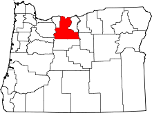 | |
| CDPs | ||
| Unincorporated communities | ||
| Indian reservation | ||
| Ghost towns | ||