Shire of Buln Buln
| Shire of Buln Buln Victoria | |||||||||||||
|---|---|---|---|---|---|---|---|---|---|---|---|---|---|
 Location in Victoria | |||||||||||||
| Population | 11,960 (1992)[1] | ||||||||||||
| • Density | 9.500/km2 (24.604/sq mi) | ||||||||||||
| Established | 1878 | ||||||||||||
| Area | 1,259 km2 (486.1 sq mi) | ||||||||||||
| Council seat | Drouin | ||||||||||||
| County | Buln Buln, Mornington | ||||||||||||
| |||||||||||||
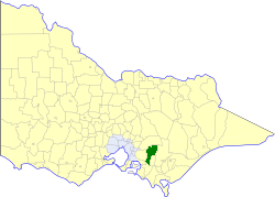
The Shire of Buln Buln was a local government area about 95 kilometres (59 mi) east-southeast of Melbourne, the state capital of Victoria, Australia. The shire covered an area of 1,259 square kilometres (486.1 sq mi), and existed from 1878 until 1994.
History
Buln Buln was first incorporated as a shire on 20 September 1878. Its eastern part split away on 9 December 1881, to form the Shire of Warragul (Warragul was proclaimed a Rural City in 1990), while its southern part split away on 29 May 1891, to form the Shire of Korumburra. Parts in its southwest, around the town of Lang Lang, were annexed to the Shire of Cranbourne on 21 March 1892 and 27 January 1893.[2]
A comprehensive history of the shire, Buln Buln, was written by Graeme Butler in 1979.[3]
On 2 December 1994, the Shire of Buln Buln was abolished, and, along with the Rural City of Warragul, the Shire of Narracan, and parts of the Shire of Upper Yarra, was merged into the newly created Shire of Baw Baw.[4]
Wards
The Shire of Buln Buln was divided into four ridings on 30 April 1958, each of which elected three councillors:
- Neerim Riding
- North Drouin Riding
- South Drouin Riding
- Longwarry Riding
Towns and localities
- Drouin
- Drouin South
- Drouin West
- Hallora
- Icy Creek
- Jindivick
- Labertouche
- Lardner
- Longwarry
- Mountain View
- Nayook
- Neerim South
- Noojee
- Poowong East
- Ripplebrook
- Tarago
Population
| Year | Population |
|---|---|
| 1954 | 8,015 |
| 1958 | 8,400* |
| 1961 | 8,427 |
| 1966 | 8,668 |
| 1971 | 8,414 |
| 1976 | 8,361 |
| 1981 | 9,062 |
| 1986 | 10,210 |
| 1991 | 11,137 |
* Estimate in the 1958 Victorian Year Book.
References
- ↑ Australian Bureau of Statistics, Victoria Office (1994). Victorian Year Book. pp. 49–52. ISSN 0067-1223.
- ↑ Victorian Municipal Directory. Brunswick: Arnall & Jackson. 1992. pp. 616–618. Accessed at State Library of Victoria, La Trobe Reading Room.
- ↑
- Butler, Graeme; Buln Buln (Vic. : Shire). Council (1979), Buln Buln : a history of the Buln Buln Shire, Shire of Buln Buln, ISBN 978-0-9595231-0-2
- ↑ Australian Bureau of Statistics (1 August 1995). Victorian local government amalgamations 1994-1995: Changes to the Australian Standard Geographical Classification (PDF). Commonwealth of Australia. p. 4. ISBN 0-642-23117-6. Retrieved 2008-01-05.
Coordinates: 38°08′S 145°51′E / 38.133°S 145.850°E