City of Warrnambool
| City of Warrnambool Victoria | |||||||||||||
|---|---|---|---|---|---|---|---|---|---|---|---|---|---|
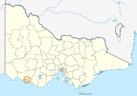 Location in Victoria | |||||||||||||
| Population | 33,644 (2015 est)[1] | ||||||||||||
| • Density | 278.74/km2 (721.94/sq mi) | ||||||||||||
| Established | 1855 | ||||||||||||
| Gazetted | 23 September 1994[2] | ||||||||||||
| Area | 120.7 km2 (46.6 sq mi) | ||||||||||||
| Mayor | Kylie Gaston | ||||||||||||
| Council seat | Warrnambool | ||||||||||||
| Region | Barwon South West | ||||||||||||
| State electorate(s) | South-West Coast | ||||||||||||
| Federal Division(s) | Wannon | ||||||||||||
|
| |||||||||||||
| Website | City of Warrnambool | ||||||||||||
| |||||||||||||
The City of Warrnambool is a local government area in the Barwon South West region of Victoria, Australia, located in the south-western part of the state. It covers an area of 120.7 square kilometres (46.6 sq mi) and, at the 2011 census, had a population of 32,029.[3] It is entirely surrounded by the Shire of Moyne and the Southern Ocean. It is one of only a few regional councils in Victoria to remain serving just one urban district after the amalgamation process of 1994, although through that process it did gained some portions of the former Shire of Warrnambool.[2]
The City is governed and administered by the Warrnambool City Council; its seat of local government and administrative centre is located at the council headquarters in the central district of Warrnambool. The City is named after the main urban settlement located in the centre of the LGA, that is Warrnambool, which is also the LGA's most populous urban centre with a population of 28,413.[4]
History
Warrnambool was first incorporated as a municipality on 7 December 1855. It became a borough on 1 October 1863, and a town on 2 February 1883. It was proclaimed as a city on 8 April 1918. On 25 October 1955 and 1 October 1978, it annexed part of the south riding of the Shire of Warrnambool, expanding its area progressively to 34.43 square kilometres (13.29 sq mi) by the time of Victoria's local government amalgamations.[5]
In 1993, the new Kennett Liberal government announced a program of local government reform, in which many of Victoria's 210 councils were to be amalgamated. The southwest region containing 23 councils was the first to be reviewed, and the City of Warrnambool sought to be part of the process early on. Warrnambool's strength in tertiary education and manufacturing was taken into account.[6] By June, it was clear that Warrnambool would be the only municipality in the region to be spared, and that it would gain Allansford and some other rural areas from the Shire of Warrnambool.[7] On 23 September 1994, the council was dismissed and replaced with a Government-appointed commissioner.[8] It first held elections for a new council in March 1996.[9]
Council
Current composition
The council is composed of seven councillors elected to represent an unsubdivided municipality.[10]
| Ward | Councillor | Notes | |
|---|---|---|---|
| Unsubdivided | Rob Askew | ||
| Jacinta Ermacora | |||
| Kylie Gaston | |||
| Peter Hulin | |||
| Brian Kelson | |||
| Michael Neoh | Mayor (2013–14) | ||
| Peter Sycopoulis | |||
Former wards
Prior to the statewide amalgamations of the 1990s, the council had four wards and twelve councillors, with three councillors per ward elected to represent each ward; the former wards were Albert, Hopkins, Merri and Victoria.[5] The new council then had, until 2004, seven wards and seven councillors, with one councillor per ward elected to represent each ward. However post-2004, following an electoral representation review, the decision was made to keep the seven councillors, but abolish the wards, as the review concluded that the geography and natural features of Warrnambool didn't support the retention of equal wards, and that the City of Warrnambool as a whole was a single community of interest.[11]
Former wards from 1996 to 2004:
- Botanic Ward
- Cassady Ward
- Levy Ward
- Pertobe Ward
- Proudfoot Ward
- Sherwood Ward
- Wollaston Ward
Administration and governance
The council meets in the council chambers at the council headquarters in the Warrnambool Civic Centre, which is also the location of the council's administrative activities. It also provides customer services at its administrative centre in Warrnambool.
Geography
The City of Warrnambool is dominated by the Warrnambool urban area, which represents 35.0 square kilometres (13.5 sq mi), or 29.0%, of the City's area and at the 2006 census had a population of 28,150.[12]
Other towns within the City's area include:
- Allansford (1,203)
- Bushfield
- Dennington (1,171)
- Illowa
- Woodford
- Yangery
See also
References
- ↑ "3218.0 – Regional Population Growth, Australia, 2014–15". Australian Bureau of Statistics. Retrieved 29 September 2016.
- 1 2 Victoria Government Gazette – Online Archive (1837–1997). "S63 of 1994". State Library of Victoria. State Government of Victoria (published 23 September 1994). pp. 5–6. Retrieved 10 January 2014.
- ↑ Census QuickStats (2011). "Warrnambool (C) – LGA26730". Australian Bureau of Statistics. Government of Australia. Retrieved 10 January 2014.
- ↑ Census QuickStats (2011). "Warrnambool (SS) – SSC21434". Australian Bureau of Statistics. Government of Australia. Retrieved 10 January 2014.
- 1 2 Victorian Municipal Directory. Brunswick: Arnall & Jackson. 1992. pp. 518–519. Accessed at State Library of Victoria, La Trobe Reading Room.
- ↑ Taylor, Thomas (26 February 1994). "Bush councils in Victoria's southwest face a shakeup". The Age. p. 1.
- ↑ Gettler, Leon (17 June 1994). "23 councils become 8 in board's proposal". The Age. p. 7.
- ↑ Gettler, Leon (24 September 1994). "Councils merged and rates frozen". The Age. p. 10.
- ↑ Australian Bureau of Statistics (1 August 1995). Victorian local government amalgamations 1994–1995: Changes to the Australian Standard Geographical Classification (PDF). Commonwealth of Australia. p. 11. ISBN 0-642-23117-6. Retrieved 5 January 2008.
- ↑ Local Government in Victoria. "Warrnambool City Council". Department of Transport, Planning and Local Infrastructure. State Government of Victoria. Retrieved 10 January 2014.
- ↑ Victorian Electoral Commission (10 May 2004). "Final Report – Electoral Representation Review – Warrnambool City Council" (PDF). Retrieved 14 December 2013.
- ↑ Australian Bureau of Statistics (25 October 2007). "Warrnambool (Urban Centre/Locality)". 2006 Census QuickStats. Retrieved 11 March 2008. Map
External links
- Warrnambool City Council official website
- Metlink local public transport map
- Link to Land Victoria interactive maps
Coordinates: 38°28′00″S 142°28′00″E / 38.46667°S 142.46667°E