Silas, Alabama
| Silas, Alabama | |
|---|---|
| Town | |
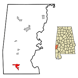 Location in Choctaw County and the state of Alabama | |
| Coordinates: 31°46′18″N 88°19′52″W / 31.77167°N 88.33111°W | |
| Country | United States |
| State | Alabama |
| County | Choctaw |
| Area | |
| • Total | 5.2 sq mi (13.5 km2) |
| • Land | 5.2 sq mi (13.5 km2) |
| • Water | 0 sq mi (0 km2) |
| Elevation | 233 ft (71 m) |
| Population (2010) | |
| • Total | 452 |
| • Density | 87/sq mi (33.5/km2) |
| Time zone | Central (CST) (UTC-6) |
| • Summer (DST) | CDT (UTC-5) |
| ZIP code | 36919 |
| Area code(s) | 251 |
| FIPS code | 01-70416 |
| GNIS feature ID | 0126840 |
| Website |
www |
Silas is a town in Choctaw County, Alabama, United States. At the 2010 census the population was 452.[1]
Geography
Silas is located in southern Choctaw County at 31°46'17.850" North, 88°19'51.568" West (31.771625, -88.330991).[2]
According to the U.S. Census Bureau, the town has a total area of 5.2 square miles (13.5 km2), all land.[1]
The town is located next to U.S. Route 84 near the Mississippi state line.
Demographics
| Historical population | |||
|---|---|---|---|
| Census | Pop. | %± | |
| 1950 | 383 | — | |
| 1960 | 353 | −7.8% | |
| 1970 | 345 | −2.3% | |
| 1980 | 343 | −0.6% | |
| 1990 | 245 | −28.6% | |
| 2000 | 529 | 115.9% | |
| 2010 | 452 | −14.6% | |
| Est. 2015 | 432 | [3] | −4.4% |
| U.S. Decennial Census[4] 2013 Estimate[5] | |||
As of the census[6] of 2000, there were 529 people, 220 households, and 157 families residing in the town. The population density was 100.8 people per square mile (38.9/km²). There were 260 housing units at an average density of 49.5 per square mile (19.1/km²). The racial makeup of the town was 71.83% White, 25.71% Black or African American, 0.19% from other races, and 2.27% from two or more races. 0.19% of the population were Hispanic or Latino of any race.
There were 220 households out of which 29.5% had children under the age of 18 living with them, 55.9% were married couples living together, 15.0% had a female householder with no husband present, and 28.6% were non-families. 27.7% of all households were made up of individuals and 8.6% had someone living alone who was 65 years of age or older. The average household size was 2.40 and the average family size was 2.94.
In the town the population was spread out with 26.3% under the age of 18, 6.2% from 18 to 24, 28.0% from 25 to 44, 25.0% from 45 to 64, and 14.6% who were 65 years of age or older. The median age was 38 years. For every 100 females there were 88.3 males. For every 100 females age 18 and over, there were 86.6 males.
The median income for a household in the town was $20,882, and the median income for a family was $25,833. Males had a median income of $27,955 versus $18,500 for females. The per capita income for the town was $14,074. About 16.5% of families and 19.0% of the population were below the poverty line, including 27.1% of those under age 18 and 11.6% of those age 65 or over.
Notable people
- Jeff Branson, Major League Baseball coach and former player; attended Southern Choctaw High School
- Spencer Johnson, NFL defensive tackle, attended Southern Choctaw High School
- Travis Pearson, football player
References
- 1 2 "Geographic Identifiers: 2010 Demographic Profile Data (G001): Silas town, Alabama". U.S. Census Bureau, American Factfinder. Retrieved June 5, 2014.
- ↑ "US Gazetteer files: 2010, 2000, and 1990". United States Census Bureau. 2011-02-12. Retrieved 2011-04-23.
- ↑ "Annual Estimates of the Resident Population for Incorporated Places: April 1, 2010 to July 1, 2015". Retrieved July 2, 2016.
- ↑ "U.S. Decennial Census". Census.gov. Retrieved June 6, 2013.
- ↑ "Annual Estimates of the Resident Population: April 1, 2010 to July 1, 2013". Retrieved June 3, 2014.
- ↑ "American FactFinder". United States Census Bureau. Retrieved 2008-01-31.
External links
Coordinates: 31°46′18″N 88°19′52″W / 31.771625°N 88.330991°W
Municipalities and communities of Choctaw County, Alabama, United States | ||
|---|---|---|
| Towns | 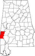 | |
| CDP | ||
| Unincorporated communities | ||
| Footnotes | ‡This populated place also has portions in an adjacent county or counties | |