Simsbury Airport
| Simsbury Airport | |||||||||||
|---|---|---|---|---|---|---|---|---|---|---|---|
 | |||||||||||
| IATA: none – ICAO: none – FAA LID: 4B9 | |||||||||||
| Summary | |||||||||||
| Airport type | Public | ||||||||||
| Owner | Airport Realty Association, LLC | ||||||||||
| Operator | Simsbury Flying Club | ||||||||||
| Location | Simsbury, Connecticut | ||||||||||
| Elevation AMSL | 195 ft / 59 m | ||||||||||
| Coordinates | 41°55′00″N 072°46′38″W / 41.91667°N 72.77722°W | ||||||||||
| Website | www.simsburyairport.com | ||||||||||
| Map | |||||||||||
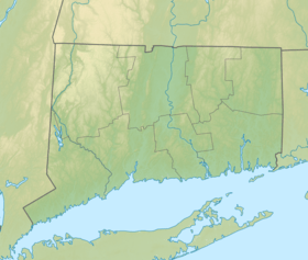 4B9  4B9 Location of airport in Connecticut/United States | |||||||||||
| Runways | |||||||||||
| |||||||||||
| Statistics (1997) | |||||||||||
| |||||||||||
Simsbury Airport (FAA LID: 4B9) is a public use airport located in Simsbury and East Granby, both towns in Hartford County, Connecticut, United States. It is privately owned by the Airport Realty Association, LLC.[1] The airport is operated by the Simsbury Flying Club, a not-for-profit group that operates an FBO at the airport. It is included in the Federal Aviation Administration (FAA) National Plan of Integrated Airport Systems for 2017–2021, in which it is categorized as a general aviation facility.[2]
Fly-In
The Simsbury Fly-In is held on the third Sunday each September. The event, which as many as 10,000 people, 150 airplanes, and over 400 classic autos have attended in the past, also showcases parachute jumpers, a simulated rescue by a LifeStar helicopter, and has vendors and manufacturers displaying their products.
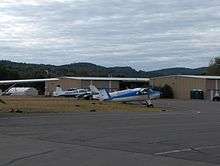
Facilities and aircraft
Simsbury Airport covers an area of 103 acres (42 ha) which contains one asphalt paved runway (3/21) measuring 2,205 x 50 ft (672 x 15 m).[1]
For the 12-month period ending June 30, 2008, the airport had 12,775 aircraft operations, an average of 35 per day: 99% general aviation and 1% air taxi. There are 52 aircraft based at this airport: 96% single engine and 4% multi-engine.[1]
Incidents and Accidents
On December 27, 2011 around 12:45 pm, a gyrocopter crashed upon landing on runway 3. The aircraft flew into a patch of rough air and the pilot lost control which resulted in a major loss of altitude. The gyrocopter made a crash landing in a nearby landfill and flipped over from the blades hitting the ground. The pilot walked away with no injuries, but his gyrocopter was destroyed.[3]
References
- 1 2 3 4 FAA Airport Master Record for 4B9 (Form 5010 PDF), effective 2008-06-30
- ↑ "List of NPIAS Airports" (PDF). FAA.gov. Federal Aviation Administration. 21 October 2016. Retrieved 27 November 2016.
- ↑ http://www.courant.com/community/simsbury/hc-simsbury-gyrocopter-crash-1227-20111226,0,3360579.story
External links
- Simsbury Airport (official site)
- Resources for this airport:
- FAA airport information for 4B9
- AirNav airport information for 4B9
- FlightAware airport information and live flight tracker
- SkyVector aeronautical chart for 4B9
Coordinates: 41°54′58″N 72°46′44″W / 41.9161°N 72.7789°W