Smithfield, Utah
| Smithfield, Utah | |
|---|---|
| City | |
 | |
| Nickname(s): Smithy | |
| Motto: "Utah's Health City" | |
 Location in Cache County and the state of Utah | |
| Coordinates: 41°50′7″N 111°49′42″W / 41.83528°N 111.82833°WCoordinates: 41°50′7″N 111°49′42″W / 41.83528°N 111.82833°W | |
| Country | United States |
| State | Utah |
| County | Cache |
| Settled | 1859 |
| Named for | John Glover Smith |
| Area | |
| • Total | 5.0 sq mi (12.9 km2) |
| • Land | 5.0 sq mi (12.9 km2) |
| • Water | 0.0 sq mi (0.0 km2) |
| Elevation[1] | 4,603 ft (1,403 m) |
| Population (2010) | |
| • Total | 9,495 |
| • Estimate (2014) | 11,014 |
| • Density | 2,211/sq mi (853.8/km2) |
| Time zone | Mountain (MST) (UTC-7) |
| • Summer (DST) | MDT (UTC-6) |
| ZIP code | 84335 |
| Area code(s) | 435 |
| FIPS code | 49-69640[2] |
| GNIS feature ID | 1445709[1] |
| Website |
www |
Smithfield is a city in Cache County, Utah, United States. The population was 9,495 at the 2010 census,[3] with an estimated population of 11,014 in 2014.[4] It is included in the Logan, Utah-Idaho Metropolitan Statistical Area, and is the second largest city in the area after Logan, the county seat. Smithfield is home to Sky View High School, where students from all of northern Cache County come to study.
Geography
According to the United States Census Bureau, the city has a total area of 5.0 square miles (12.9 km2), all of it land.[3]
History
Originally known as "Summit Creek", Smithfield was founded in 1857 by Robert Thornley and his cousin Seth Langdon who were sent north from Salt Lake City by Brigham Young to found a settlement on Summit Creek. After a preliminary scouting, Robert returned with his new wife Annie Brighton. The first winter was spent in a wagon box. By the next summer, with more settlers arriving, a small fort was built on the edge of the creek, one cabin of which remains. As the settlement grew, a bishop was named and the town took his name. By 1917 the town had planted trees on both sides of its Main Street and had acquired a Carnegie library and a Rotary club. Dependent for many years on dairying, a Del Monte canning factory, and the sugar beet industry, the town is now essentially a bedroom community for Logan and its Utah State University.
Demographics
| Historical population | |||
|---|---|---|---|
| Census | Pop. | %± | |
| 1870 | 744 | — | |
| 1880 | 1,177 | 58.2% | |
| 1890 | 1,080 | −8.2% | |
| 1900 | 1,494 | 38.3% | |
| 1910 | 1,865 | 24.8% | |
| 1920 | 2,421 | 29.8% | |
| 1930 | 2,353 | −2.8% | |
| 1940 | 2,461 | 4.6% | |
| 1950 | 2,383 | −3.2% | |
| 1960 | 2,512 | 5.4% | |
| 1970 | 3,342 | 33.0% | |
| 1980 | 4,993 | 49.4% | |
| 1990 | 5,566 | 11.5% | |
| 2000 | 7,261 | 30.5% | |
| 2010 | 9,495 | 30.8% | |
| Est. 2015 | 10,782 | [5] | 13.6% |
As of the census[2] of 2000, there were 7,261 people, 2,066 households, and 1,782 families residing in the city. The population density was 1,686.6 people per square mile (650.5/km²). There were 2,159 housing units at an average density of 501.5 per square mile (193.4/km²). The racial makeup of the city was 95.23% White, 0.12% African American, 0.23% Native American, 0.48% Asian, 0.04% Pacific Islander, 2.82% from other races, and 1.06% from two or more races. Hispanic or Latino of any race were 5.04% of the population.
There were 2,066 households out of which 53.2% had children under the age of 18 living with them, 78.5% were married couples living together, 6.1% had a female householder with no husband present, and 13.7% were non-families. 12.2% of all households were made up of individuals and 6.8% had someone living alone who was 65 years of age or older. The average household size was 3.51 and the average family size was 3.85.
In the city the population was spread out with 37.8% under the age of 18, 12.1% from 18 to 24, 25.8% from 25 to 44, 16.2% from 45 to 64, and 8.0% who were 65 years of age or older. The median age was 25 years. For every 100 females there were 99.5 males. For every 100 females age 18 and over, there were 96.6 males.
The median income for a household in the city was $47,745, and the median income for a family was $49,828. Males had a median income of $35,708 versus $21,076 for females. The per capita income for the city was $14,933. About 4.5% of families and 6.2% of the population were below the poverty line, including 6.6% of those under age 18 and 8.0% of those age 65 or over.
Education
Smithfield is home to Sunrise, Birch Creek (recently constructed), Summit Elementary, and Sky View, a county high school.
See also
- Schreiber Foods (cheese factory in town owned by this company)
References
- 1 2 U.S. Geological Survey Geographic Names Information System: Smithfield
- 1 2 "American FactFinder". United States Census Bureau. Retrieved 2008-01-31.
- 1 2 "Geographic Identifiers: 2010 Census Summary File 1 (G001): Smithfield city, Utah". U.S. Census Bureau, American Factfinder. Retrieved August 7, 2015.
- ↑ "Annual Estimates of the Resident Population: April 1, 2010 to July 1, 2014 (PEPANNRES): Incorporated Places in Utah". U.S. Census Bureau, American Factfinder. Retrieved August 7, 2015.
- ↑ "Annual Estimates of the Resident Population for Incorporated Places: April 1, 2010 to July 1, 2015". Retrieved July 2, 2016.
- ↑ "Census of Population and Housing". Census.gov. Retrieved June 4, 2015.
External links
![]() Media related to Smithfield, Utah at Wikimedia Commons
Media related to Smithfield, Utah at Wikimedia Commons
- City of Smithfield official website
- Smithfield Fire and EMS
- Smithfield Sun, online newspaper
 |
Lewiston | Richmond | Wasatch-Cache National Forest / Garden City | |
| Amalga | |
Wasatch-Cache National Forest / Laketown | ||
| ||||
| | ||||
| Mendon | Logan, Hyde Park | Wasatch-Cache National Forest |
Municipalities and communities of Cache County, Utah, United States | ||
|---|---|---|
| Cities | 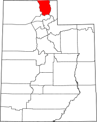 | |
| Towns | ||
| CDPs | ||
| Unincorporated community | ||
| Ghost town | ||