Solon Springs, Wisconsin
| Solon Springs, Wisconsin | |
|---|---|
| Village | |
 Location of Solon Springs, Wisconsin | |
| Coordinates: 46°21′17″N 91°48′1″W / 46.35472°N 91.80028°WCoordinates: 46°21′17″N 91°48′1″W / 46.35472°N 91.80028°W | |
| Country | United States |
| State | Wisconsin |
| County | Douglas |
| Area[1] | |
| • Total | 2.30 sq mi (5.96 km2) |
| • Land | 1.57 sq mi (4.07 km2) |
| • Water | 0.73 sq mi (1.89 km2) |
| Elevation[2] | 1,122 ft (342 m) |
| Population (2010)[3] | |
| • Total | 600 |
| • Estimate (2012[4]) | 604 |
| • Density | 382.2/sq mi (147.6/km2) |
| Time zone | Central (CST) (UTC-6) |
| • Summer (DST) | CDT (UTC-5) |
| Area code(s) | 715 and 534 |
| FIPS code | 55-74600[5] |
| GNIS feature ID | 1584172[2] |
Solon Springs is a village in Douglas County, Wisconsin, United States. The population was 600 at the 2010 census. The village is located within the Town of Solon Springs.
History
Solon Springs was first called White Birch, from a grove of white birch trees near the original town site.[6] The present name of Solon Springs honors Thomas F. Solon, who discovered mineral springs here.[6] A post office was established as White Birch in 1885, and the name of the post office was changed to Solon Springs in 1896.[7]
Geography
Solon Springs is located at 46°21′3″N 91°49′5″W / 46.35083°N 91.81806°W (46.351049, -91.818139).[8]
According to the United States Census Bureau, the village has a total area of 2.30 square miles (5.96 km2), of which, 1.57 square miles (4.07 km2) of it is land and 0.73 square miles (1.89 km2) is water.[1]
Solon Springs is located 32 miles southeast of the city of Superior.
Transportation
Major highways
U.S. Highway 53 serves as a main route in the community. The main route, however, now bypasses the village and the original portion of highway that still exists in Solon Springs is referred to as "Business 53".
Airport
Solon Springs Municipal Airport (KOLG) serves the village and surrounding communities.
Demographics
| Historical population | |||
|---|---|---|---|
| Census | Pop. | %± | |
| 1930 | 282 | — | |
| 1940 | 392 | 39.0% | |
| 1950 | 480 | 22.4% | |
| 1960 | 530 | 10.4% | |
| 1970 | 598 | 12.8% | |
| 1980 | 590 | −1.3% | |
| 1990 | 575 | −2.5% | |
| 2000 | 576 | 0.2% | |
| 2010 | 600 | 4.2% | |
| Est. 2015 | 602 | [9] | 0.3% |
As of 2000 the median income for a household in the village was $30,250, and the median income for a family was $46,875. Males had a median income of $30,500 versus $23,438 for females. The per capita income for the village was $16,807. About 3.7% of families and 10.6% of the population were below the poverty line, including 9.3% of those under age 18 and 8.6% of those age 65 or over.
2010 census
As of the census[3] of 2010, there were 600 people, 263 households, and 168 families residing in the village. The population density was 382.2 inhabitants per square mile (147.6/km2). There were 408 housing units at an average density of 259.9 per square mile (100.3/km2). The racial makeup of the village was 97.5% White, 0.2% African American, 1.3% Native American, and 1.0% from two or more races. Hispanic or Latino of any race were 0.7% of the population.
There were 263 households of which 25.9% had children under the age of 18 living with them, 50.2% were married couples living together, 9.9% had a female householder with no husband present, 3.8% had a male householder with no wife present, and 36.1% were non-families. 28.9% of all households were made up of individuals and 14.8% had someone living alone who was 65 years of age or older. The average household size was 2.28 and the average family size was 2.81.
The median age in the village was 43.1 years. 23.2% of residents were under the age of 18; 5.9% were between the ages of 18 and 24; 23.9% were from 25 to 44; 31.4% were from 45 to 64; and 15.7% were 65 years of age or older. The gender makeup of the village was 48.5% male and 51.5% female.
References
- 1 2 "US Gazetteer files 2010". United States Census Bureau. Retrieved 2012-11-18.
- 1 2 "US Board on Geographic Names". United States Geological Survey. 2007-10-25. Retrieved 2008-01-31.
- 1 2 "American FactFinder". United States Census Bureau. Retrieved 2012-11-18.
- ↑ "Population Estimates". United States Census Bureau. Retrieved 2013-06-24.
- ↑ "American FactFinder". United States Census Bureau. Retrieved 2008-01-31.
- 1 2 Chicago and North Western Railway Company (1908). A History of the Origin of the Place Names Connected with the Chicago & North Western and Chicago, St. Paul, Minneapolis & Omaha Railways. p. 192.
- ↑ "Douglas County". Jim Forte Postal History. Retrieved 5 April 2015.
- ↑ "US Gazetteer files: 2010, 2000, and 1990". United States Census Bureau. 2011-02-12. Retrieved 2011-04-23.
- ↑ "Annual Estimates of the Resident Population for Incorporated Places: April 1, 2010 to July 1, 2015". Retrieved July 2, 2016.
- ↑ "Census of Population and Housing". Census.gov. Retrieved June 4, 2015.
External links
Municipalities and communities of Douglas County, Wisconsin, United States | ||
|---|---|---|
| City | 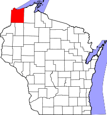 | |
| Villages | ||
| Towns | ||
| CDPs | ||
| Unincorporated communities |
| |
| Indian reservation | ||
| Footnotes | ‡This populated place also has portions in an adjacent county or counties | |