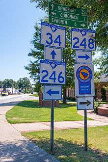
South Carolina Highway 34
| ||||
|---|---|---|---|---|
| Route information | ||||
| Maintained by SCDOT | ||||
| Length: | 186.8 mi[1] (300.6 km) | |||
| Existed: | 1922 – present | |||
| Major junctions | ||||
| West end: |
| |||
|
| ||||
| East end: |
| |||
| Location | ||||
| Counties: | Greenwood, Newberry, Fairfield, Kershaw, Lee, Darlington, Marlboro, Dillon | |||
| Highway system | ||||
| ||||

South Carolina Highway 34 (SC 34) is a primary state highway in the U.S. state of South Carolina. As one of the longer state highways, it traverses the state east-west from Greenwood to Dillon, connecting the cities of Newberry, Winnsboro, Camden, Bishopville and Darlington.
Route description
SC 34 begins as a hidden highway in downtown Greenwood, at the intersection of Main Street and Maxwell Avenue. On city and state official maps, SC 34 is on an east parallel to US 25 Bus./US 178 Bus. along Main Street with some sections being in concurrency; however, no signage identifies this unique relationship, thus the hidden status for 1.6 miles (2.6 km). At the intersection of Main Street and Ninety Six Highway, the first signage of SC 34 appears, heading east to Ninety Six.[2]
SC 34 travels through the town of Ninety Six and near the Ninety Six National Historic Site. Near Newberry, it takes a bypass route along Dixie Drive and Wilson Road, before continuing east to Winnsboro. Now going southeast, it goes through Ridgeway, to Lugoff, where it overlaps with US 1/US 601 to Camden. Continuing east and parallel to I-20, SC 34 joins with US 15 at Bishopville and skirts north of Lee State Park. East of Lydia, SC 34 separates from US 15 and goes directly to Darlington. Heading in a northeasterly direction now, it goes through Brownsville then east into downtown Dillon, where it ends at the intersection of Main Street and Second Avenue.
History
An original part of the South Carolina state route system, in 1922 the road ran from Darlington to Ridgeway. In 1933 the road was extended to Dillon and about 1943 a bridge over the Pee Dee river was opened. In the early 1950s the road was extended to Greenwood, creating the current configuration. SC 34 was bypassed south around Newberry in 1976 and the original route through the town remained as SC 34 Business. The first part of the road to be paved was the section though Camden in 1929. Over the next several years other parts were paved until the road was fully paved by the early 1940s. During the past several decades, much of the route has been widened to four lanes.
Junction list
| County | Location | mi[1] | km | Destinations | Notes |
|---|---|---|---|---|---|
| Greenwood | Greenwood | 0.0 | 0.0 | North end of US 25 Bus. and west end of US 178 Bus. overlap | |
| 1.6 | 2.6 | South end of US 25 Bus. and east end of US 178 Bus. overlap | |||
| 2.8 | 4.5 | ||||
| Ninety Six | 9.0 | 14.5 | North end of SC 246 overlap; to Ninety Six National Historic Site | ||
| 9.1 | 14.6 | South end of SC 246 overlap | |||
| | 14.6 | 23.5 | To Greenwood State Park | ||
| Newberry | Chappells | 19.0 | 30.6 | ||
| Silverstreet | 30.2 | 48.6 | South end of SC 121 overlap | ||
| | 34.8 | 56.0 | North end of SC 121 overlap | ||
| Newberry | 35.6 | 57.3 | Boundary Street – Newberry | ||
| 36.6 | 58.9 | ||||
| 38.2 | 61.5 | East end of US 76 overlap | |||
| 39.0 | 62.8 | ||||
| 39.2 | 63.1 | West end of US 76 overlap | |||
| 41.5 | 66.8 | I-26 exit 74. | |||
| | 45.9 | 73.9 | |||
| Fairfield | | 60.4 | 97.2 | ||
| Winnsboro | 72.9 | 117.3 | North end of US 321 overlap | ||
| Winnsboro Mills | 76.3 | 122.8 | |||
| 76.6 | 123.3 | South end of US 321 overlap | |||
| | 82.8 | 133.3 | I-77 exit 34. | ||
| Ridgeway | 85.2 | 137.1 | North end of US 21 overlap | ||
| 85.5 | 137.6 | South end of US 21 overlap | |||
| Kershaw | Lugoff | 103.0 | 165.8 | South end of US 1/US 601 overlap | |
| Camden | 105.5 | 169.8 | Springdale Drive | ||
| 107.8 | 173.5 | North end of US 601 overlap | |||
| 109.2 | 175.7 | North end of US 1 overlap; to Woodward Field | |||
| Lee | | 119.1 | 191.7 | ||
| Bishopville | 129.7 | 208.7 | South end of US 15/SC 341 overlap | ||
| 131.1 | 211.0 | North end of SC 341 overlap | |||
| Darlington | Lees Crossroads | 141.0 | 226.9 | North end of US 15 overlap | |
| Earlys Crossroads | 147.1 | 236.7 | North end of SC 151 overlap | ||
| Darlington | 152.4 | 245.3 | |||
| 152.7 | 245.7 | South end of SC 151 overlap | |||
| 153.1 | 246.4 | ||||
| 153.7 | 247.4 | ||||
| Marlboro | Brownsville | 171.3 | 275.7 | ||
| Dillon | | 184.3 | 296.6 | I-95 exit 190. | |
| Dillon | 186.8 | 300.6 | |||
1.000 mi = 1.609 km; 1.000 km = 0.621 mi
| |||||
Bannered routes
Newberry business loop
| |
|---|---|
| Location: | Newberry, South Carolina |
| Length: | 2.6 mi[3] (4.2 km) |
| Existed: | 1976–2010 |
SC 34 Business was established in 1976, following the old mainline route through downtown Newberry, via Boundary Street, Caldwell Street and Main Street. Sometime between 2006-2010 the route was decommissioned.
References
- 1 2 Google (September 3, 2013). "South Carolina Highway 34" (Map). Google Maps. Google. Retrieved September 3, 2013.
- ↑ Greenwood Urban Area, Greenwood County (PDF) (Map). South Carolina Department of Transportation. March 2012. Retrieved September 2, 2013.
- ↑ Google (September 2, 2013). "South Carolina Highway 34 Business - Newberry" (Map). Google Maps. Google. Retrieved September 2, 2013.
External links
-
 Media related to South Carolina Highway 34 at Wikimedia Commons
 - Mapmikey's South Carolina Highways Page: SC 30-39