Texas State Highway Spur 69
| |||||||
|---|---|---|---|---|---|---|---|
| Route information | |||||||
| Length: | 1.260 mi[1] (2.028 km) | ||||||
| Existed: |
orig. 1939 curr. 1969 – present | ||||||
| Major junctions | |||||||
| West end: |
| ||||||
| East end: |
| ||||||
| Highway system | |||||||
| |||||||

Spur 69 is a four-lane state-maintained roadway in Austin, Texas. It is 1.2 miles (1.9 km) in length and is named Koenig Lane /ˈkeɪnɪɡ/. It forms a link between RM 2222 and US 290 at I-35. Spur 69 is signed over its entire length as RM 2222, rather than as Spur 69.
Between 1939 and 1945, Spur 69 referred to a short section of what is now SH 12 near Deweyville. The current location in Austin was first assigned in 1969.
In 1990, Spur 69 was redesignated as State Highway 169; the designation was reverted to Spur 69 in 1991. There already was a SH 69 at the time.
Route description
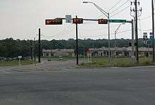
Spur 69 begins at an intersection with North Lamar Boulevard in Austin, Travis County, where the roadway continues northwest as RM 2222. From here, the highway heads southeast as West Koenig Lane, a four-lane divided highway signed as RM 2222. The road passes businesses before heading into residential areas with some commercial establishments, becoming East Koenig Lane. Spur 69 crosses the Capital MetroRail Red Line, turning east and becoming an undivided freeway with frontage roads. The highway reaches an interchange with Airport Boulevard south of the Highland Mall and becomes a divided highway again as it comes to a large interchange with I-35/US 290. It is east of this interchange that Spur 69 ends and the freeway continues east as part of US 290.[1][2][3]
History
Spur 69 was first designated in Deweyville, Newton County in 1939, running from SH 87 to the Sabine River.[1] This road was replaced with a portion of SH 235 in 1945, which became SH 12 in 1960.[1][4] The current Spur 69 was designated in 1969 to run from I-35 west to Koenig Lane near the Southern Pacific railroad tracks. The highway was extended west to its current western terminus at RM 2222 and North Lamar Boulevard in 1972. In 1989, Spur 69 was replaced with SH 169, with the designation reverting to Spur 69 in 1991.[1]
Major intersections
The entire route is in Austin, Travis County.
| mi[1] | km | Destinations | Notes | ||
|---|---|---|---|---|---|
| 0.000 | 0.000 | ||||
| Lamar Boulevard | |||||
| West end of freeway | |||||
| Airport Boulevard | |||||
| I-35 exit 238 | |||||
| 1.260 | 2.028 | ||||
| 1.000 mi = 1.609 km; 1.000 km = 0.621 mi | |||||
References
- 1 2 3 4 5 6 Transportation Planning and Programming Division (n.d.). "State Highway Spur No. 69". Highway Designation Files. Texas Department of Transportation. Retrieved June 16, 2010.
- ↑ County Grid Map 431 (PDF) (Map). Texas Department of Transportation. 2010. Retrieved October 11, 2011.
- ↑ Google (October 11, 2011). "overview of Texas State Highway Spur 69" (Map). Google Maps. Google. Retrieved October 11, 2011.
- ↑ Transportation Planning and Programming Division (n.d.). "State Highway No. 235". Highway Designation Files. Texas Department of Transportation. Retrieved October 11, 2011.