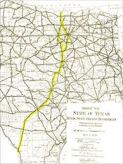
Interstate 35 in Texas
| ||||
|---|---|---|---|---|
.png) | ||||
| Route information | ||||
| Maintained by TxDOT | ||||
| Length: | 407.195 mi[1] (655.317 km) | |||
| Existed: | 1959 – present | |||
| Major junctions | ||||
| South end: |
| |||
|
| ||||
| North end: |
| |||
| Highway system | ||||
| ||||

Interstate 35 (abbreviated I-35 or IH-35) in Texas is a major north–south Interstate Highway running from Laredo near the United States-Mexico border to the Red River north of Gainesville where it crosses into Oklahoma. Along its route, it passes through the cities of San Antonio, Austin, and Waco before it splits into two auxiliary routes just north of Hillsboro. Interstate 35E heads northeast where it passes through Dallas. Interstate 35W turns northwest to run through Fort Worth. The two branches meet up in Denton to again form Interstate 35, where it continues to the Oklahoma border. The exit numbers for Interstate 35E maintain the sequence of exit numbers from the southern segment of Interstate 35, and the northern segment of Interstate 35 follows on from the sequence of exit numbers from Interstate 35E. Interstate 35W maintains its own sequence of exit numbers.
In Texas, Interstate 35 runs for just over 407 miles (655 km),[1] which does not include either the 85-mile (137-km) segment of Interstate 35W or the 97-mile (156-km) segment of Interstate 35E. Texas contains more miles of the overall length of Interstate 35 than any other state, almost one-third of the entire length.
The Interstate is currently undergoing an extensive renovation and expansion project, known as 'My35.' The project includes work on portions of the interstate from Dallas south to Laredo.
I-35's Terminus may be extended south to meet up with the proposed Interstate 2 extension. This will only occur if I-2 is extended.
Route description
Laredo and South Texas
In Laredo, Interstate 35 is between 6 and 8 main lanes in each direction, dropping to 4 near mile marker 13. After running concurrently with US 83 for 20 miles (32 km), the highway continues north-northeast across the South Texas Plains. The highway passes through the towns of Cotulla, Dilley, Pearsall, Devine, and Lytle before reaching San Antonio.
San Antonio
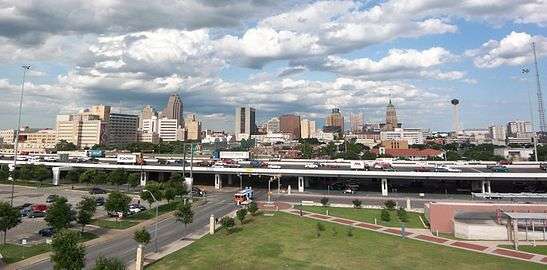
In San Antonio, I-35 is listed as the PanAm Expressway. It starts out as four lanes from the south until it reaches the Poteet-Jourdanton Freeway, expanding to six to eight mainlanes of travel. Its southern point begins in the southwest corner of town and travels northeast, crossing Interstate 410 near its southwest point. At the southwest corner of Downtown, it reaches an intersection with Interstate 10, United States Route 87 and United States Route 90. US 90 continues east and west from this junction, while I-10 westbound/U.S. 87 northbound joins with I-35 northbound along the western side of Downtown. In this section, it splits lanes to form two levels, a lower one for local traffic and a higher one for express traffic. They briefly rejoin near the northwest corner of Downtown to allow I-10/U.S. 87 to split off and go northwest.
I-35 continues, resplitting lanes again as it curves around the northwest corner of Downtown and turns east. It rejoins the lanes as it goes through an intersection at the northeast corner of Downtown, where Interstate 37's northern terminus is located, while United States Highway 281 will continue on the north–south freeway. I-35 continues east for a few miles until it begins to curve back to the northeast. It merges with I-410 on its eastern north–south leg from its northbound direction in a triangular interchange and continues north concurrently from there. A couple miles later, I-410 will split off onto its northern west–east leg, while I-35 resumes its north-northeast course past the northeast corner of the city.
Trucks are restricted from travel in the far left lane of I-35 in either direction throughout the San Antonio area. The restriction covers Bexar, Guadalupe, and Comal Counties.[2]
Austin
In Austin, Interstate 35 is named Interregional Highway. Through most of the greater Austin area, I-35 is three to four lanes in each direction, dropping to three lanes north of Williamson county. It forms the eastern boundary of Downtown Austin and also passes through the eastern side of the University of Texas campus. I-35 is co-located with U.S. Highway 290 through central Austin.
Trucks are restricted from travel in the far left lane of I-35 in either direction throughout the Austin area. The restriction covers Hays and Travis counties and most of Williamson county and ends north of Jarrell, Texas where I-35 is reduced to three lanes in each direction .[3]
I-35 is split into two decks between Martin Luther King Boulevard and Airport Boulevard, north of Downtown Austin. Both the upper and lower decks are signed as I-35 and US 290, and they use a common set of exit numbers, with some exit numbers duplicated between the two decks. The upper deck lanes are express lanes, with no on- or off-ramps. Drivers wishing to exit between Martin Luther King Boulevard and Airport Boulevard must use the lower deck.
The I-35 corridor between San Antonio and Austin is considered one of the most congested stretches of highway in the Interstate System. Much of this traffic is due to I-35 being considered one of the primary NAFTA corridors. Efforts to alleviate the congestion include State Highway 130, which forms an I-35 bypass loop to the east of Austin. Many local and regional governance organizations have on-going studies on other methods to improve mobility on I-35, which include such features as commuter rail lines and additional managed lanes.[4]
On March 26, 2015, an overpass bridge beam fell in Salado, Texas, killing one person.[5]
Waco and Central Texas

In Waco, Interstate 35 is known as the Jack Kultgen Freeway. I-35 has six to eight lanes through the city of Waco. It passes just to the west of the Baylor University campus and crosses the Brazos River adjacent to McLane Stadium, the new home of Baylor Bears football. Beginning in Waco and continuing up until just before the I-35E/I-35W split north of Hillsboro, I-35 is co-located with U.S. Highway 77.
'My35' Expansion Project
Interstate 35 through Central Texas is undergoing major expansion and renovation. The project is known as 'Main Street Texas', which is part of the larger scale 'My35' expansion plan. The 'Main Street' project primarily focuses on expanding the number of main lanes from four to six through McLennan and Bell counties.[6] It also calls for complete replacement of the main lane bridges over the Brazos River, and extensive renovations to frontage roads and interchanges throughout the corridor. Funding for the project has been secured, with the exception of the portion of freeway to be renovated through the Downtown Waco area. $280 million in funding has yet to be secured for that section of the project.[7]
Dallas and Fort Worth
Denton and North Texas
Just southwest of Denton, Interstate 35W and Interstate 35E join to reform Interstate 35, which then continues north to the Oklahoma border. The exit numbers on I-35 continue on from the last exit of Interstate 35E.
Just north of Denton, U.S. Highway 77 is co-located with Interstate 35 through to the Oklahoma border, although it is not signed as such.
History
Central Texas
The right-of-way for the future Interstate 35 in Austin began being purchased in 1946,[8] running along the so-called "inter-regional highway" (named for the precursor to the current Interstate Highway System). The formal opening of Interstate 35 in Austin took place in 1962. The alignment was chosen to line up with U.S. Highway 81 and with East Avenue, which formed the eastern boundary of Austin.[9] US 81 has since been truncated and does not extend to Austin, and East Avenue today forms part of the frontage road for I-35 through downtown Austin.
In 1975, a 2-mile (3.2 km) set of elevated express lanes were added to I-35 between 15th Street and Airport Boulevard.[10] The reason double-decking was used is because the highway is bounded in the area by the University of Texas campus on the west and by the Mount Calvary Cemetery on the east, restricting the available right-of-way. The lower deck kept its original configuration, which featured short on- and off-ramps with limited visibility. In 2000, some off-ramps on the lower deck were removed, in response to the already dangerous conditions becoming more so as traffic levels on the road increased.[11] Interstate 35 in general and the double-decked section in particular have been viewed as a social dividing line between the central Austin and U.T. communities and the more economically depressed East Austin neighborhoods.[12]
Interstate 35 at one time had one of the few at-grade railroad crossings in the Interstate Highway System. The crossing was removed during the 1970s.[4]
North Texas
Construction on Interstate 35 in the DFW region began around 1960 with the upgrading of U.S. 77 to Interstate standards between Dallas and Denton. By 1965, Interstate 35 was complete from Dallas to the Oklahoma border, and by 1967 it was complete from both Dallas and Fort Worth southward to Austin. The remaining segment of Interstate 35W from Fort Worth to Denton was not completed until 1969.
Exit list
| County | Location | mi | km | Exit | Destinations | Notes | |
|---|---|---|---|---|---|---|---|
| Webb | Laredo | 0.00 | 0.00 | – | At-grade intersection; one-way street, southbound exit; national southern terminus; south end of US 83 overlap; highway continues as US 83 | ||
| At-grade intersection; one-way street, northbound entrance; national southern terminus; south end of US 83 overlap | |||||||
| 1A | Scott Street, Washington Street | Southbound exit and northbound entrance | |||||
| 1B | Park Street, Sanchez Street | Southbound exit and northbound entrance | |||||
| 2 | Access to Laredo International Airport | ||||||
| 3A | Hillside Road, Calton Road | ||||||
| 3B | |||||||
| 4 | Del Mar Boulevard, Santa Maria Avenue | ||||||
| 4A | Northbound exit and southbound entrance | ||||||
| 4B | International Boulevard, Las Cruces Drive, Shiloh Drive | Signed as exit 7 southbound | |||||
| 5 | San Isidro Parkway | Northbound exit only | |||||
| 8A | Signed as exit 8 southbound, current northern end of I-69W | ||||||
| 8B | No southbound exit, Future I-69W, access to Laredo International Airport and Doctors Hospital | ||||||
| 9 | Killam Industrial Boulevard | Southbound exit only | |||||
| 12A | Port Laredo | Northbound exit only | |||||
| 12B | Carriers Drive – Uniroyal Road | Southbound exits are via exits 12 and 13 | |||||
| | 18 | North end of US 83 overlap | |||||
| | 22 | Webb | |||||
| | 24 | ||||||
| | 27 | Callaghan | |||||
| | 32 | San Roman Interchange | |||||
| | 38 | Northbound exit and southbound entrance | |||||
| La Salle | | 39 | |||||
| | 48 | Caiman Creek Interchange | |||||
| | 56 | ||||||
| | 63 | Elm Creek Interchange | |||||
| | 65 | ||||||
| Cotulla | 67 | ||||||
| 69 | Signed as exit 68 northbound | ||||||
| | 74 | Gardendale | |||||
| | 77 | ||||||
| La Salle–Frio county line | | 82 | |||||
| Frio | Dilley | 84 | |||||
| 85 | |||||||
| | 86 | ||||||
| | 91 | ||||||
| Pearsall | 99 | ||||||
| 101 | |||||||
| 104 | |||||||
| | 111 | ||||||
| Moore | 114 | ||||||
| Medina | | 121 | |||||
| Devine | 122 | ||||||
| | 124 | ||||||
| | 125 | CR 770 | Northbound exit only | ||||
| Natalia | 127 | ||||||
| Atascosa | Lytle | 131 | |||||
| Bexar | 133 | Southbound exit and northbound entrance | |||||
| | 135 | Luckey Road | |||||
| | 137 | Shepherd Road | |||||
| | 139 | Kinney Road | |||||
| Von Ormy | 140 | ||||||
| 141 | Benton City Road – Von Ormy | ||||||
| San Antonio | - | Medina River Turnaround | Southbound entrance only; Former northbound exit | ||||
| 144 | Fischer Road | ||||||
| 145A | I-410 exit 53 | ||||||
| 145B | No northbound entrance | ||||||
| 146 | Cassin Road | Southbound exit is via exit 147 | |||||
| 147 | Somerset Road | ||||||
| 148 | Signed as exit 149 southbound; Access to Southwest General Hospital | ||||||
| 149 | Palo Alto Road | Signed as exit 148 northbound | |||||
| 150A | Zarzamora Street | ||||||
| 150B | Access to Stinson Municipal Airport | ||||||
| 151 | Southcross Boulevard | ||||||
| 152A | Division Avenue | ||||||
| 152B | Malone Avenue, Theo Avenue | ||||||
| 153 | South end of I-10/US 87 overlap, west exit 572 | ||||||
| 154A | |||||||
| 154B | South Laredo Street, Cevallos Street | ||||||
| 155A | |||||||
| 155B | Frio Street, Cesar E. Chavez Boulevard – Downtown San Antonio | ||||||
| 156 | North end of I-10/US 87 overlap, east exit 570 | ||||||
| 155C | West Houston Street, Commerce Street | Southbound exit only | |||||
| 157A | San Pedro Avenue, Main Avenue, Lexington Avenue | ||||||
| 157B | Access to Baptist Medical Center and Metropolitan Methodist Hospita | ||||||
| 157C | St. Mary's Street | Northbound exit only | |||||
| 158 | Signed as exits 158A (north) and 158B (south) southbound; I-37 north exit 142, northern terminus of I-37 | ||||||
| 158C | Southbound exit only | ||||||
| 159A | New Braunfels Avenue | ||||||
| 159B | Walters Street – Fort Sam Houston | ||||||
| 160 | AT&T Center Parkway | Northbound exit is via exit 159B | |||||
| 160 | Splashtown Drive | Northbound exit and southbound entrance | |||||
| 161 | Binz-Englemann Road | Northbound exit and southbound entrance | |||||
| 162 | Northbound exit and southbound entrance, I-410 north exit 31 | ||||||
| 162 | Binz-Englemann Road – Brooke Army Medical Center | Southbound exit and northbound entrance | |||||
| 163 | Petroleum Drive – Brooke Army Medical Center | Northbound exit and southbound entrance | |||||
| 163 | South end of I-410 overlap; southbound exit and northbound entrance | ||||||
| 164A | Rittiman Road | ||||||
| 164B | Eisenhauer Road | ||||||
| 165 | |||||||
| 166 | North end of I-410 overlap, east exit 27 | ||||||
| 167A | Randolph Boulevard – Windcrest | Northbound exit is via exit 166A | |||||
| 167B | Thousand Oaks Drive, Starlight Terrace | Signed as exit 167 northbound | |||||
| 168 | Weidner Road | ||||||
| 169 | Wurzbach Parkway, O'Connor Road | ||||||
| 170A | Judson Road | Signed as exit 170 southbound | |||||
| Live Oak | 170B | Toepperwein Road | Southbound exit is part of exit 172 | ||||
| 171 | Southbound exit is via exit 172 | ||||||
| 172 | |||||||
| Selma | 173 | Olympia Parkway, Retama Parkway, Forum Parkway | |||||
| 174A | |||||||
| Guadalupe | Schertz | 174B | Schertz Parkway | ||||
| 175 | |||||||
| 176 | Wiederstein Road | ||||||
| Comal | 177 | ||||||
| 178 | |||||||
| 180 | Schwab Road | ||||||
| New Braunfels | 182 | Engel Road | |||||
| 183 | Solms Road | ||||||
| 184 | |||||||
| 185 | |||||||
| 186 | Walnut Avenue | ||||||
| 187 | |||||||
| 188 | Guadalupe River Turnaround | Northbound exit only | |||||
| 189 | Access to New Braunfels Regional Airport | ||||||
| 190A | Signed as exit 190 northbound | ||||||
| 190B | Post Road | Southbound exit and northbound entrance | |||||
| 191 | |||||||
| 193 | Conrads Lane, Kohlenberg Road | ||||||
| | 195 | Watson Lane, Old Bastrop Road | |||||
| | 196 | ||||||
| Hays | San Marcos | 199 | Posey Road | ||||
| 200 | Centerpoint Road | ||||||
| 201 | McCarty Lane | ||||||
| 202 | Access to Central Texas Medical Center | ||||||
| 204A | Signed as exit 204 northbound | ||||||
| 204B | C. M. Allen Parkway | Southbound exit only | |||||
| 205 | |||||||
| 206 | |||||||
| 207 | River Ridge Parkway | Southbound exit only | |||||
| 208 | Blanco River | ||||||
| 210 | Yarrington Road | ||||||
| Kyle | 213 | ||||||
| 215 | Access to Seton Medical Center Hays | ||||||
| Buda | 217 | ||||||
| 219 | Robert S. Wright Boulevard | Northbound exit and southbound entrance | |||||
| 220 | |||||||
| 221 | Main Street | Southbound exit and northbound entrance | |||||
| Travis | Austin | 223A | Southbound access via exit 223 | ||||
| 223 | Northbound access via exit 220 | ||||||
| 225 | |||||||
| 226 | |||||||
| 227 | Slaughter Lane (Loop 275 north) | ||||||
| — | Frontage Road | Northbound exit and entrance | |||||
| 228 | William Cannon Drive | ||||||
| 229 | Stassney Lane | ||||||
| 230 | Ben White Boulevard, Woodward Street | Signed as exit 231 southbound | |||||
| 231 | South end of US 290 overlap; signed as exit 230 southbound | ||||||
| 232A | Oltorf Street | ||||||
| 232B | Woodland Avenue | ||||||
| 233 | Riverside Drive | ||||||
| Bridge over the Colorado River (Lady Bird Lake) | |||||||
| 234A | Cesar Chavez Street, Holly Street | Signed as Holly St. only northbound | |||||
| 234B | Cesar Chavez Street, 2nd Street, 4th Street | Northbound exit and southbound entrance | |||||
| 8th Street, 3rd Streets – Huston-Tillotson University | Southbound exit and northbound entrance | ||||||
| 234C | 6th Street, 12th Street | Northbound exit and southbound entrance | |||||
| 12th Street, 11th Street – State Capitol | Southbound exit and northbound entrance | ||||||
| South end of double deck highway; upper deck is Express | |||||||
| 235A | Access to University Medical Center Brackenridge | ||||||
| 235B | Manor Road | Lower deck only | |||||
| 236 | Lower deck only; signed as exits 236A (Dean Keeton Street, 32nd Street) and 236B (38½ Street) southbound, access to St. David's Medical Center | ||||||
| North end of double deck highway | |||||||
| 237A | Airport Boulevard | ||||||
| 237B | Signed as exit 238A southbound, access to Dell Children's Medical Center | ||||||
| 238A | Southbound exit is via 238B | ||||||
| 238B | North end of US 290 overlap | ||||||
| 240 | Signed as exits 239 (south) and 240 (north) northbound | ||||||
| 241 | Rundberg Lane | ||||||
| 243 | Braker Lane | ||||||
| 244 | Techridge Boulevard, Yager Lane | Southbound exit is via exit 245 | |||||
| 245 | |||||||
| 246 | Howard Lane (Loop 275 south) | Signed as exit 245 northbound | |||||
| 247 | |||||||
| 248 | Grand Avenue Parkway | ||||||
| Williamson | Round Rock | 250 | Signed as exit 251 southbound | ||||
| Southbound exit and northbound entrance | |||||||
| 252B | Access to Round Rock Medical Center | ||||||
| 253 | |||||||
| 254 | |||||||
| 256 | Access to Scott & White Healthcare - Round Rock Hospital | ||||||
| Round Rock–Georgetown line | 257 | Westinghouse Road | |||||
| Georgetown | 259A | Frontage Road | Northbound exit and southbound entrance | ||||
| 259 | Signed as exit 259B northbound; No northbound entrance | ||||||
| 260 | Access to Georgetown Medical Center | ||||||
| 261 | |||||||
| 262 | Williams Drive | ||||||
| 264 | |||||||
| 265 | SH 130 exit 411 | ||||||
| 266 | |||||||
| 268 | |||||||
| Jarrell | 271 | Ronald Reagan Boulevard | |||||
| 274 | County Rd 312 | Southbound exit and northbound entrance | |||||
| 275 | |||||||
| 277 | County Rd 305 | ||||||
| Bell | | 279 | Hill Road | ||||
| | 280 | Grainger Road, Hackberry Road – Prairie Dell | |||||
| | 281 | Rest area | Signed as exit 282A southbound | ||||
| | 282 | Signed as exit 282B southbound | |||||
| | 283 | ||||||
| Salado | 284 | Stagecoach Road, Robertson Road | |||||
| 285 | |||||||
| | 286 | ||||||
| Belton | 287 | Amity Road | |||||
| 289A | Tahuaya Road | ||||||
| 289B | Frontage Road | Northbound exit only | |||||
| 290 | Shanklin Road | ||||||
| 292 | |||||||
| 293A | South end of US 190 overlap | ||||||
| 293B | Northbound exit is via exit 293A | ||||||
| 294A | |||||||
| 294B | |||||||
| Temple | 297 | ||||||
| 298 | North end of US 190 overlap | ||||||
| 300 | 49th–57th streets, Avenue H | ||||||
| 301 | One-way street | ||||||
| One-way street; access to Draughon-Miller Central Texas Regional Airport | |||||||
| 302 | Nugent Avenue | ||||||
| 303A | Signed as exit 303 southbound; N. 3rd St. not signed northbound | ||||||
| 303B | Mayborn Civic and Convention Center, Cultural Activities Center | Closed for construction; northbound exit and entrance | |||||
| 304 | |||||||
| | 305 | Berger Road | |||||
| Troy | 306 | ||||||
| 308 | |||||||
| | 311 | Big Elm Road | |||||
| Falls | | 314 | Old Blevins Road | ||||
| McLennan | Bruceville-Eddy | 315 | |||||
| 318A | Frontage Road | Entrances only; exits closed | |||||
| 318B | Bruceville | Southbound exit and northbound entrance | |||||
| | 319 | Woodlawn Road | Signed as exit 318B northbound | ||||
| | 321 | Callan Ranch Road | Northbound exit and entrance | ||||
| Lorena | 322 | ||||||
| 323 | Southbound exit and northbound entrance | ||||||
| Hewitt | 325 | ||||||
| 328 | |||||||
| 329 | Frontage Road | Northbound exit | |||||
| Waco | 330A | Corporation Boulevard | Southbound exit only | ||||
| 330B | Signed as exit 330 northbound, access to Hillcrest Baptist Medical Center and Providence Medical Center | ||||||
| 331 | New Road | ||||||
| 333A | |||||||
| 333B | 24th–19th streets | Northbound exit and southbound entrance | |||||
| 334A | South end of US 77 overlap; signed as exit 334 southbound | ||||||
| 334B | 8th Street | Northbound exit only | |||||
| 335A | 5th–4th streets – Downtown Waco | ||||||
| 335B | |||||||
| 335C | Martin Luther King Jr. Boulevard, Lake Brazos Parkway | ||||||
| 336 | Forrest Street | Northbound exit and southbound entrance | |||||
| 337A | Signed as exits 337A (south) and 337B (north) northbound | ||||||
| Bellmead | 338A | ||||||
| 338B | Behrens Circle | ||||||
| 339 | |||||||
| Lacy-Lakeview | 340 | Meyers Lane | Southbound exit is via exit 341 | ||||
| 341 | Craven Avenue | ||||||
| 342A | |||||||
| 342B | |||||||
| | 343 | ||||||
| | 345 | Old Dallas Road | |||||
| | 345A | Hilltop Lane | Under construction;[13] southbound exit and northbound entrance | ||||
| | 346 | Ross Road | |||||
| | 349 | Wiggins Road | |||||
| West | 351 | ||||||
| 353 | |||||||
| 354 | Marable Street | ||||||
| McLennan–Hill county line | | 355 | County Line Road | ||||
| Hill | | 356 | County Road 3102 | ||||
| Abbott | 358 | ||||||
| | 359 | ||||||
| | 362 | Chatt Road | |||||
| Hillsboro | 364A | ||||||
| 364B | Northbound exit and southbound entrance | ||||||
| 367 | Northbound exit and southbound entrance | ||||||
| 368A | No southbound entrance | ||||||
| 368B | Northbound exit is via exit 368A | ||||||
| 370 | No southbound exit; north end of US 77 overlap | ||||||
| | — | I-35 north splits into I-35E and I-35W | |||||
| See | |||||||
| Denton | Denton | 467 | I-35 south splits into I-35E and I-35W; exit number is for I-35W | ||||
| 468 | Southbound exit and northbound entrance, access to Texas Health Presbyterian Hospital Denton | ||||||
| 469 | |||||||
| 470 | Southbound exit is via exit 471 | ||||||
| 471 | South end of US 77 overlap | ||||||
| 472 | Ganzer Road | ||||||
| 473 | |||||||
| 474 | Cowling Road | Northbound exit and southbound entrance | |||||
| 475A | Southbound exit and northbound entrance | ||||||
| 475B | Rector Road | ||||||
| Sanger | 477 | ||||||
| 478 | |||||||
| 479 | Belz Road | ||||||
| 480 | Lois Road | ||||||
| 481 | View Road | ||||||
| 482 | Chisam Road | ||||||
| Cooke | Valley View | 483 | |||||
| 485 | Frontage Road | Southbound exit and northbound entrance | |||||
| 486 | |||||||
| 487 | No southbound entrance | ||||||
| 488 | Signed as exit 489 southbound | ||||||
| 491 | Spring Creek Road | ||||||
| Gainesville | 494 | ||||||
| 495 | Frontage Road | Southbound exit and northbound entrance | |||||
| 496A | Weaver Street | Northbound exit only | |||||
| 496B | |||||||
| 497 | Frontage Road | ||||||
| 498A | Signed as exits 498A (east) and 498B (west) northbound | ||||||
| 498B | Livestock–Poultry–Exotics Inspection Station | Southbound exit and entrance | |||||
| 499 | Frontage Road | Northbound exit and entrance | |||||
| 500 | |||||||
| 501 | |||||||
| 502 | Texas travel information center, rest area | Southbound exit and entrance | |||||
| 503 | Frontage Road | No southbound exit | |||||
| 504 | Frontage Road | Exits only | |||||
| Red River | 407.195 | 655.317 | Continuation into Oklahoma | ||||
1.000 mi = 1.609 km; 1.000 km = 0.621 mi
| |||||||
Auxiliary routes
I-35 has three auxiliary routes in Texas:
 I-35E: a branch route of I-35 that runs from a split just north of Hillsboro, passing through Waxahachie, Dallas and Lewisville before reforming I-35 just south of Denton.
 I-35W: a branch route of I-35 that runs from a split just north of Hillsboro, passing through Fort Worth before reforming I-35 just south of Denton.
 I-635: a partial loop around the northern and eastern boundaries of Dallas. I-635 intersects with I-35E in north Dallas, and does not intersect either I-35W or I-35.
Miscellanea
- Interstate 35 has been designated the Texas portion of the Purple Heart Trail. Signage noting this designation is being added along the route.[14]
References
- 1 2 Transportation Planning and Programming Division (n.d.). "Interstate Highway No. 35". Highway Designation Files. Texas Department of Transportation. Retrieved July 23, 2007.
- ↑ "Minute Order 110856" (PDF). Texas Transportation Commission. Retrieved 2007-07-28.
- ↑ "May 27 Minutes" (PDF). Texas Transportation Commission. Retrieved 2007-07-28.
- 1 2 "Building a Better IH 35 for Central Texas" (PDF). Texas Department of Transportation. Archived from the original (PDF) on July 16, 2004. Retrieved 2007-07-29.
- ↑ "One killed, several injured in Texas highway beam collapse". Yahoo News. 27 March 2015.
- ↑ "TxDOT awards contract for I-35 expansion in Temple". Killeen Daily Herald. Retrieved 15 October 2014.
- ↑ "TxDot 'Main Street Texas' Funding Map" (PDF). Texas Department of Transportation. Retrieved 15 October 2014.
- ↑ "History Lesson". Experience Austin. Archived from the original on 2007-07-01. Retrieved 2007-07-30.
- ↑ Christiansen, Dennis L. (2005-08-11). "History and Impacts of the Interstate Highway System in Texas" (PDF). Texas Transportation Institute. pp. 32–35. Retrieved 2007-07-29.
- ↑ Mann, Dave (2002-09-20). "Born to be Reviled". Austin Chronicle. Retrieved 2007-07-30.
- ↑ Blakeslee, Nate (1999-06-10). "I-35: Rebuilding The Lower Deck". Politics. Austin Chronicle. Retrieved 2007-07-30.
- ↑ "East Austin Stories". University of Texas at Austin. Archived from the original on 2007-06-12. Retrieved 2007-07-30.
- ↑ Google (2013-08-18). "Interstate 35 in Texas" (Map). Google Maps. Google. Retrieved 2013-08-18.
- ↑ "79(R) SB 678 - Enrolled version - Bill Text". state.tx.us.
External links
-
 Media related to Interstate 35 in Texas at Wikimedia Commons
| Previous state: Terminus |
Texas | Next state: Oklahoma |