St. Charles Township, Kane County, Illinois
| St. Charles Township | |
|---|---|
| Township | |
 Location in Kane County | |
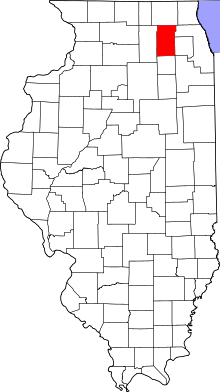 Kane County's location in Illinois | |
| Coordinates: 41°56′34″N 88°19′12″W / 41.94278°N 88.32000°WCoordinates: 41°56′34″N 88°19′12″W / 41.94278°N 88.32000°W | |
| Country |
|
| State |
|
| County | Kane |
| Established | November 6, 1849 |
| Area | |
| • Total | 35.55 sq mi (92.1 km2) |
| • Land | 34.82 sq mi (90.2 km2) |
| • Water | 0.74 sq mi (1.9 km2) 2.08% |
| Elevation | 728 ft (222 m) |
| Population (2010) | |
| • Total | 50,854 |
| • Density | 1,460.6/sq mi (563.9/km2) |
| Time zone | CST (UTC-6) |
| • Summer (DST) | CDT (UTC-5) |
| ZIP codes | 60119, 60120, 60134, 60174, 60175, 60177, 60184 |
| GNIS feature ID | 0429694 |
St. Charles Township is one of sixteen townships in Kane County, Illinois, USA. As of the 2010 census, its population was 50,854 and it contained 19,043 housing units.[1]
Geography
According to the 2010 census, the township has a total area of 35.55 square miles (92.1 km2), of which 34.82 square miles (90.2 km2) (or 97.95%) is land and 0.74 square miles (1.9 km2) (or 2.08%) is water.[1] It is divided by the Fox River.
Cities, towns, villages
- Bartlett (west edge)
- Campton Hills (partial)
- South Elgin (partial)
- St. Charles (vast majority)
- Wayne (west half)
School districts
- Geneva Community Unit School District 304
- School District U-46
- St. Charles Community Unit School District 303
Political districts
- Illinois's 14th congressional district
- State House District 49
- State House District 50
- State House District 55
- State Senate District 25
- State Senate District 28
References
- "Saint Charles Township, Kane County, Illinois". Geographic Names Information System. United States Geological Survey. Retrieved 2010-06-26.
- United States Census Bureau 2009 TIGER/Line Shapefiles
- United States National Atlas
- 1 2 "Population, Housing Units, Area, and Density: 2010 - County -- County Subdivision and Place -- 2010 Census Summary File 1". United States Census. Retrieved 2013-05-28.
External links
 |
Plato Township | Elgin Township | Hanover Township, Cook County | |
| Campton Township | |
Wayne Township, DuPage County | ||
| ||||
| | ||||
| Blackberry Township | Geneva Township | Winfield Township, DuPage County |
Municipalities and communities of Kane County, Illinois, United States | ||
|---|---|---|
| Cities | ||
| Villages | ||
| Townships |
| |
| CDP | ||
| Other unincorporated communities |
| |
| Footnotes | ‡This populated place also has portions in an adjacent county or counties | |
This article is issued from Wikipedia - version of the 12/4/2013. The text is available under the Creative Commons Attribution/Share Alike but additional terms may apply for the media files.