St. Lawrence County, New York
| St. Lawrence County, New York | ||
|---|---|---|
| ||
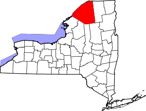 Location in the U.S. state of New York | ||
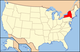 New York's location in the U.S. | ||
| Founded | 1802 | |
| Named for | Saint Lawrence River | |
| Seat | Canton | |
| Largest city | Ogdensburg | |
| Area | ||
| • Total | 2,821 sq mi (7,306 km2) | |
| • Land | 2,680 sq mi (6,941 km2) | |
| • Water | 141 sq mi (365 km2), 5.0% | |
| Population | ||
| • (2010) | 111,944 | |
| • Density | 42/sq mi (16/km²) | |
| Congressional district | 21st | |
| Time zone | Eastern: UTC-5/-4 | |
| Website |
www | |

St. Lawrence County is a county in the U.S. state of New York. As of the 2010 census, the population was 111,944. [1] The county seat is Canton.[2] The county is named for the Saint Lawrence River, which in turn was named for the Catholic saint Lawrence of Rome, on whose Feast day the river was discovered by French explorer Jacques Cartier.
St. Lawrence County comprises the Ogdensburg-Massena, NY Micropolitan Statistical Area.
St. Lawrence County is New York's largest county by area.
History
When counties were established in New York State in 1683, the present St. Lawrence County was part of Albany County. This was an enormous territory, including the northern part of New York State as well as all of the present State of Vermont and, in theory, extending westward to the Pacific Ocean. The county was reduced in size on July 3, 1766 by the creation of Cumberland County, and further on March 16, 1770 by the creation of Gloucester County, both containing territory now in Vermont.
On March 12, 1772, what was left of Albany County was split into three parts, one remaining under the name Albany County. The other two were called Tryon County (later renamed Montgomery County) and Charlotte County (later renamed Washington County). Tryon County contained the western portion (and, since no western boundary was specified, theoretically extended west to the Pacific). The eastern boundary of Tryon County was approximately five miles west of the present city of Schenectady, and the county included the western part of the Adirondack Mountains and the area west of the West Branch of the Delaware River. The area then designated as Tryon County includes what are now 37 counties of New York State. The county was named for William Tryon, colonial governor of New York. Charlotte County contained the eastern portion of Albany County.
In 1784, following the peace treaty that ended the American Revolutionary War, the name "Charlotte County" was changed to Washington County to honor George Washington, the American Revolutionary War general and later President of the United States of America. Tryon County was changed to Montgomery County to honor the general, Richard Montgomery, who had captured several places in Canada and died trying to capture the city of Quebec; it replaced the name of the hated British governor.
In 1788, Clinton County was split off from Washington County. This was a much larger area than the present Clinton County, including part of what would later become St. Lawrence County, as well as several other counties or county parts of the present New York State.
In 1789, the size of Montgomery County was reduced by the splitting off of Ontario County from Montgomery. The actual area split off from Montgomery County was much larger than the present county, also including the present Allegany, Cattaraugus, Chautauqua, Erie, Genesee, Livingston, Monroe, Niagara, Orleans, Steuben, Wyoming, Yates, and part of Schuyler and Wayne Counties.
St. Lawrence County is part of Macomb's Purchase of 1791.
In 1791, Herkimer County was one of three counties split off from Montgomery (the other two being Otsego, and Tioga County). This was much larger than the present county, however, and was reduced by a number of subsequent splits. The first was the splitting off in 1794 of Onondaga County. This county was larger than the current Onondaga County, including the present Cayuga, Cortland, and part of Oswego Counties. This was followed by the splitting off in 1798 from Herkimer County of two portions: one, Oneida County, was larger than the current Oneida County, including the present Jefferson, Lewis, and part of Oswego Counties; another portion, together with a portion of Tioga County, was taken to form Chenango County.
In 1799, Clinton County was reduced in size by the splitting off of Essex County from Clinton County.
In 1802, parts of Clinton, Herkimer, and Montgomery Counties were taken to form the new St. Lawrence County. At that time Ogdensburg was the county seat. In 1828 the county seat was moved to Canton. The selection of Canton as the county was a compromise by the state legislature to end competition between factions supporting Ogdensburg and Potsdam for the county seat.[3]
Earthquake
On September 5, 1944, a 5.8 magnitude earthquake centered in Massena struck the county. The earthquake was felt from Canada south to Maryland, and from Maine west to Indiana. The earthquake was the strongest earthquake in New York State history.[4]
Geography
According to the U.S. Census Bureau, the county has a total area of 2,821 square miles (7,310 km2), of which 2,680 square miles (6,900 km2) is land and 141 square miles (370 km2) (5.0%) is water.[5] It is the largest county by area in New York. It is larger than the entire state of Rhode Island (1544.9 square miles) and the state of Delaware (2488.72 square miles).
Part of the County is in the Adirondack Park and includes much of the Oswegatchie River, Cranberry Lake and Lake Ozonia.
Adjacent counties
- Stormont, Dundas and Glengarry United Counties, Ontario, Canada – north
- Leeds and Grenville United Counties, Ontario, Canada – northwest
- Franklin County – east
- Herkimer County – south
- Hamilton County – south
- Lewis County – southwest
- Jefferson County – west
Demographics
| Historical population | |||
|---|---|---|---|
| Census | Pop. | %± | |
| 1810 | 7,885 | — | |
| 1820 | 16,037 | 103.4% | |
| 1830 | 36,354 | 126.7% | |
| 1840 | 56,706 | 56.0% | |
| 1850 | 68,617 | 21.0% | |
| 1860 | 83,689 | 22.0% | |
| 1870 | 84,826 | 1.4% | |
| 1880 | 85,997 | 1.4% | |
| 1890 | 85,048 | −1.1% | |
| 1900 | 89,083 | 4.7% | |
| 1910 | 89,005 | −0.1% | |
| 1920 | 88,121 | −1.0% | |
| 1930 | 90,960 | 3.2% | |
| 1940 | 91,098 | 0.2% | |
| 1950 | 98,897 | 8.6% | |
| 1960 | 111,239 | 12.5% | |
| 1970 | 111,991 | 0.7% | |
| 1980 | 114,254 | 2.0% | |
| 1990 | 111,974 | −2.0% | |
| 2000 | 111,931 | 0.0% | |
| 2010 | 111,944 | 0.0% | |
| Est. 2015 | 111,007 | [6] | −0.8% |
| U.S. Decennial Census[7] 1790–1960[8] 1900–1990[9] 1990–2000[10] 2010–2015[1] | |||
As of the census[11] of 2000, there were 113,931 people, 40,506 households, and 26,936 families residing in the county. The population density was 42 people per square mile (16/km²). There were 49,721 housing units at an average density of 18 per square mile (7/km²). The racial makeup of the county was 94.51% White, 2.38% African American, 0.87% Native American, 0.71% Asian, 0.03% Pacific Islander, 0.69% from other races, and 0.51% from two or more races. Hispanic or Latino of any race were 1.79% of the population. 16.9% were of French, 16.1% Irish, 13.9% American, 11.6% English, 8.1% French Canadian, 7.9% German and 7.6% Italian ancestry according to Census 2000. 97.6% spoke English, 1.2% Spanish and 1.2% French as their first language.
There were 40,506 households out of which 31.80% had children under the age of 18 living with them, 51.50% were married couples living together, 10.30% had a female householder with no husband present, and 33.50% were non-families. 26.50% of all households were made up of individuals and 11.20% had someone living alone who was 65 years of age or older. The average household size was 2.49 and the average family size was 2.99.
In the county the population was spread out with 23.40% under the age of 18, 13.80% from 18 to 24, 27.40% from 25 to 44, 22.40% from 45 to 64, and 13.00% who were 65 years of age or older. The median age was 35 years. For every 100 females there were 103.30 males. For every 100 females age 18 and over, there were 102.10 males.
The median income for a household in the county was $30,356, and the median income for a family was $34,510. Males had a median income of $30,135 versus $24,253 for females. The per capita income for the county was $14,728. About 12.30% of families and 19.90% of the population were below the poverty line, including 21.30% of those under age 18 and 10.30% of those age 65 or over.
Education
School districts
There are 17 school districts centered in St. Lawrence County, all under the jurisdiction of the St. Lawrence-Lewis BOCES Supervisory District along with Harrisville Central School District in Lewis County, New York.
- Brasher Falls Central School District: St. Lawrence Central School, Brasher Falls
- Canton Central School District: Hugh Williams Senior High School, Canton
- Clifton-Fine Central School District: Clifton-Fine Central School, Star Lake
- Colton-Pierrepont Central School District: Colton-Pierrepont Central School, Colton
- Edwards-Knox Central School District: Edwards-Knox Central School, Russell
- Gouverneur Central School District: Gouverneur Junior/Senior High School, Gouverneur
- Hammond Central School District: Hammond Central School, Hammond
- Hermon-Dekalb Central School District: Hermon-Dekalb Central School, Dekalb Junction
- Heuvelton Central School District: Heuvelton Central School, Heuvelton
- Lisbon Central School District: Lisbon Central School, Lisbon
- Madrid-Waddington Central School District: Madrid-Waddington Central School, Madrid
- Massena Central School District: Massena Senior High School, Massena
- Morristown Central School District: Morristown Central School, Morristown
- Norwood-Norfolk Central School District: Norwood-Norfolk Central School, Norfolk
- Ogdensburg City School District: Ogdensburg Free Academy, Ogdensburg
- Parishville-Hopkinton Central School District: Parishville-Hopkinton Central School, Parishville
- Potsdam Central School District: Potsdam High School, Potsdam
All public high schools in St. Lawrence County compete in the New York State Public High School Athletic Association Section X Northern Athletic Conference.
Universities and colleges
Saint Lawrence County is home to St. Lawrence University, State University of New York at Potsdam, Clarkson University, the SUNY-ESF Ranger School, and the State University of New York at Canton.
Media
Radio
- 1340 WMSA, Massena www.1340wmsa.com
- WVLF-FM Mix 96.1 www.mymix961.com
- WRCD-FM 101.5 The Fox www.1015thefox.com
- WSNN (99.3, Potsdam)
- WPDM (1470, Potsdam)
- WSLU (89.5, Canton)
Transportation
Airports
The following public use airports are located in the county:[12]
- Massena International Airport (MSS) – Massena
- Ogdensburg International Airport (OGS) – Ogdensburg
- Potsdam Municipal Airport (PTD) – Potsdam
- Moores Airport (1E8) – Degrasse
Communities
City
Towns
Villages
Census-designated places
Hamlets
See also
- List of counties in New York
- National Register of Historic Places listings in St. Lawrence County, New York
- St. Lawrence County Public Transportation
References
- 1 2 "State & County QuickFacts". United States Census Bureau. Retrieved October 13, 2013.
- ↑ "Find a County". National Association of Counties. Retrieved 2011-06-07.
- ↑ Linda Casserly, County Courthouse Has 'Fiery' History, St. Lawrence Plaindealer, May 23, 2000. Archived copy on website of New York 4th Judicial District, St. Lawrence County.
- ↑ Historic Earthquakes, US Geological Survey, (2012-11-01). Retrieved on 2013-07-12.
- ↑ "2010 Census Gazetteer Files". United States Census Bureau. August 22, 2012. Retrieved January 7, 2015.
- ↑ "County Totals Dataset: Population, Population Change and Estimated Components of Population Change: April 1, 2010 to July 1, 2015". Retrieved July 2, 2016.
- ↑ "U.S. Decennial Census". United States Census Bureau. Retrieved January 7, 2015.
- ↑ "Historical Census Browser". University of Virginia Library. Retrieved January 7, 2015.
- ↑ "Population of Counties by Decennial Census: 1900 to 1990". United States Census Bureau. Retrieved January 7, 2015.
- ↑ "Census 2000 PHC-T-4. Ranking Tables for Counties: 1990 and 2000" (PDF). United States Census Bureau. Retrieved January 7, 2015.
- ↑ "American FactFinder". United States Census Bureau. Retrieved 2008-01-31.
- ↑ St. Lawrence County Public and Private Airports, New York. Retrieved June 13, 2013.
External links

Municipalities and communities of St. Lawrence County, New York, United States | ||
|---|---|---|
| City | | |
| Towns | ||
| Villages | ||
| CDPs |
| |
| Hamlets | ||
Albany (capital) | ||
| Topics |
|  |
| Politics | ||
| Regions |
| |
| Metro areas | ||
| Counties |
| |
| Places | ||
Coordinates: 44°30′N 75°04′W / 44.50°N 75.07°W