Starvation Heights, Oregon
Starvation Heights is an unincorporated community in Jackson County, Oregon, U.S.[1] It is located about 4 miles (6.4 km) north of the community of Rogue River, and 9 miles (14 km) ENE of Grants Pass.
It was named before 1883 for its poor and infertile soil, a granite-like mix which supported only scrub vegetation. The neighboring rise is slightly lower in elevation, but had rich soil. Failed farmers were said to be "starved out" when they moved on.[2] The soil has since been improved.
References
- ↑ "Starvation Heights". Geographic Names Information System. United States Geological Survey. Retrieved 2011-08-15.
- ↑ Cheryl Martin Sund (2009). Rogue River: Images of America. Arcadia Publishing. p. 14. ISBN 978-0-7385-7091-4. Retrieved 2011-08-15.
Municipalities and communities of Jackson County, Oregon, United States | ||
|---|---|---|
| Cities | 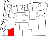 | |
| CDPs | ||
| Other unincorporated communities | ||
| Ghost towns | ||
Coordinates: 42°29′07″N 123°10′05″W / 42.4853984°N 123.1681094°W
This article is issued from Wikipedia - version of the 10/13/2016. The text is available under the Creative Commons Attribution/Share Alike but additional terms may apply for the media files.